The Gulf at Low Tide
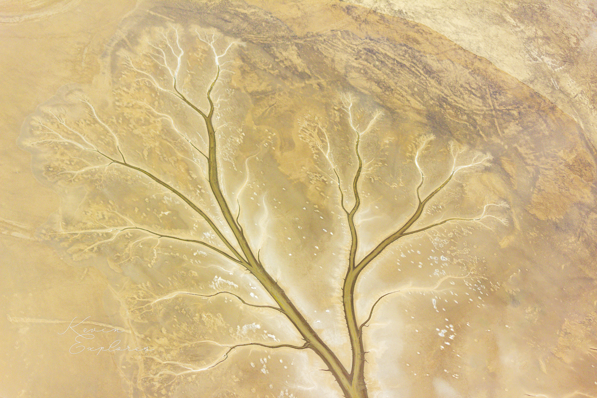
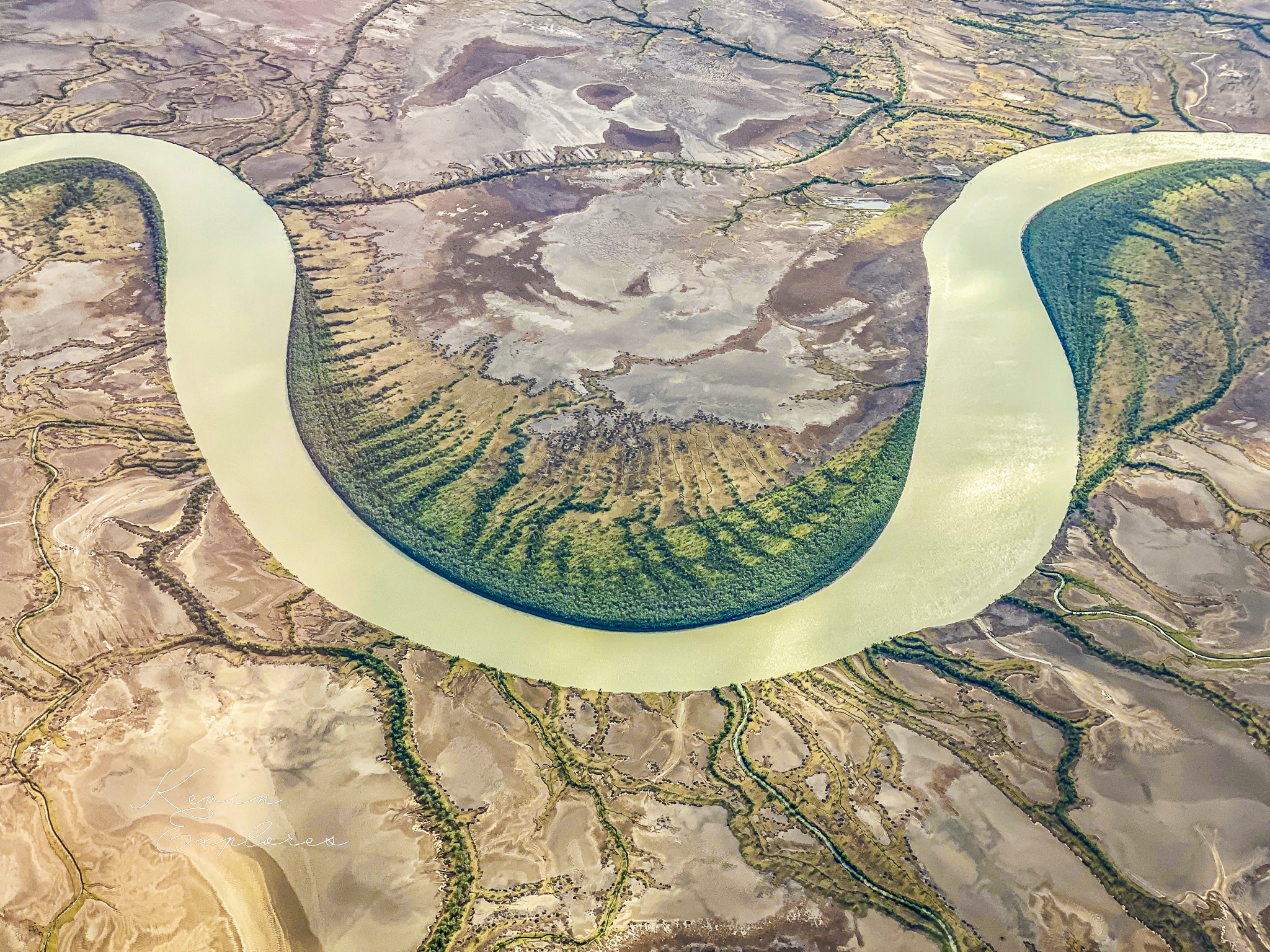
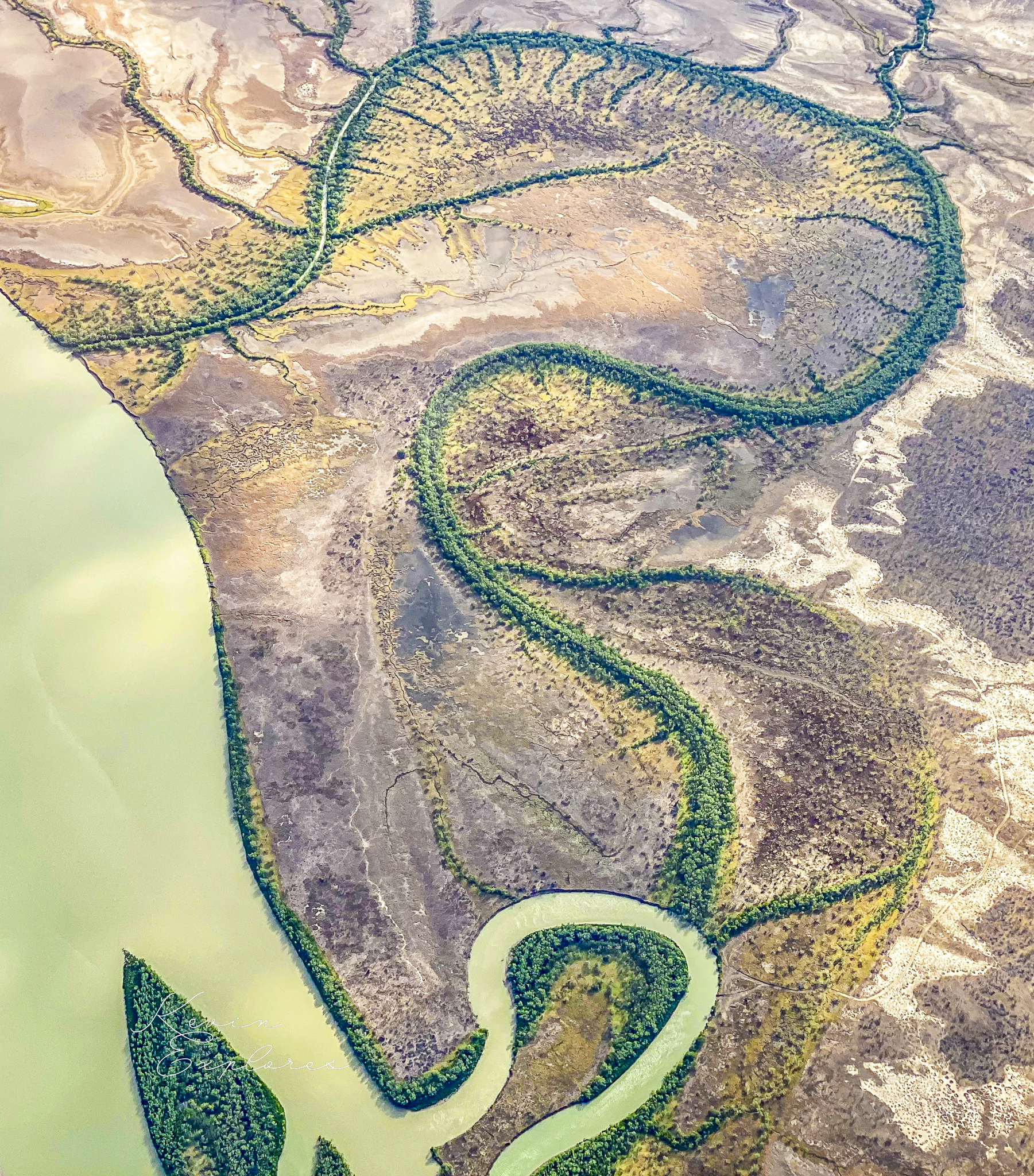
There's a moment, flying low over the southern Gulf of Carpentaria at low tide, when the landscape stops making sense as coast and starts reading as something else entirely. The image that keeps stopping me is a single tidal drainage channel, branching upward through shallow water across pale sediment — so perfectly tree-shaped it looks like it was drawn. No trunk, no leaves, just the architecture of flow, preserved in mud.
That image is a good way into what this place actually is.
The Gulf of Carpentaria is a shallow sea — most of it less than 70 metres deep — sitting on a shelf so flat and low that sea level has repeatedly decided what it gets to be. During the last glacial maximum, around 20,000 years ago, sea levels were roughly 120 metres lower than today. The Gulf didn't exist. In its place sat Lake Carpentaria — a freshwater body up to 15 metres deep and perhaps 600 km across, surrounded by grassland, draining westward across what is now the Arafura seafloor. The Aboriginal peoples who occupied this landscape lived beside a lake, not a sea.
Then the ice melted. Sea level rose, breached the Arafura Sill around 11,700 years ago, and the lake became an estuary, then a sea. By about 7,700 years ago water had reached something close to present sea level — then kept rising another 1.5 to 2 metres above that before settling back down over the following few thousand years. The intertidal zone you're looking at today is geologically brand new. Every mudflat, every mangrove finger, every sinuous tidal creek was built in the last few thousand years on top of what was grassland savanna within living memory of the first peoples here.
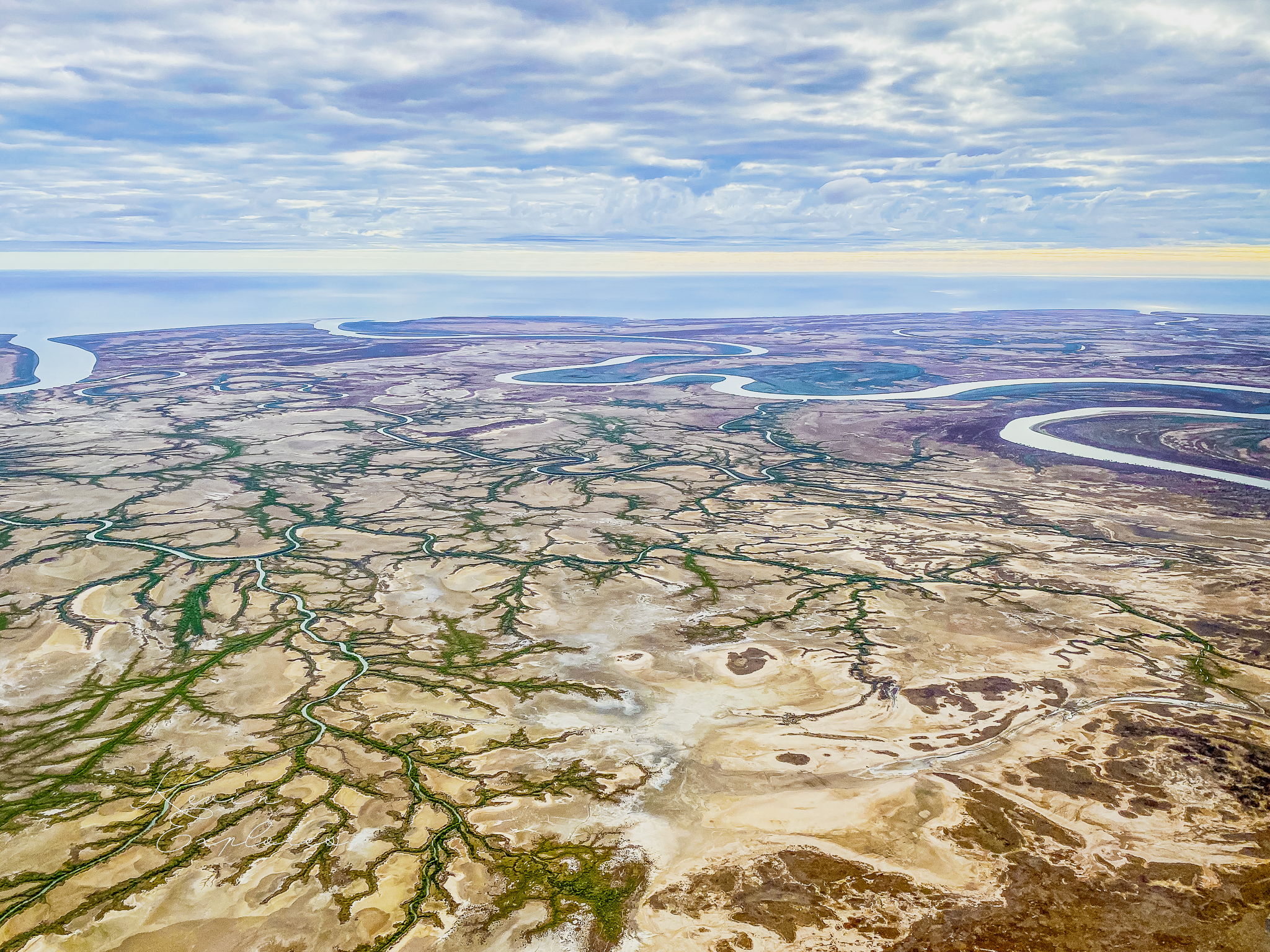
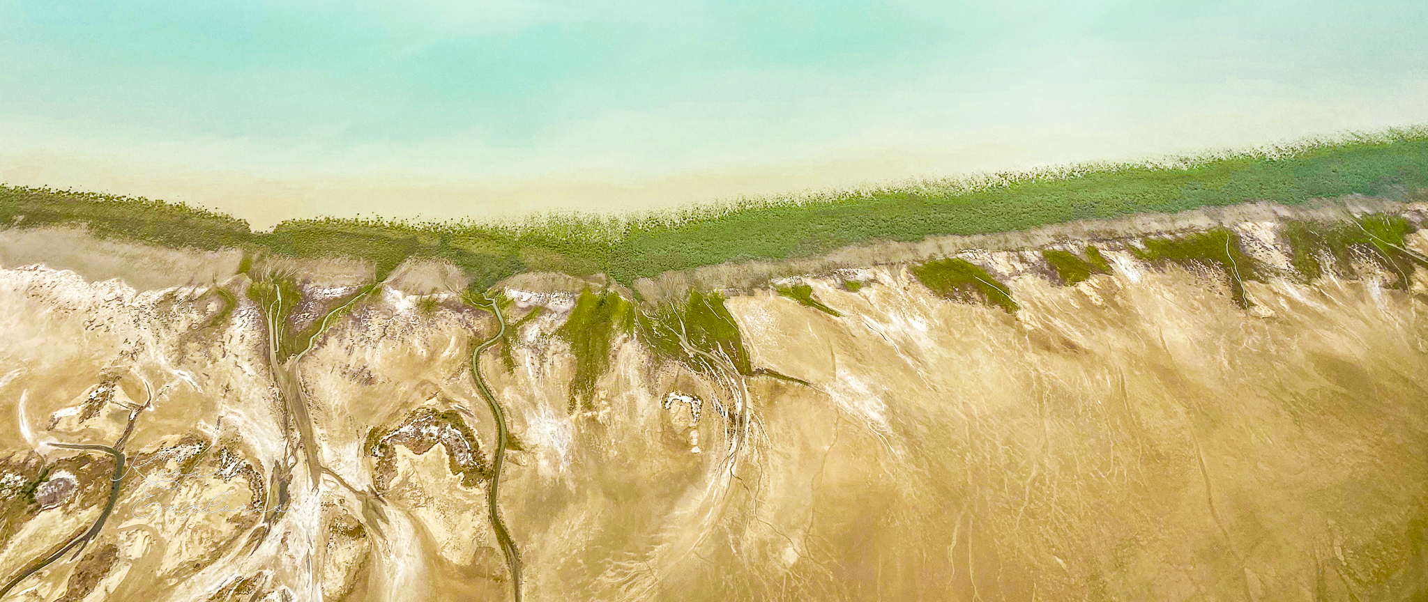
That youth matters, because it means the coast is still actively writing its own record. Behind the mangrove fringe, running parallel to the shoreline, are low sandy ridges called cheniers — built from shell and coarse sediment during periods when river discharge drops and wave energy can rework the mudflat surface. Between them lie muddy plains deposited during wetter periods when rivers run full and push fine sediment seaward. The oldest cheniers date back around 6,000 years; the youngest are still forming. Read them inland to seaward and you're reading the climatic history of the monsoon — wet periods and dry, written in alternating mud and shell.
The rivers are the engine of all of it. The Gulf's southern rivers — the Leichhardt, the Albert, the Gregory, the Nicholson among others — deliver the sediment that builds the mudflats, and the nutrients that make them productive. Those nutrients fuel algal growth on the flat surface, which in turn feeds the invertebrates — worms, crabs, bivalves — that sustain one of Australia's most significant shorebird systems. Up to 13,000 migratory shorebirds of at least 22 species use the intertidal flats of the south-east Gulf, including the endangered Far Eastern Curlew, which flies here from Siberia. The mudflat is not just a physical surface — it's the fuelling station at the southern end of one of the world's great migration routes.
Which makes the events of late 2015 worth sitting with. Over a period of about three months, starting around November that year, mangroves died across more than 1,000 kilometres of Gulf coastline. Some 7,400 hectares of forest — around 6% of the Gulf's total mangrove cover — collapsed synchronously from Karumba in Queensland to the Limmen River in the Northern Territory. It remains the largest recorded mangrove dieback event in history. Research led by Professor Norm Duke at James Cook University identified the primary driver: a strong El Niño had pushed sea levels 20 to 30 centimetres below normal, reducing tidal inundation of the upper mangrove zone at precisely the time temperatures were at their highest and rainfall at its lowest. Less than a boot-height of water. That was the margin.
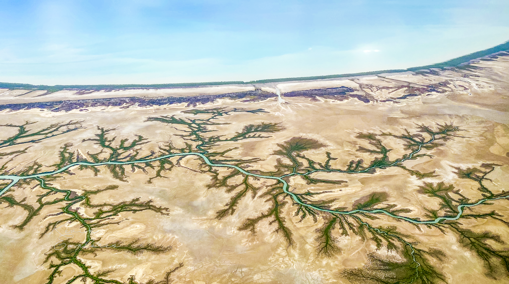
Flying over the southern Gulf is a lesson in how finely calibrated this landscape is. The tidal range here is 2 to 4 metres — enough to expose vast plains at low tide, enough to inundate them completely at high. That daily movement is what keeps the system productive: oxygenating sediments, flushing nutrients, maintaining the conditions that worms and crabs and migratory birds depend on. Interrupt the tidal signal — by a drought, by a sea level shift, by reduced river flows upstream — and the whole chain feels it, from the mudflat to Siberia.
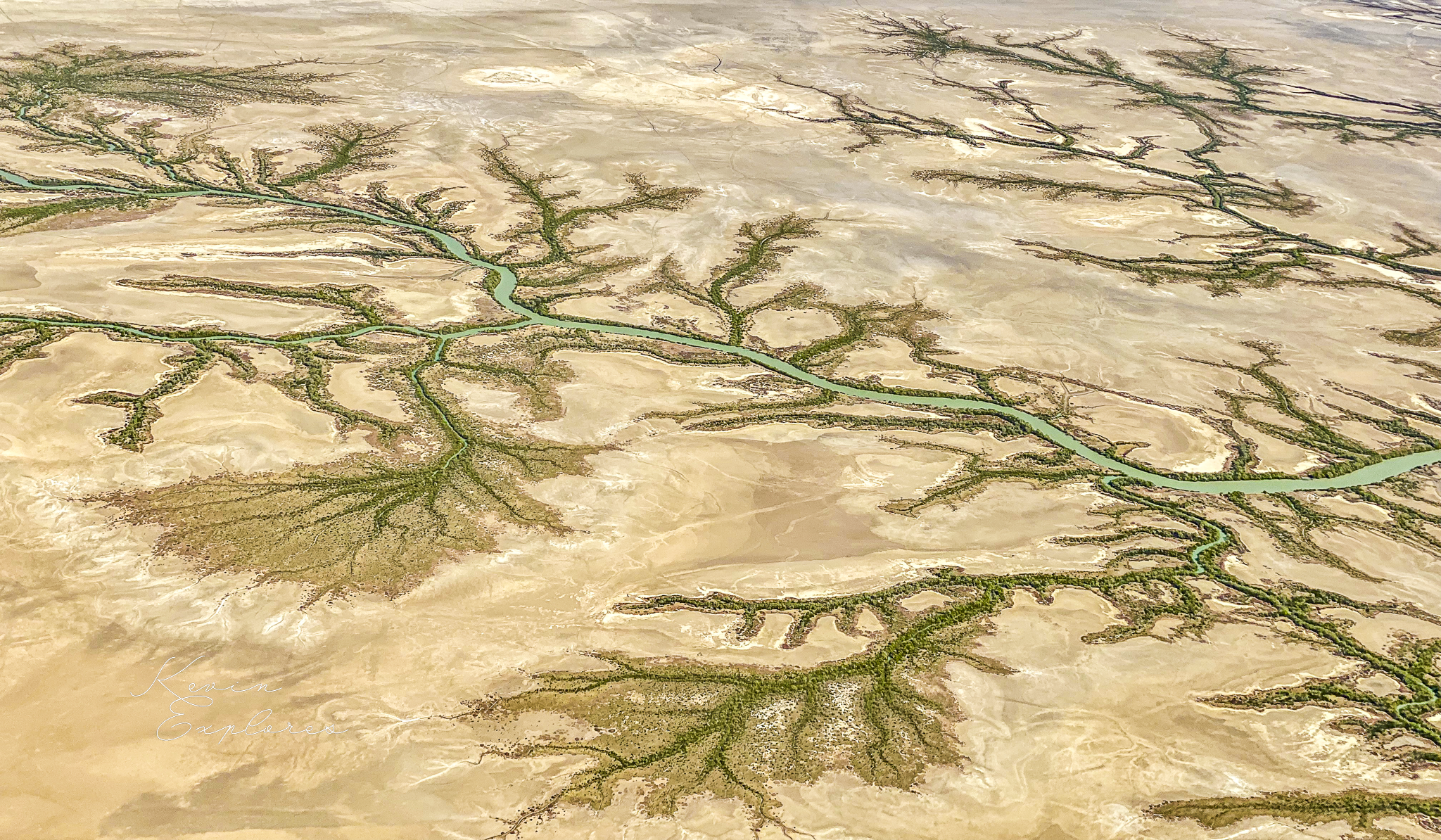
What strikes me most from the air is not the scale of this system, though the scale is enormous. It's the precision of it. The tidal creek branches with mathematical regularity. The mangrove fringe holds exactly to the inundation contour. The chenier ridges record every shift in the monsoon. This coast is not wilderness in the sense of something untouched — it's a landscape that has been responding, continuously and precisely, to every change thrown at it for thousands of years.
The question now is what it does with the changes coming next.
Cheers K
Never miss a post by subscribing at Substack and reading past posts on my blog.