The Ground Beneath the Green — a geological story of Far North Queensland
From a 420-million-year-old coral reef at Chillagoe to the volcanic maars of the Atherton Tableleands.
Watch this first. Before you read a single word.
Scotese (2019) Plate tectonics animation
750 million years of Earth history. Watch where Australia starts — and where it ends up.
That four-minute animation contains the entire backstory of the landscape in Far North Qld.
Let me show you where Far North Queensland appears in the story — and before I do, let me give you the tools to read it.
How rocks become landscapes — the three families
Every rock belongs to one of three families, depending on how it formed. Each family weathers differently, produces different soils, and ultimately generates a different vegetation community. Understanding this is the key that unlocks why the landscape looks the way it does — and why the plants change so dramatically as you move from one geological zone to another.
Igneous rocks — born from heat
Igneous rocks form from molten material — magma — that either erupts at the surface or cools slowly underground. The distinction between those two pathways produces two very different rocks with very different consequences for the landscape.
Basalt
When magma erupts at the surface as lava and cools quickly, the result is basalt — dark, fine-grained, dense. Basalt is the rock of the Atherton Tablelands. The shield volcanoes that built this landscape between 7 million years ago and as recently as 10,000 years ago poured enormous flows of basalt across the countryside, filling valleys and creating the rolling plateau surface we drive across today.
Basalt is rich in calcium, magnesium, iron and phosphorus — the minerals plants need most. In the wet tropical climate it weathers rapidly and chemically, releasing those nutrients continuously into the soil. The iron oxidises to haematite and goethite — the same chemistry as rust — giving the soil its deep red colour and greatly improving its ability to hold nutrients. The result is the krasnozem: deep, red, near-neutral pH, high fertility, excellent water retention. The most productive agricultural soil in tropical Australia, and the substrate for the most complex rainforest on the continent.
Basalt also leaves a spectacular signature at the moment of its cooling. As a lava flow solidifies, it contracts. The tension resolves into a network of fractures propagating downward from the surface, dividing the flow into regular polygonal columns — typically five or six-sided. Mungalli Falls and Millaa Millaa Falls near Millaa Millaa and Millstream Falls near Ravenshoe both drop over exposed basalt flows whose columnar jointing is clearly visible in the cliff face. The columns are the frozen internal structure of a lava flow that poured across this landscape between one and three million years ago. The same rock, above the falls, has weathered to the deep red krasnozem of the Tablelands.
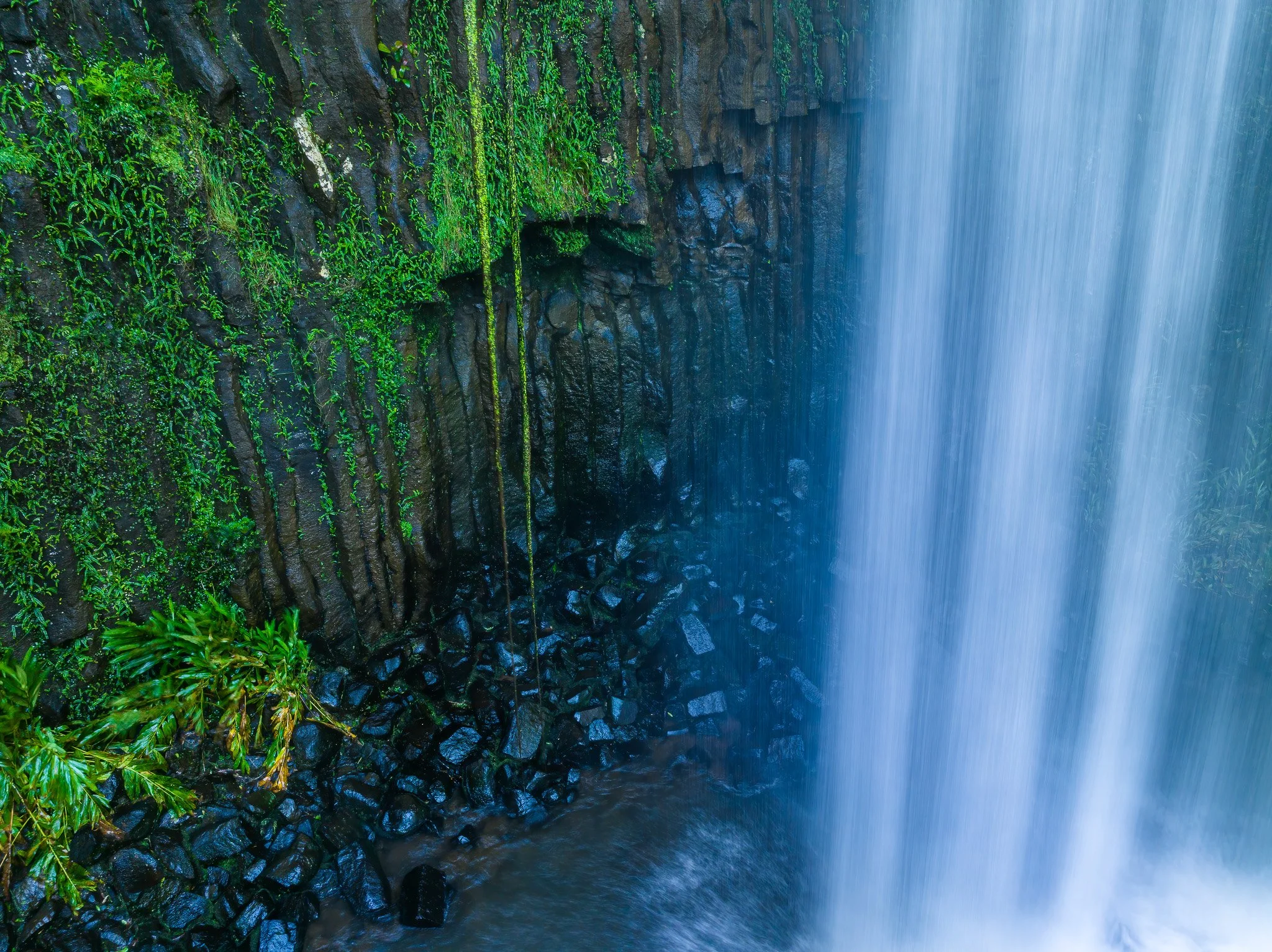
Basalt columns behind the curtain of water at Millaa Millaa Falls
Granite
When magma cools slowly deep underground over millions of years, it produces granite — pale, coarse-grained, with visible crystals of quartz, feldspar and mica. Granite is the rock of Bartle Frere, the Bellenden Ker Range, the Lamb Range, and the country around Davies Creek and Emerald Creek.
Granite’s dominant mineral is quartz, and quartz is chemically almost entirely inert. It contributes nothing nutritionally to the soil. Granite breaks down physically rather than chemically, disaggregating into a coarse sandy grit known as grus — pale, acid, free-draining and nutrient-poor. Plants on granite soils are adapted to genuine nutritional stress. Their leaves are tough, waxy and fibrous — not primarily as a drought response but because nutrients are too scarce to invest in soft, nitrogen-rich tissue. The open eucalypt woodland at Davies Creek, the grevillea and wattle understorey, the northern bettong habitat — all are expressions of granite chemistry, not rainfall.
Drive fifteen minutes south from Davies Creek and you are on deep red basalt krasnozem with closed rainforest. Drive fifteen minutes north and you are on pale granite sand with open eucalypt woodland. Same altitude, same rainfall, different rock, completely different world.
The granite of Davies Creek Falls
Sedimentary rocks — born from accumulation
Sedimentary rocks form when particles — sand, silt, mud, shell fragments, the remains of marine organisms — accumulate in layers, compress and cement into rock over time. They form at the surface, usually under water, and often preserve a record of the environment in which they were deposited: fossils, layered beds, graded sequences from underwater avalanches. Two types matter particularly in this story.
Limestone
Limestone is compressed marine reef material — calcium carbonate. It does not break down into particles like basalt or granite. Instead it dissolves in weak acid: rainwater combined with carbon dioxide forms carbonic acid, which dissolves the rock and carries it away as ions in solution. What remains is highly alkaline soil, calcium-rich, completely different from the surrounding acid soils. At Chillagoe, the karst towers are alkaline islands in an acid savannah sea. The specialist plants that grow on them can tolerate high-pH conditions that exclude the surrounding eucalypt community entirely. Walk from the savannah onto the limestone and the vegetation changes within metres.
Karst towers at Chillagoe
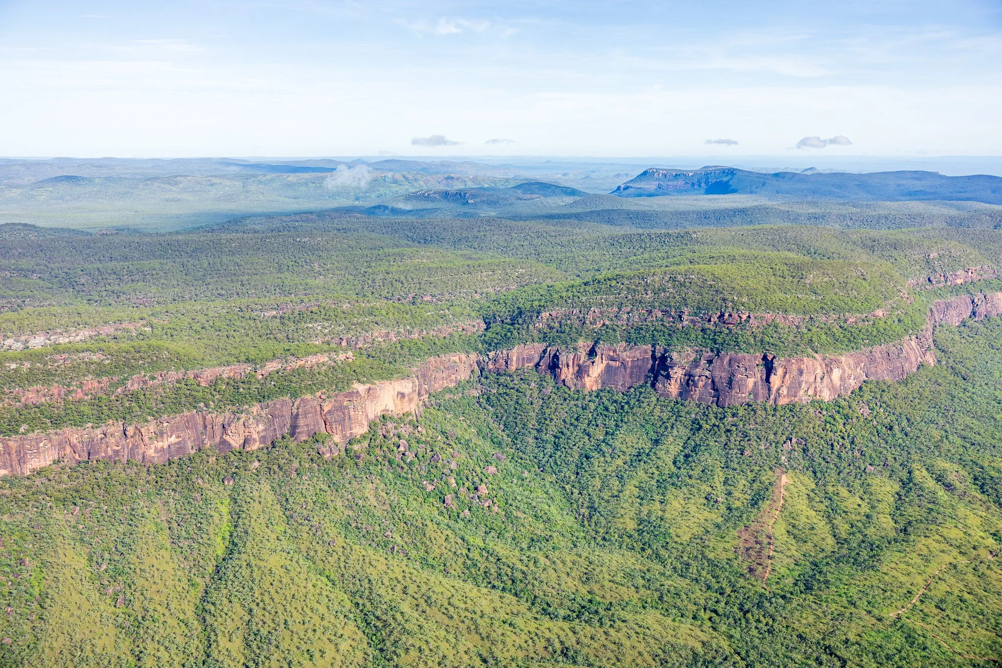
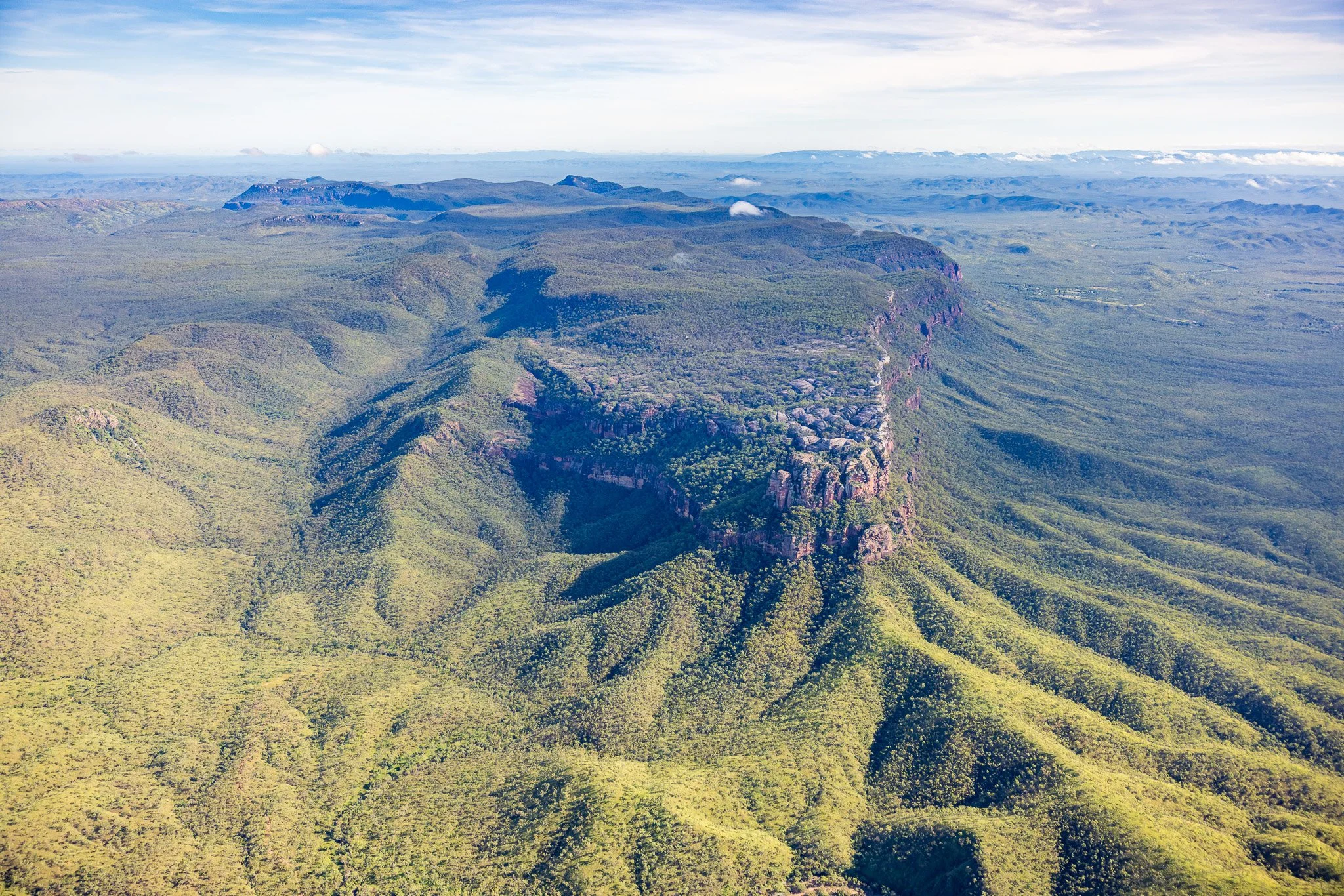
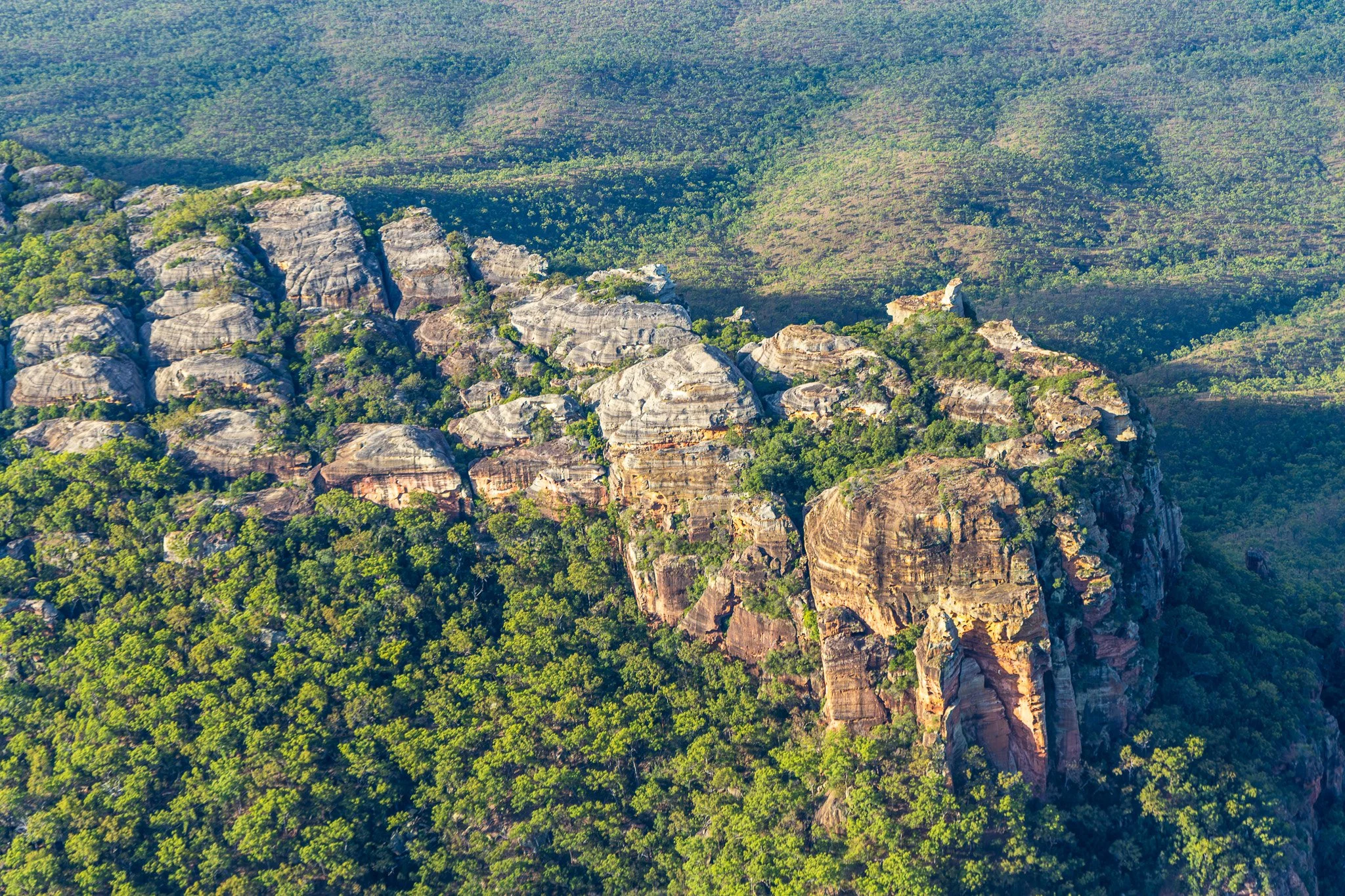
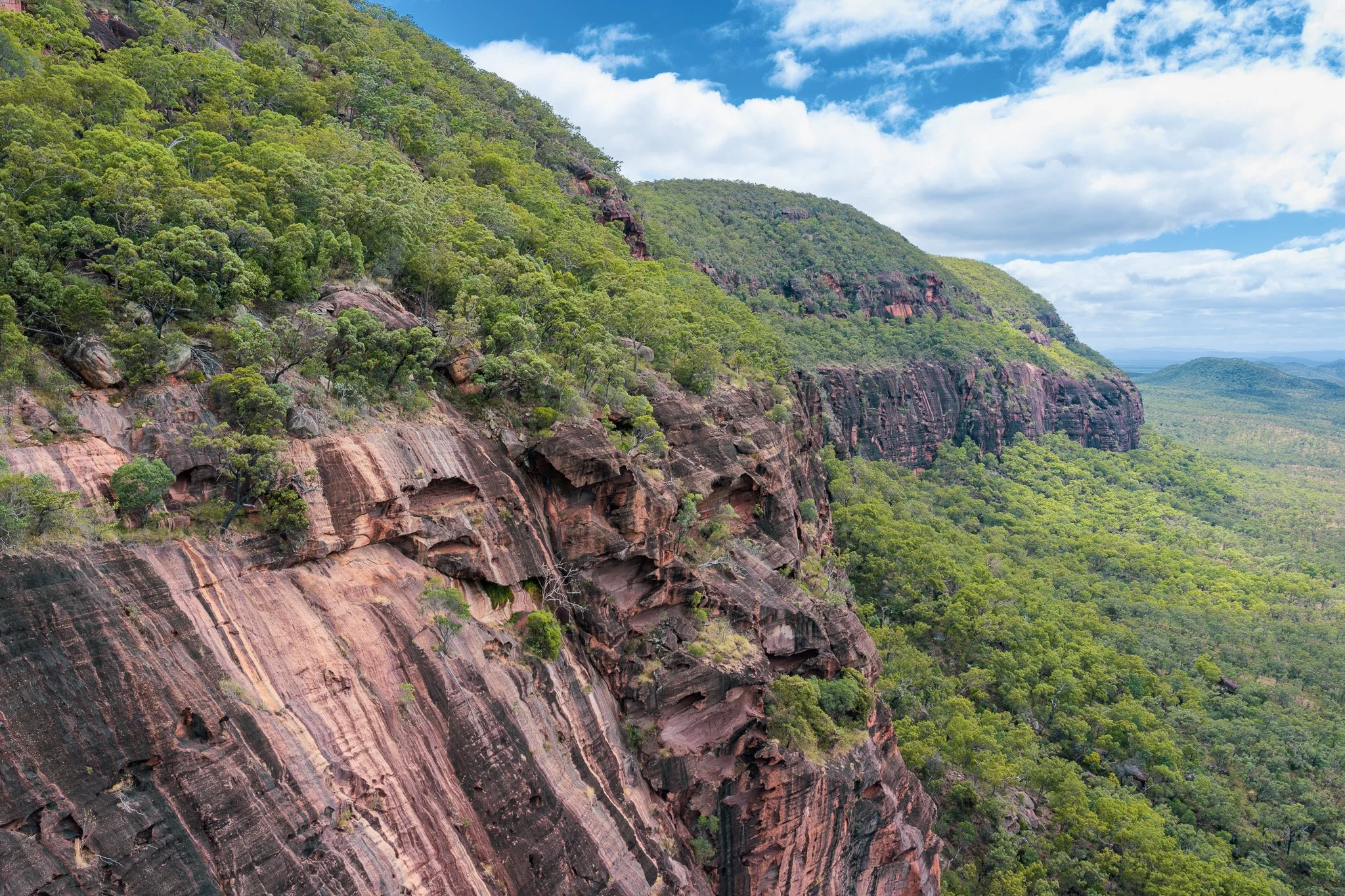
Sandstone and conglomerate
Sandstone and conglomerate form from compressed sand, gravel and river sediment. They produce thin, stony, nutrient-poor soils with poor water retention. The spectacular mesa of Ngarrabullgan at Mount Mulligan is built from sandstone and conglomerate laid down in a Permian rift valley 270 to 230 million years ago. The mesa top carries plant and animal communities found nowhere else in the region — because the sandstone substrate is so different from the surrounding volcanic and metamorphic country that species have adapted in place over millions of years to conditions that simply do not exist elsewhere.
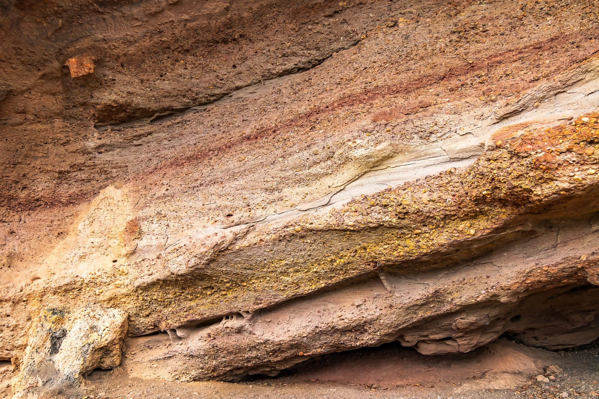
Sandstone and conglomerate of Ngarrabullgan
Metamorphic rocks — born from transformation
Metamorphic rocks are existing rocks — igneous or sedimentary — that have been transformed by extreme heat or pressure without melting completely. Slate was once shale. Schist was once mudstone. Quartzite was once sandstone or chert. Marble was once limestone.
The Hodgkinson Formation is the dominant rock of the Cairns district — metamorphosed deep-water marine sediments that now form the gorge walls of the Barron, the coastal ranges, and most of the rugged country between the Tablelands and the sea. It was originally turbiditic seafloor sediment, buried and transformed by continental collision 360 million years ago.
Hodgkinson Formation soils are variable. Greenstone — metamorphosed basalt — weathers to relatively fertile soil. Greywacke and argillite produce moderately fertile soils. Quartzite produces thin acid soils approaching granite in their poverty. On steep gorge terrain, soil depth is severely limited by erosion regardless of rock type. The result is transitional, patchy vegetation that shifts as the rock composition changes beneath it. Descend through the Barron Gorge by train or cableway and watch the plant communities on the walls — they are reading the geological sequence in real time.
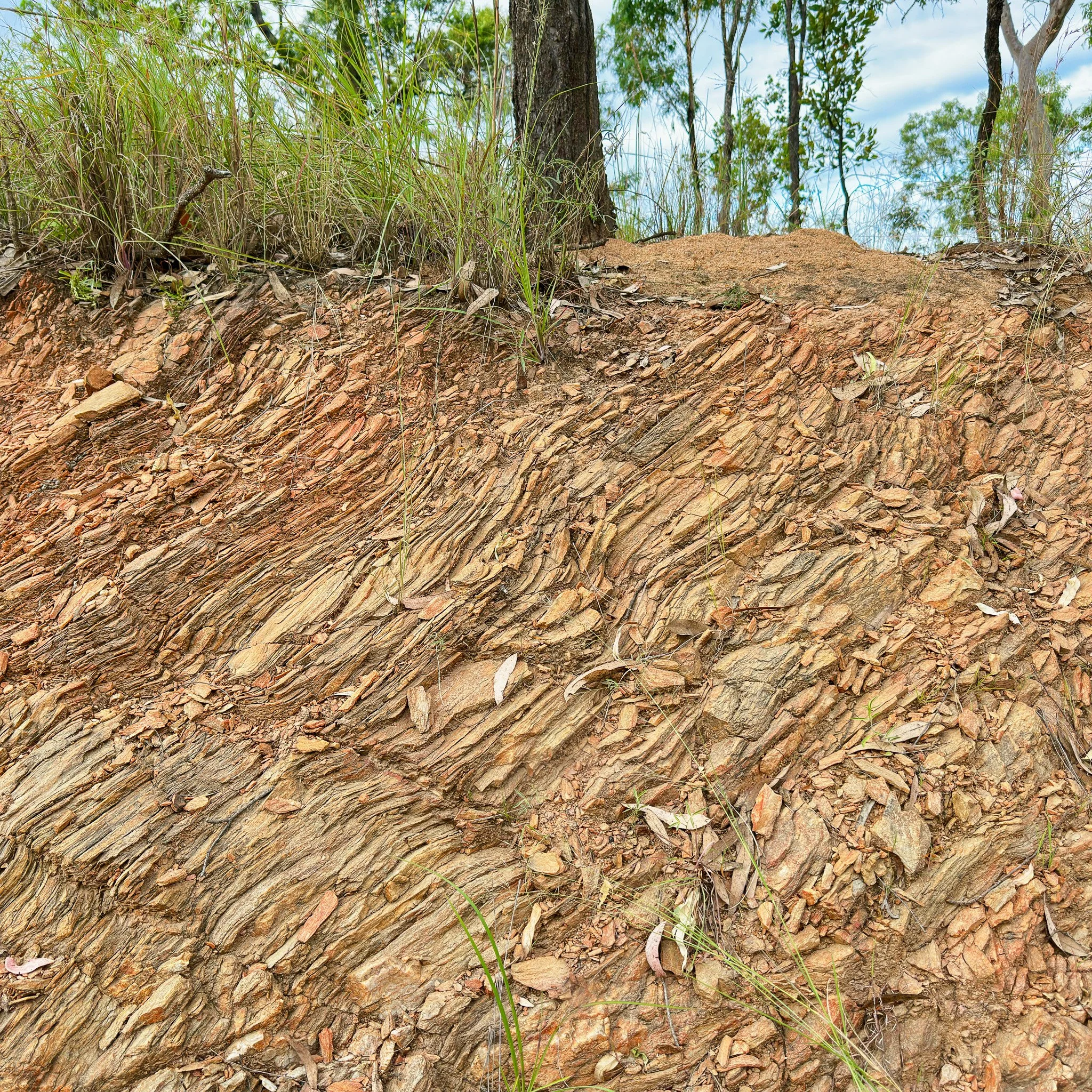
From left: a drop at the Barron Falls and a roadside cutting on the way to Emerald Creek Falls
The climate multiplier
All of the above is amplified by the tropical climate. Chemical weathering rate roughly doubles for every ten degrees of temperature increase. In the Wet Tropics — high temperatures, year-round moisture — basalt weathers perhaps five to ten times faster than in a temperate climate, releasing nutrients continuously. The same high rainfall that accelerates basalt’s advantage simultaneously amplifies granite’s deficiency by leaching the few nutrients granite releases before plant roots can access them. The tropical climate maximises every difference the rock chemistry creates. The rock is the author. The climate is the amplifier. The plants are the visible result.
The stage — before the local story begins
What is now Australia was never alone. For most of its geological history it was part of Gondwana — the great southern supercontinent that included Antarctica, South America, Africa, Madagascar and India, all locked together for over 400 million years.
At 420 million years ago, the part of Gondwana that would become FNQ sat in warm tropical seas. Coral reefs were growing on submarine volcanoes in a long narrow rift sea that opened along what is now the Palmerville Fault — roughly where Chillagoe sits today. Those reefs are now the karst limestone towers that rise from the savanna west of Mareeba.
By 250 million years ago, Australia had drifted to near-polar latitudes. The South Pole was approximately at Brisbane’s latitude. Glaciers covered much of the continent. The forests growing around what is now Mount Mulligan were cold-climate Gondwanan trees whose fossils became coal. The same plant fossils are found in Antarctica, Africa, South America and India. One continent, one flora, proof of assembly.
When Tasmania finally cleared Antarctica around 33 million years ago, ocean currents circled the south pole for the first time. Antarctica froze. Australia’s north got wetter.
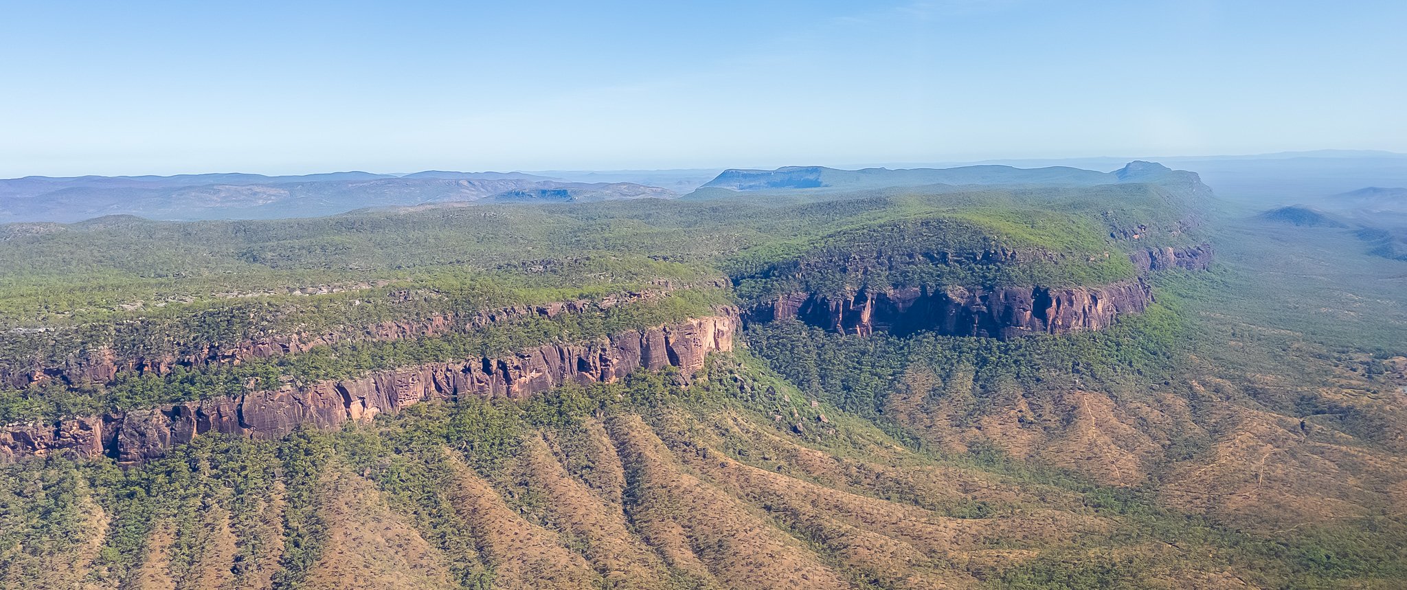
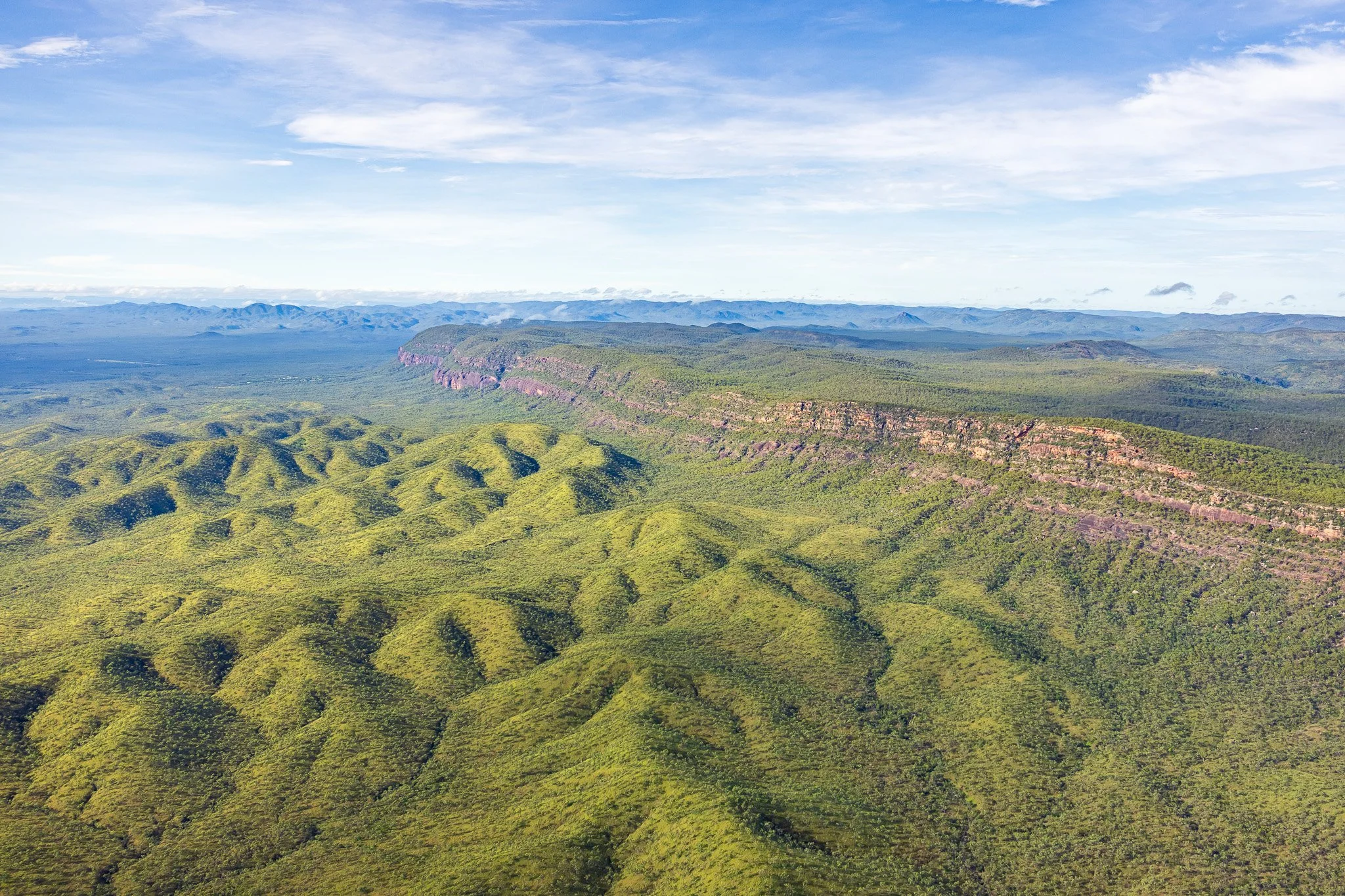
By about 95 million years ago, the eastern edge of Australia broke away. New Zealand and the Queensland Plateau drifted east. The Coral Sea opened. The continent was left with a steep eastern face — the Great Escarpment. Every mountain road in FNQ, every gorge, every waterfall descending from the Tablelands traces back to that moment. Dinosaurs were still alive when it happened.
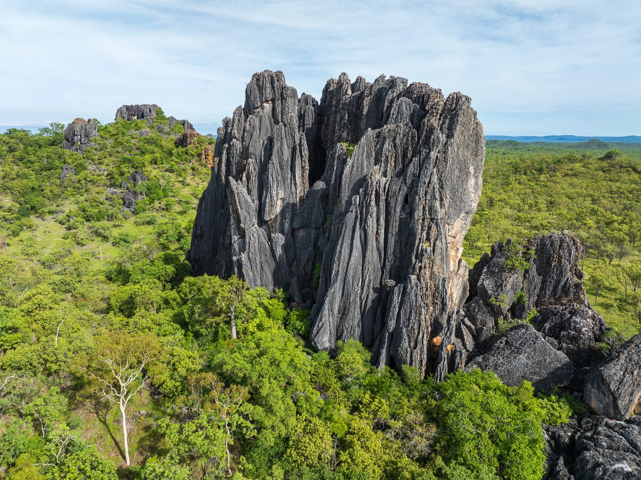
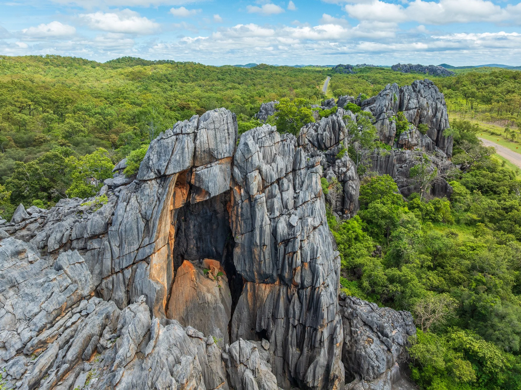
Chillagoe — an ancient reef, folded vertical
The karst towers at Chillagoe are among the most geologically extraordinary landforms in Australia, and almost no one knows their origin story.
420 million years ago, a long narrow sea opened along the Palmerville Fault. Submarine volcanoes erupted on the sea floor. Coral reefs grew around their rims. Hot springs deposited the copper, zinc and lead later mined at Mungana — submarine black smokers, preserved in rock. The reef community included corals, shellfish, crinoids and radiolaria, all now fossils visible in the limestone exposures.
As the basin deepened, reef sediments periodically became unstable and avalanched down submarine canyons into deep water — turbidity currents carrying coarse material that settled first, finer material drifting down after. Over 60 million years this process built a sediment pile perhaps 10 kilometres thick.
Then, 370 million years ago, the continents collided. Horizontal reef layers were folded almost vertically. What was once flat reef now stands on end. Cave development may have begun 300 million years ago — making Chillagoe potentially one of the longest continuously developing karst systems on Earth.
Here the three rock families intersect in one place. The folded reef is sedimentary limestone. But between 325 and 315 million years ago, granite magma rose through the crust nearby, cooling into the intrusive igneous bodies whose remnants are still visible around Chillagoe today. Where that granite came close to the limestone, the heat was intense enough to transform it — without melting it — into crystalline marble. Sedimentary rock, changed by proximity to igneous rock, becoming metamorphic. The same reef material, reborn.
Walk from the surrounding savannah onto the limestone and the vegetation changes immediately. Alkaline soils on the towers support dry vine scrub completely distinct from the surrounding acid savannah. The rock boundary is the vegetation boundary — visible from the air as a sharp change in canopy colour and texture.
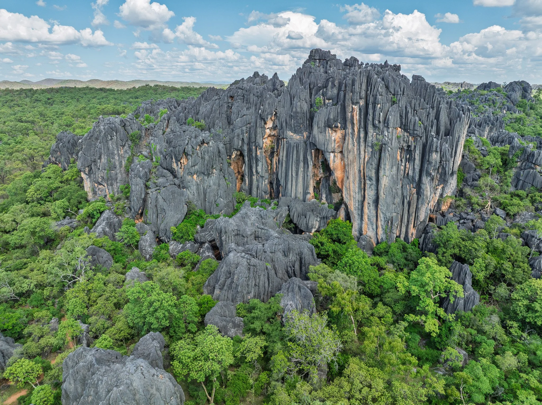
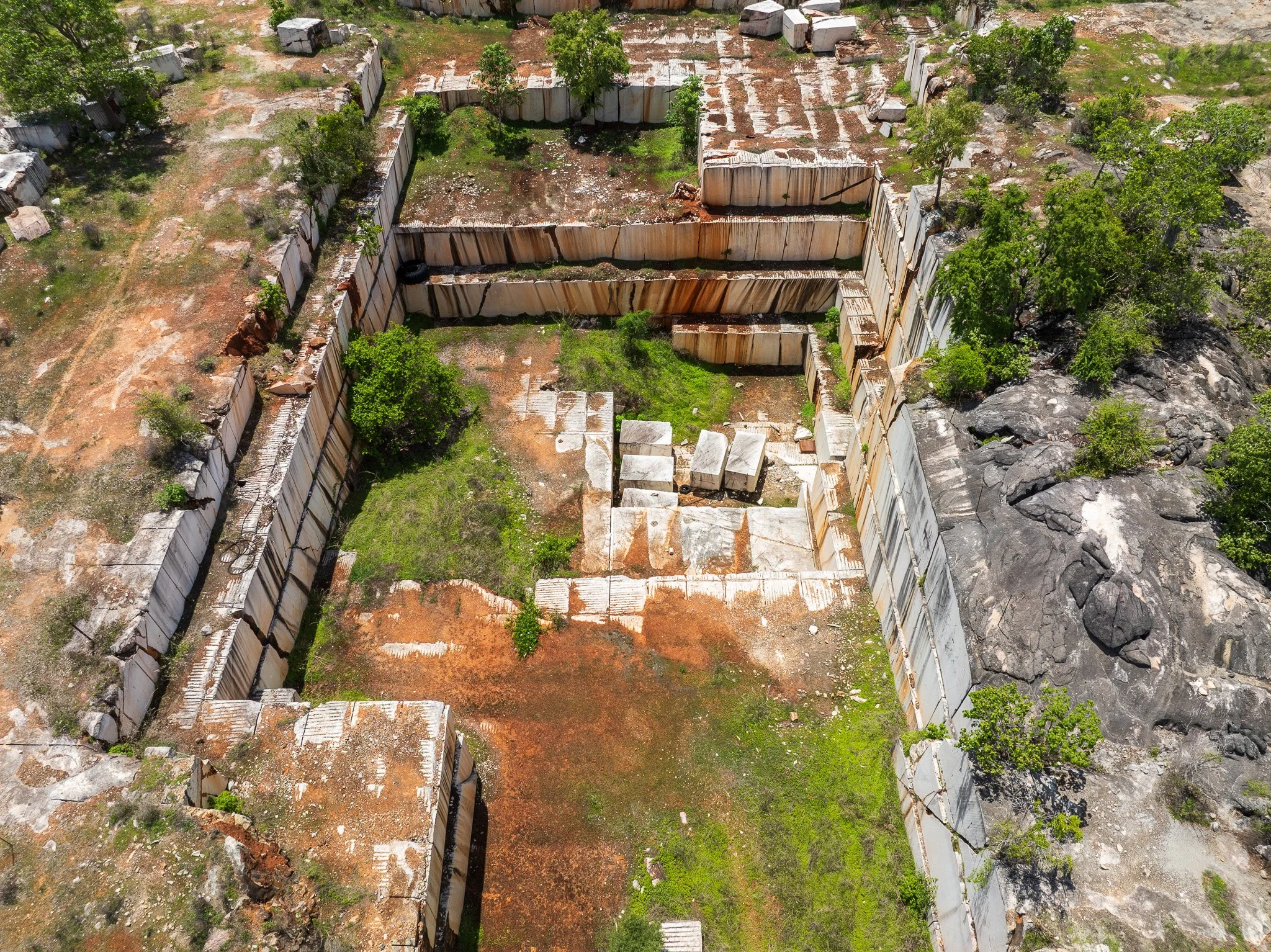
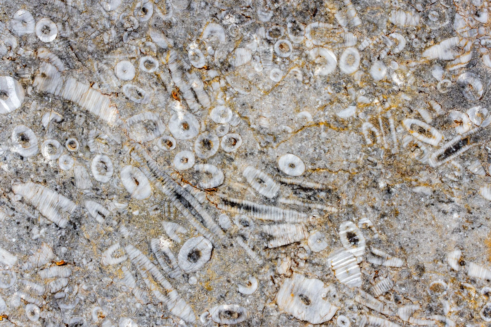
Karst tower, marble mine and crinoid fossils
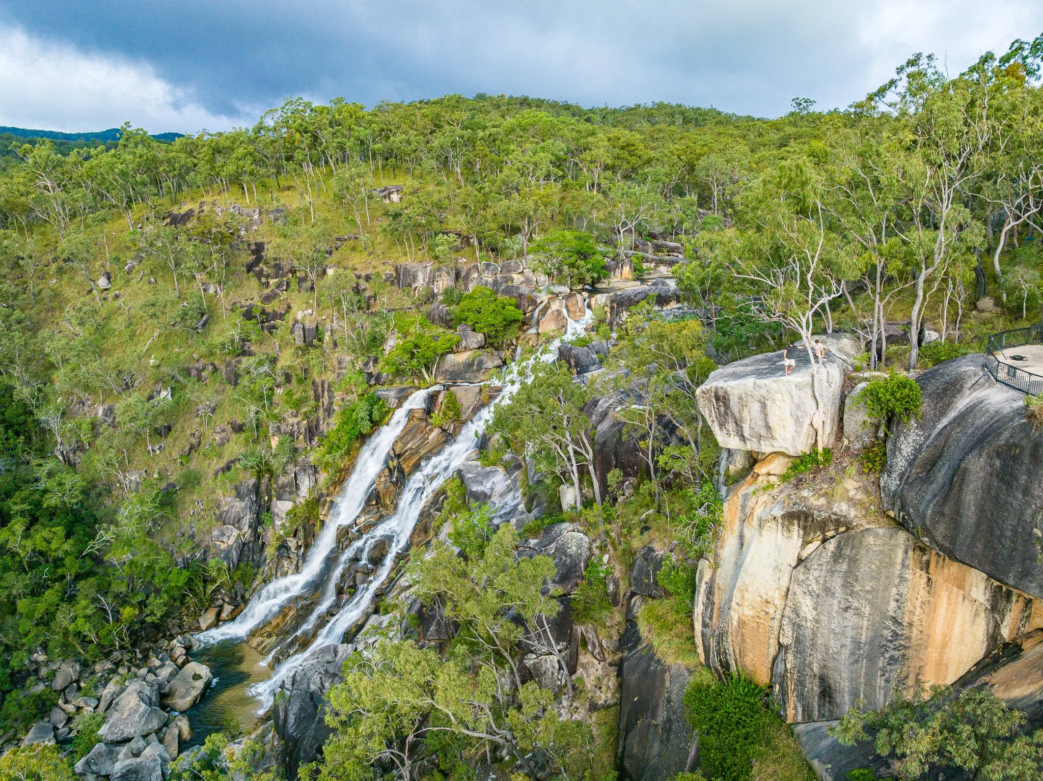
Davies Creek — the granite world
If basalt is the rock of abundance, granite is the rock of austerity — and Davies Creek is where the contrast is most instructive. The Tinaroo Granite, which cooled underground between 270 and 260 million years ago, forms the Lamb Range east of the Tablelands and the rugged country around Davies Creek and Emerald Creek National Parks.
The granite landscape is immediately readable from the air. The rounded boulders characteristic of granite weathering — the remnant kernels of fracture-bounded blocks left when the surrounding rock disaggregated to sandy grus — are visible on the hillsides. The vegetation is open: scattered eucalypts, sparse understorey, grass between the boulders. The contrast with the closed rainforest just kilometres away on the basalt Tablelands is absolute.
The northern bettong — one of FNQ’s most significant threatened mammals; has its stronghold in the open grassy woodland of the Davies Creek and Dinden National Park country. It depends on the fungi, grasses and open habitat that the granite soils produce. It could not persist on basalt country with its closed rainforest. The bettong’s range is a geological map as much as a species distribution.
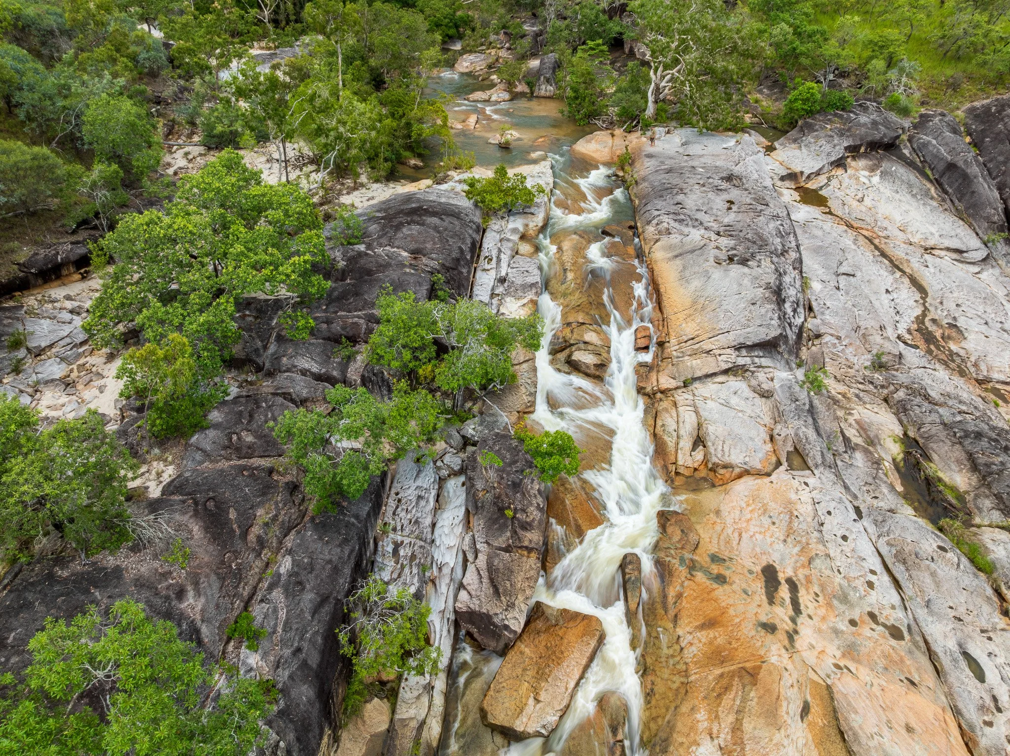
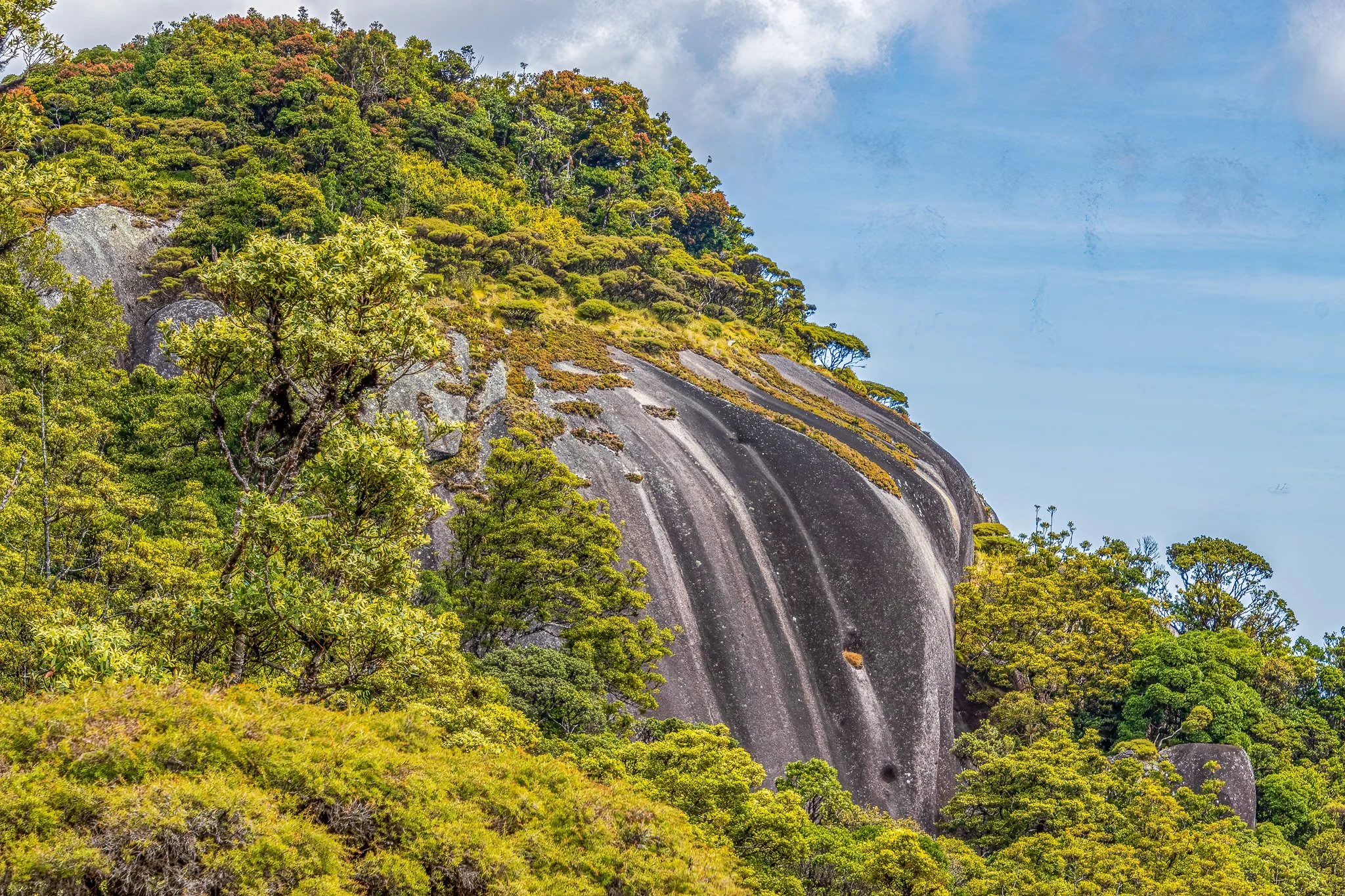
Exposed granite in Davies Creek and on Mount Kahlpahlim (Lambs Head)
Ngarrabullgan — a sandstone island
Eighteen kilometres long, six and a half wide, rising 200 to 400 metres above the surrounding landscape on all sides — Ngarrabullgan at Mount Mulligan is a sandstone and conglomerate mesa in a landscape otherwise dominated by volcanics and metamorphics. It is ten times the surface area of Uluru and almost unknown outside the region.
The sandstone was laid down 270 to 230 million years ago when this was a Permian rift valley with a central lake surrounded by peat swamps and Glossopteris forests. The same cold-climate Gondwanan flora whose fossils connect Australia to Antarctica, Africa and South America. Those forests became the coal seams later mined at Mount Mulligan — the site of one of Australia’s worst mining disasters, where 75 men died in a coal gas explosion in 1921.
The geological boundary is sharp and the vegetation announces it. The mesa top has plant and animal communities not found beyond its margins — a direct result of millions of years of isolation on a substrate that does not occur in the surrounding country. Archaeological evidence shows the Djungan people first lived on the mountain more than 37,000 years ago but stopped camping on the summit approximately 600 years ago — consistent with the Djungan tradition that Ngarrabullgan is inhabited by the Eekoo spirit. The geological isolation that created unique ecology also created unique cultural significance.
The Atherton Tablelands — red soil and recent fire
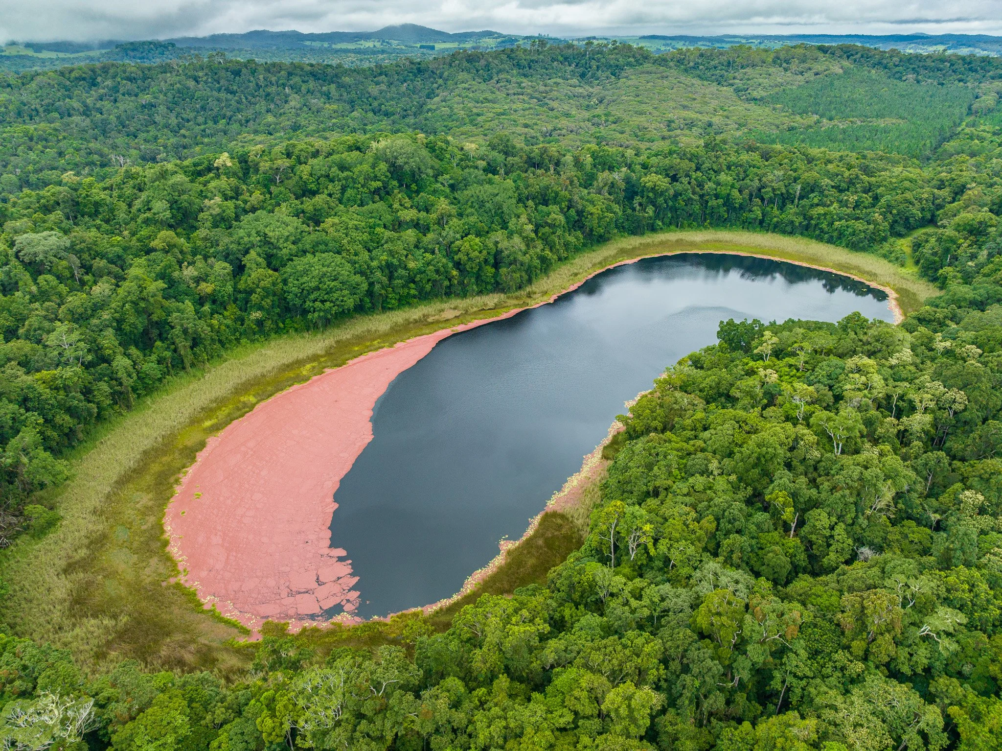
The Atherton Basalt Province switched on approximately 7 million years ago. Shield volcanoes poured massive flows of basalt across the landscape, filling valleys and creating the rolling plateau surface of the Tablelands. Sixty-five eruptive centres have been identified across nearly 2,500 square kilometres. The red soil that defines this country — that grows the dairy herds, the avocados, the macadamias, the most structurally complex rainforest in Australia — is the weathered product of those flows.
The ecological consequence is dramatic. Strangler figs — a keystone species feeding fruit bats, cassowaries and dozens of other animals — are two to three times more abundant on basalt than on any other substrate. One mineral difference in the rock, cascading through an entire food web.
Around one million years ago, the character of volcanism changed. The great shield volcanoes gave way to smaller, more explosive events. Cinder cones and maars replaced the landscape-building flows. The maars formed when rising magma hit the groundwater table and triggered violent steam explosions. Lakes Eacham, Barrine and Euramoo are the water-filled craters. Lake Eacham is approximately 9,000 years old. Lake Barrine approximately 17,300. Lake Euramoo approximately 23,000.
These are not ancient features in any human sense. They formed within the living memory of the culture that has the longest continuous relationship with this landscape. Aboriginal oral tradition records the formation of these lakes as volcanic events. A Dyirbal storyteller recorded in 1964 noted that the area around the lakes was open scrub at the time, not rainforest. Pollen analysis has since confirmed that the surrounding rainforest is less than 7,600 years old. The oral record and the geological record agree.
The youngest features in this landscape are within the living memory of the culture with the longest continuous relationship with it.
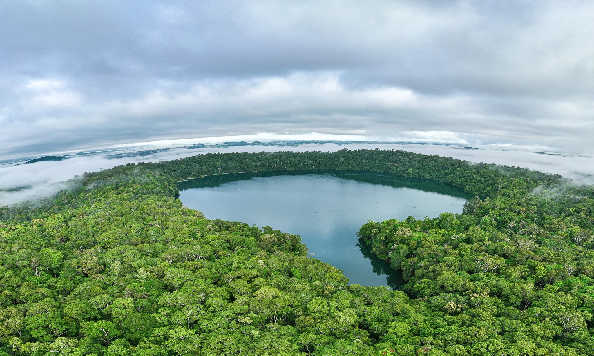
Lake Eacham and Lake Euramoo
The Barron River Gorge — a thief and its consequences
The Barron River is, geomorphologically speaking, a thief.
Before its gorge existed in anything like its current form, the upper Tablelands drained westward — toward the Gulf of Carpentaria, as the gentle basalt plateau naturally directed it. Lava flows near Biboohra from Bones Knob, dated at approximately 1.79 million years ago, filled the ancient paleo-channel, blocking the westward drainage and forcing water eastward toward the coastal escarpment. What had been a gentle slope to the Gulf became a plunge over the full height of the Great Escarpment. The hydraulic energy was enormous. The gorge began to cut.
Willmott and Stephenson, whose 1989 Rocks and Landscapes of the Cairns District remains an authoritative geological account of this region, are explicit: the Barron captured first the Clohesy River near Koah, then the former headwaters of the Mitchell River near Mareeba. Both originally flowed northwest toward the Gulf. The increased discharge from these relatively recent captures accounts for the steepness and narrowness of the gorge below Kuranda. The gorge has been cut by retreat of Barron Falls. At one millimetre of retreat per year over six kilometres, that is approximately six million years of cutting — dramatically accelerated by the lava capture event at 1.79 million years ago.
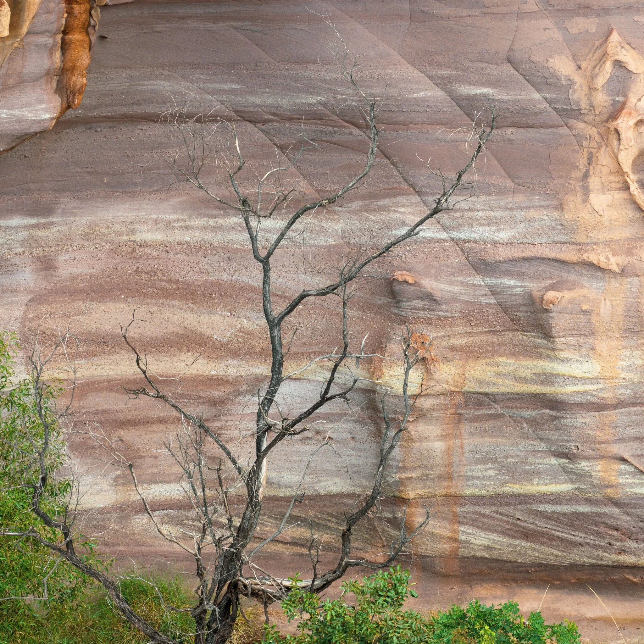
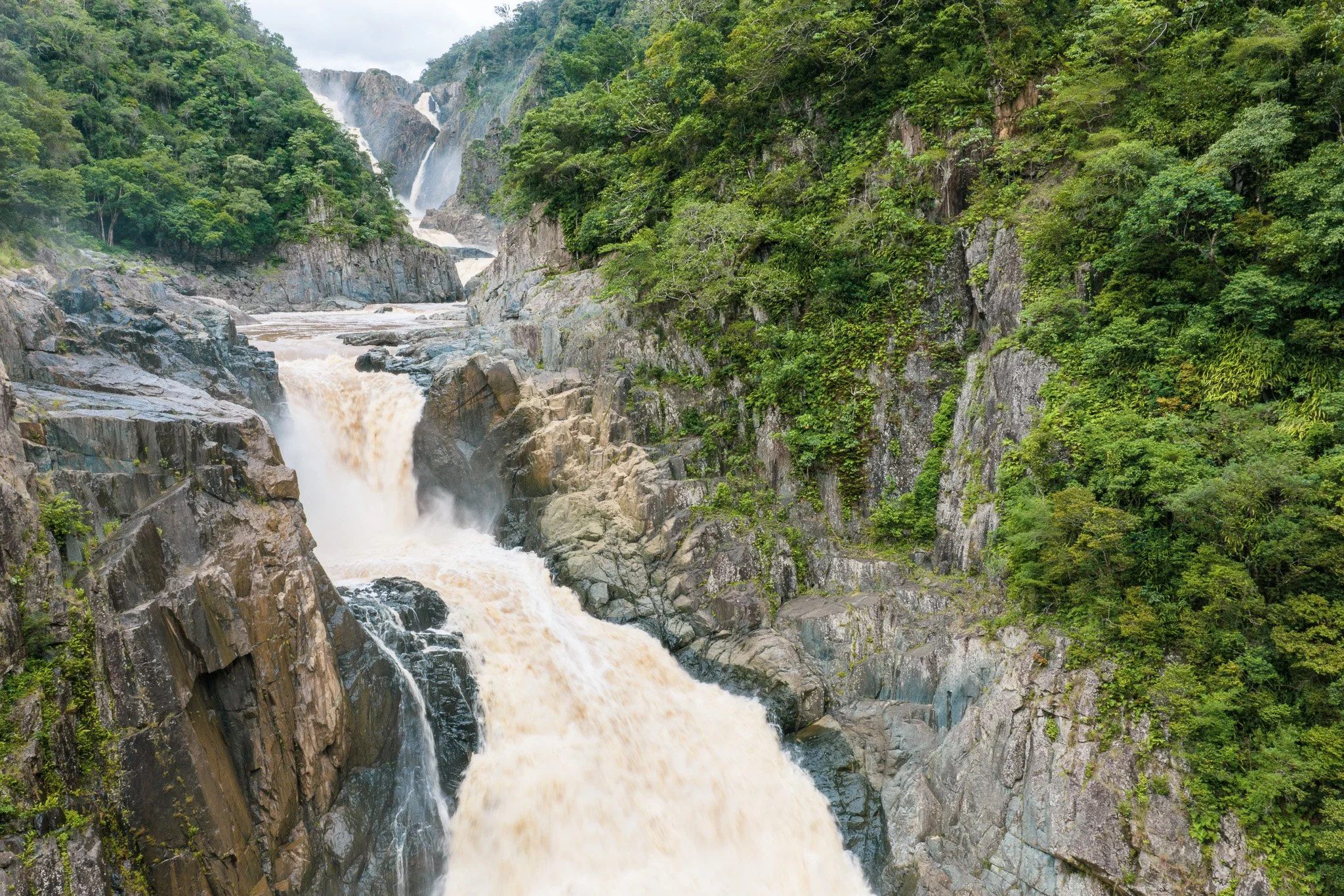
The gorge walls are Hodgkinson Formation metamorphics — the same ancient seafloor sediments introduced earlier, now exposed by a river cutting back through the Great Escarpment. The gorge is not granite-faced, as some tourism copy claims. It is metasedimentary rock: argillite, greywacke, quartzite and greenstone, steeply dipping, closely fractured, transformed from deep-sea sediment by continental collision 360 million years ago.
Most visitors experience Barron Gorge as scenery. What they are actually watching is a landscape still in the act of forming — a stolen river, a retreating waterfall, and 400 million years of rock exposed in a single descent.
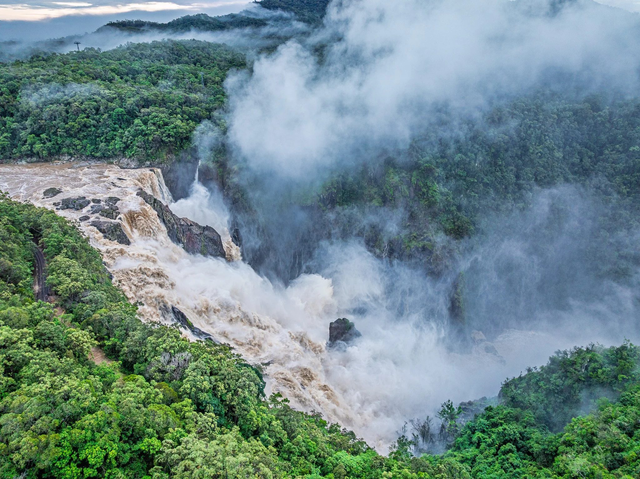
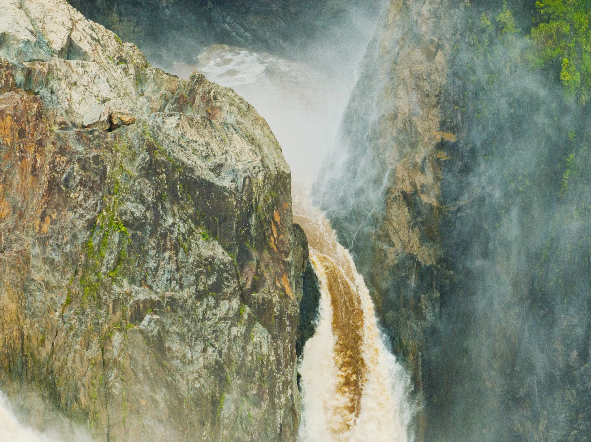
Barron Falls Din Din in flood — a knickpoint retreating upstream through 360-million-year-old metamorphic rock.
Every flood moves it fractionally closer to Kuranda.
The Barron Gorge began forming 1.79 million years ago when a lava flow near Biboohra blocked the westward drainage and redirected a river.
The five-layer reading
Everything described above operates through a single framework: geology comes first. The rock type determines the mineral chemistry. The mineral chemistry determines the soil. The soil determines what grows. What grows determines what lives there, what the Traditional Owners knew and named, and what European settlers transformed.
The geological layer is not background. It is the author.
I gave a version of this material recently to the Native Plants Queensland Tablelands Branch at Tolga. The audience were gardeners, revegetation practitioners, and people who know these plants intimately. They already knew the plants. What the geological framework gave them was the ground the plants are growing in, and why that ground makes them what they are.
That’s what I’m trying to do with Kevin Explores — not just show you what the landscape looks like from the air, but give you the deep-time story that explains why it looks that way. The geology wrote it. The plants are reading it aloud.
Kevin Explores - Connecting People to Country with Stories and Images from Above
Further reading: Willmott, W.F. and Stephenson, P.J. (1989) Rocks and Landscapes of the Cairns District (Queensland Department of Mines); Whitehead et al. (2007) Temporal Development of the Atherton Basalt Province (Australian Journal of Earth Sciences); Nethery, J. (2003) Chillagoe — Geological History in a Nutshell (ACKMA Conference paper).