Where there is sandstone, there was a basin.
Mt Mulligan Ngarrabullan
Sandstone begins as loose sediment — sand, gravel, organic material — carried by rivers and deposited in low places. Lakes. River deltas. Shallow seas. Rift valleys. The sediment accumulates in layers, is buried under more sediment, and over millions of years the pressure and chemistry of deep burial cements the grains into rock. Sandstone is, at its most fundamental, the record of a basin that once existed and has since been buried, compressed, and exhumed.
This means that when you find sandstone, you can ask a reliable question: where was the basin?
At Mt Mulligan (Ngarrabullgan), that question produces an uncomfortable answer.
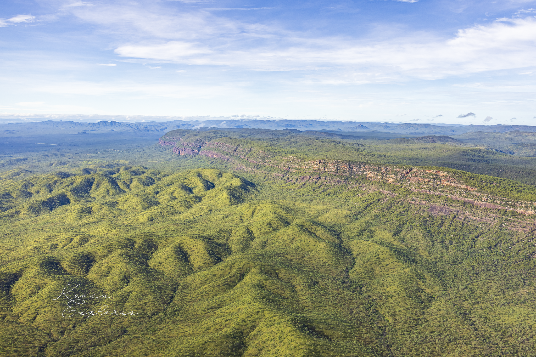
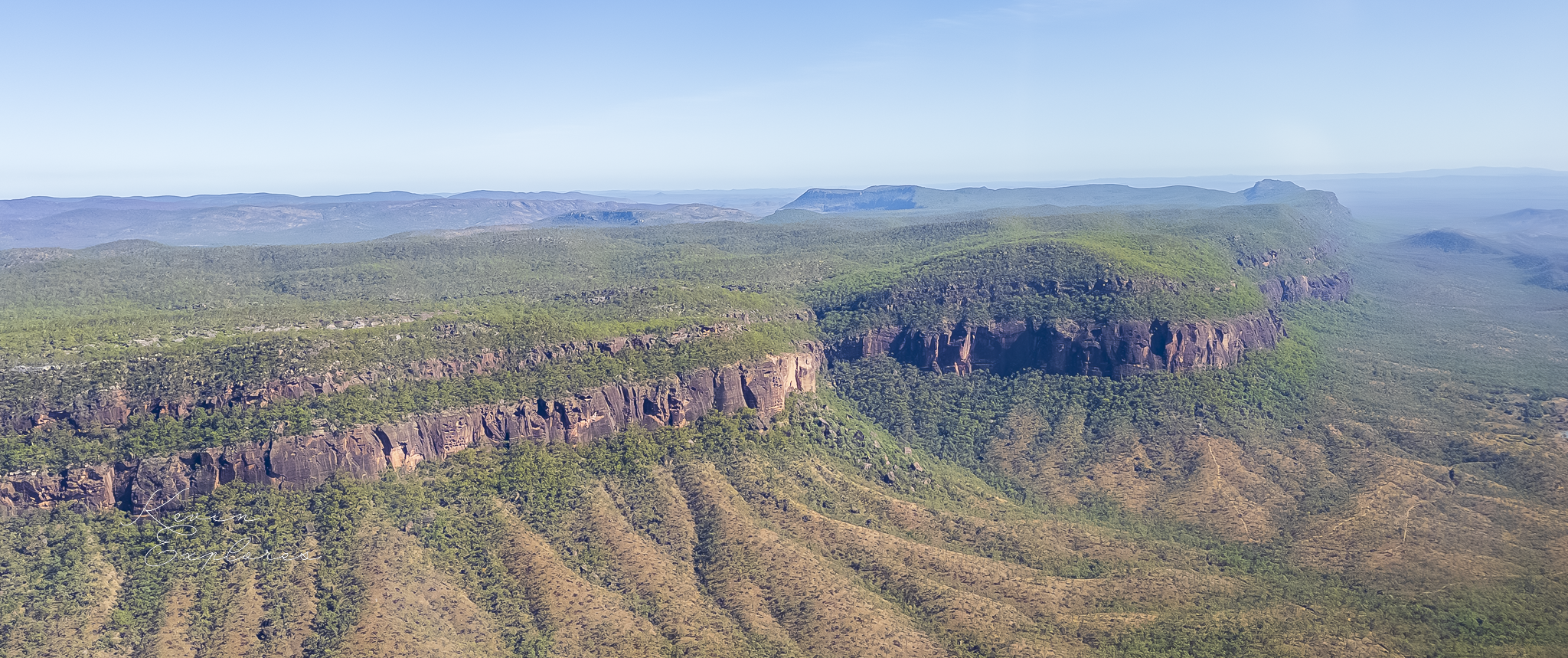
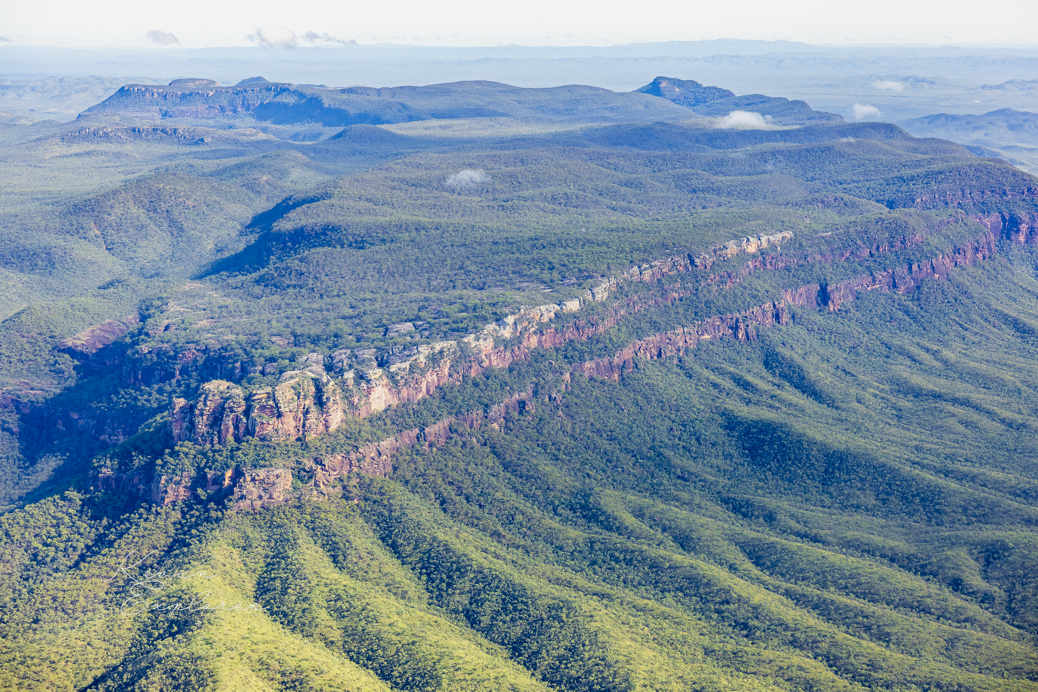
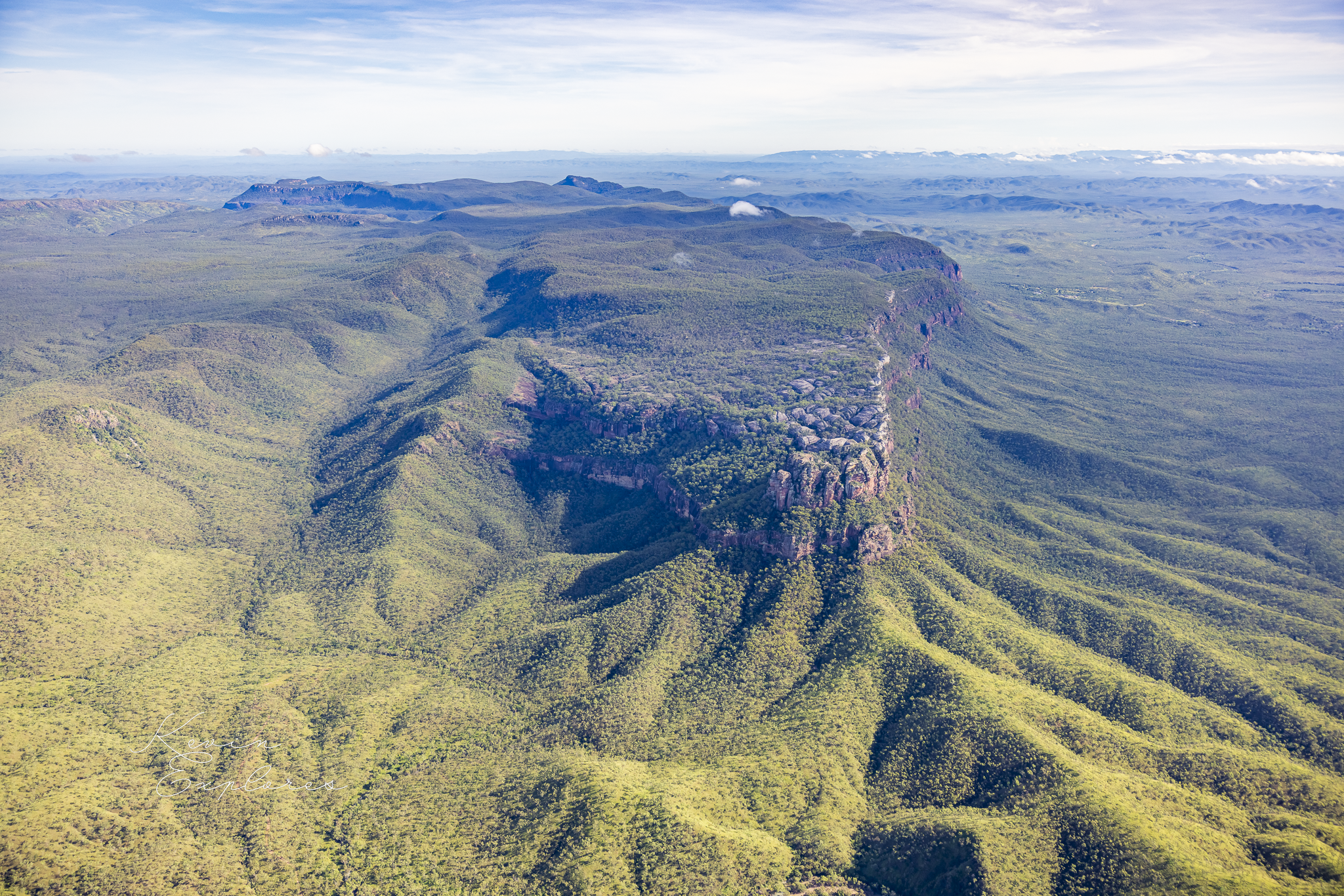
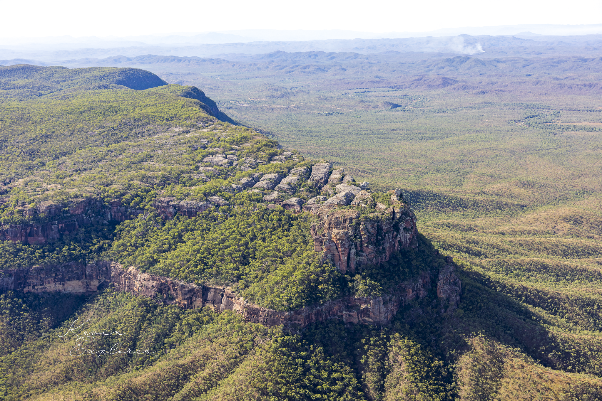
The mountain is an isolated sandstone ridge rising from a flat plain in Far North Queensland. It connects to no adjacent range. It has no obvious relationship to the surrounding landscape. It simply rises — the plateau extending well beyond what is immediately visible, its eastern escarpment running for approximately ten kilometres in a line so straight it looks drawn — and stops. If sandstone always begins as basin fill, the basin that produced this mountain should be visible somewhere in the surrounding country.
There is almost nothing.
The plain surrounding Mt Mulligan is Hodgkinson Formation — ancient seafloor sediment approximately 400 million years old, compressed and metamorphosed during one of the major collision events that built this part of the continent. It is not basin fill. It is not related to the sandstone above it. It is a completely different rock type from a completely different geological era, and it forms the floor of the landscape rather than its high points.
The sandstone sitting roughly 300 metres above it is younger. Significantly younger — approximately 270 million years old. Geologists call this sequence the Mt Mulligan Coal Measures — the word "measures" being their term for a stack of rock layers, most of which is actually sandstone. The coal is in there, but it's not the whole story. Neither is the name.
So the question sharpens. The basin that produced this sandstone was here — but everything that surrounded it has gone. The sandstone is not sitting on top of its original landscape. It is sitting above the ruins of it.
That is the paradox Mt Mulligan presents to anyone who starts paying attention.
The explanation begins underground.
The coal measures were not always high. They started low — very low. During the Permian, a fault running along what is now the eastern face of the mountain — the Kingsborough Fault, clearly mapped on the Queensland government's geological survey — caused a block of country to drop below the surrounding landscape. A rift basin formed. Rivers and lakes accumulated sediment within it. Organic material accumulated in swampy conditions, was buried, and became coal. The basin filled, layer by layer, with sandstone, siltstone, mudstone, and those coal seams. The surrounding country stood higher. The basin floor stood lower.
Then the erosion began. And here is where the story turns.
Why the Hodgkinson lost.
The Hodgkinson Formation looks tough. It is, in some senses, tough — ancient, dense, formed under enormous pressure. But it carries a structural weakness written into it by its own history. When the New England Orogeny compressed and folded the Hodgkinson around 360 million years ago, it left the rock intensely fractured. Not broken apart — but cracked, pervasively and deeply, along an enormous number of fracture planes. The rock was, in a sense, pre-broken.
Fractures are where weathering concentrates its energy. Water enters a fracture, chemically attacks the rock along that surface, widens the crack, allows more water in. The Hodgkinson's fracture network gave 200 million years of tropical weathering an almost unlimited number of attack points. The rock was dismantled from the inside out, along its own fault lines.
The Mt Mulligan sandstone had no equivalent vulnerability. Deposited after the deformation event, in a quiet rift basin, it was never subjected to the same compression. Its layers sit sub-horizontal and relatively unfractured. It is well-cemented — silica and iron oxides binding the grains into a coherent mass. When water enters it, it moves slowly through the pore spaces and distributes the weathering energy diffusely across the whole rock body rather than concentrating it at fracture surfaces. The sandstone weathers from the outside in, one surface at a time.
That is a far slower process.
Toughness in geological terms is not simply a matter of age or rock type. The Hodgkinson was ancient and had survived enormous geological events — but those events left it structurally compromised in exactly the way that sustained tropical weathering would most effectively exploit. The Mt Mulligan sandstone was younger and geologically quieter, and that quietness was its preservation.
Over 200 million years, the Hodgkinson was stripped lower and lower. The coal measures — protected inside their structural depression, resistant by virtue of their integrity rather than their hardness — were left standing. The former basin floor became the highest landform in the region.
Geologists call this relief inversion. The landscape has turned itself upside down.
What remains
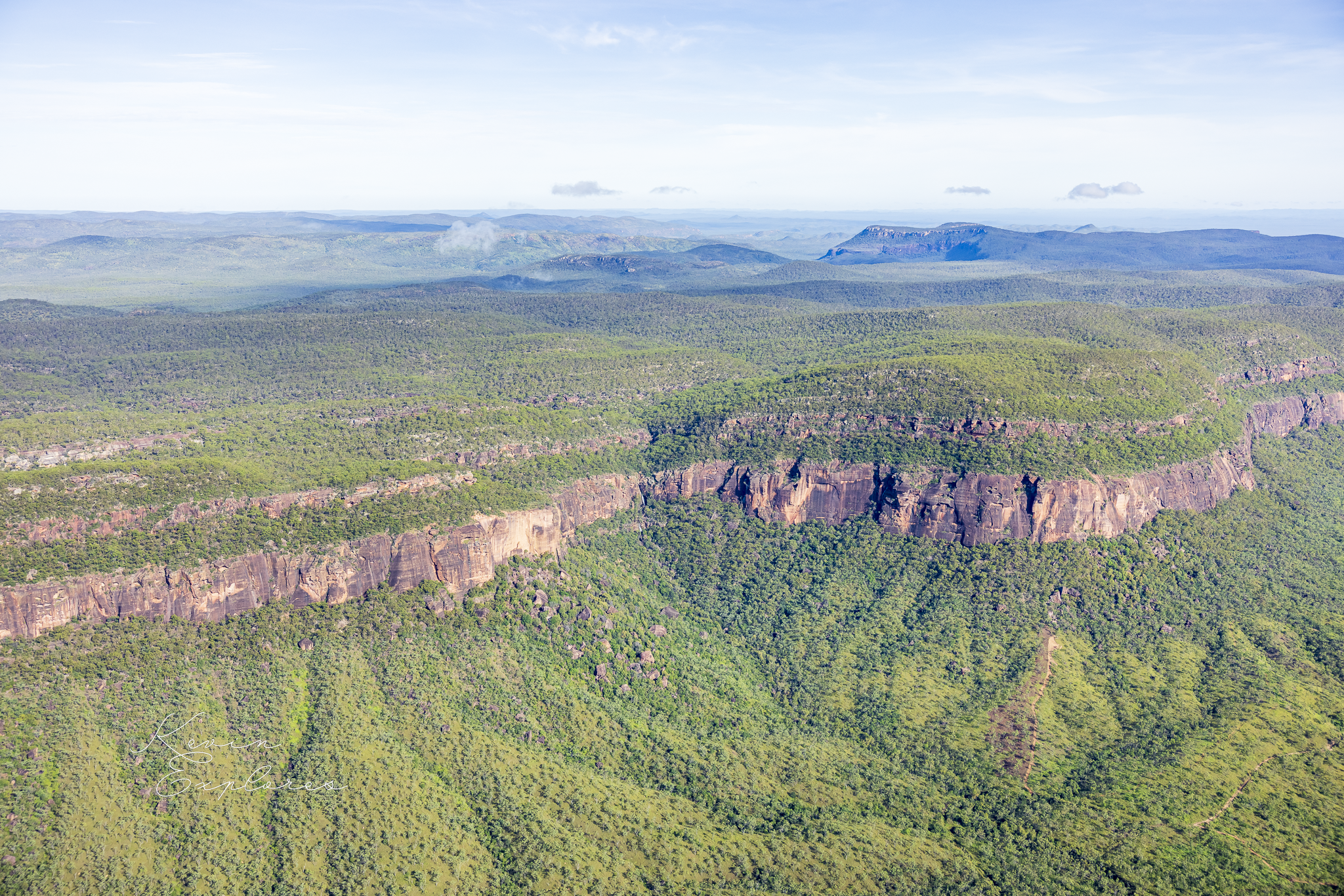
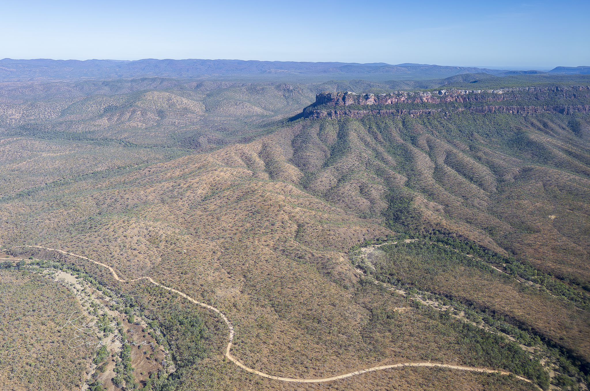
The plain surrounding Mt Mulligan is not simply flat ground. Look carefully at it from above and you can read the Hodgkinson's fracture geometry in the landscape itself — parallel ridges and shallow valleys following the foliation of the deformed basement, the structural grain of a rock that has been stripped to its bones. The plain is a record of the Hodgkinson's internal architecture, exposed by its own erosion.
The eastern escarpment of Mt Mulligan runs in a straight line for approximately ten kilometres. That linearity is not erosional — it is fault-controlled. The Kingsborough Fault set that boundary in the Permian, and the mountain's eastern face has been retreating westward along it ever since. The western margin is less abrupt, less linear — an erosional edge rather than a fault scarp, showing what the mountain looks like when structure stops defining it and weathering takes over entirely.
The mountain dropped below the surrounding landscape 270 million years ago. It now stands roughly 300 metres above it.