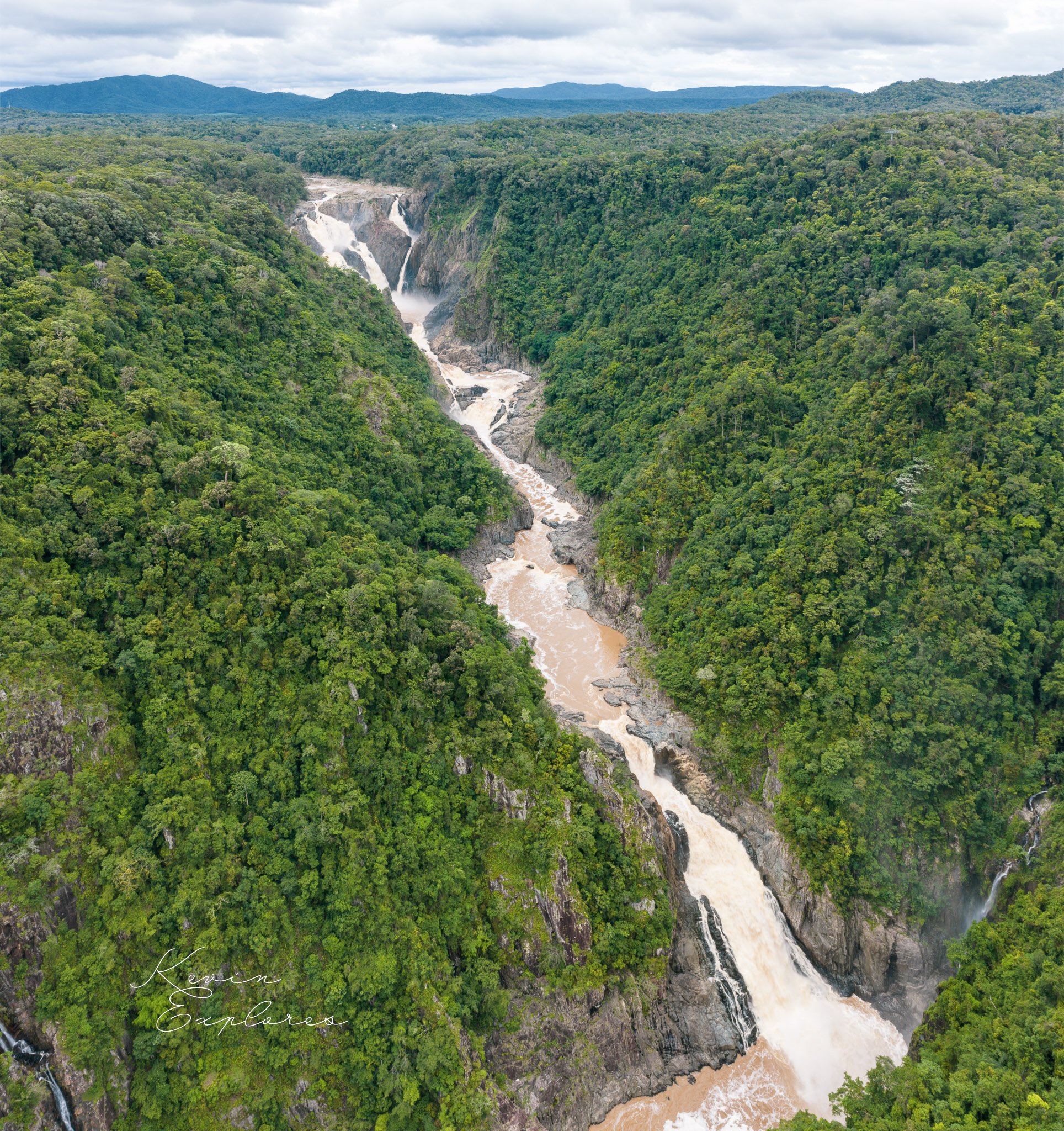
Barron Falls in Geo Context
Standing at Barron Falls this afternoon, I'm reminded that understanding the rivers geo context - ancient seabed metamorphosed, volcanic disruption, river capture, ongoing erosion - makes the beauty so much more profound.
Foundation: Ancient Metamorphic Basement
The Atherton Tablelands sits on Hodgkinson Formation metamorphics - originally seabed sediments deposited in a marine basin during the Paleozoic (roughly 400-300 million years ago). These sediments were subsequently metamorphosed through heat and pressure during tectonic events, creating the folded, foliated rocks that form the basement across this region. This provides the ancient foundation upon which everything else was built.
Granite Intrusions
During the later Paleozoic and early Mesozoic, massive granite plutons intruded into these metamorphic rocks as molten magma cooled slowly underground. These granites are visible in various locations across the tablelands and created localised variations in rock strength and erosion resistance that influenced subsequent landscape development. The contact zones between granite and metamorphics often create distinctive landscape features.
Volcanic Capping
Much more recently (Pliocene to Pleistocene, roughly 5 million to 10,000 years ago), extensive basaltic volcanism covered significant portions of the tablelands with lava flows. These created the relatively flat-topped plateau topography and fertile volcanic soils that characterize much of the region today. The volcanic episode included the maars, shield volcanoes, and scoria cones - Mt Quincan, the Wongabel cones, crater lakes like Eacham and Barrine.
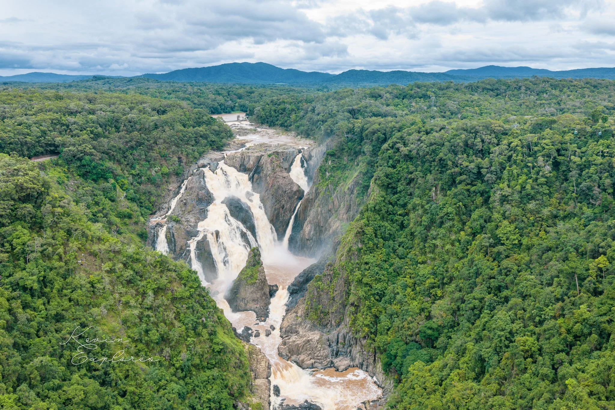
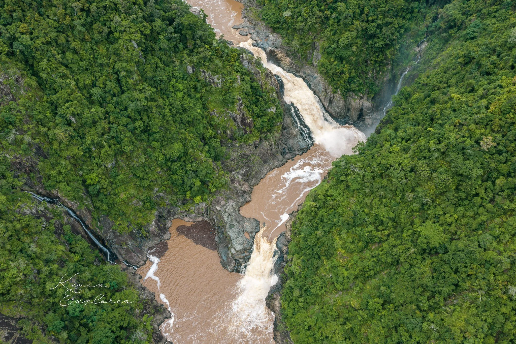
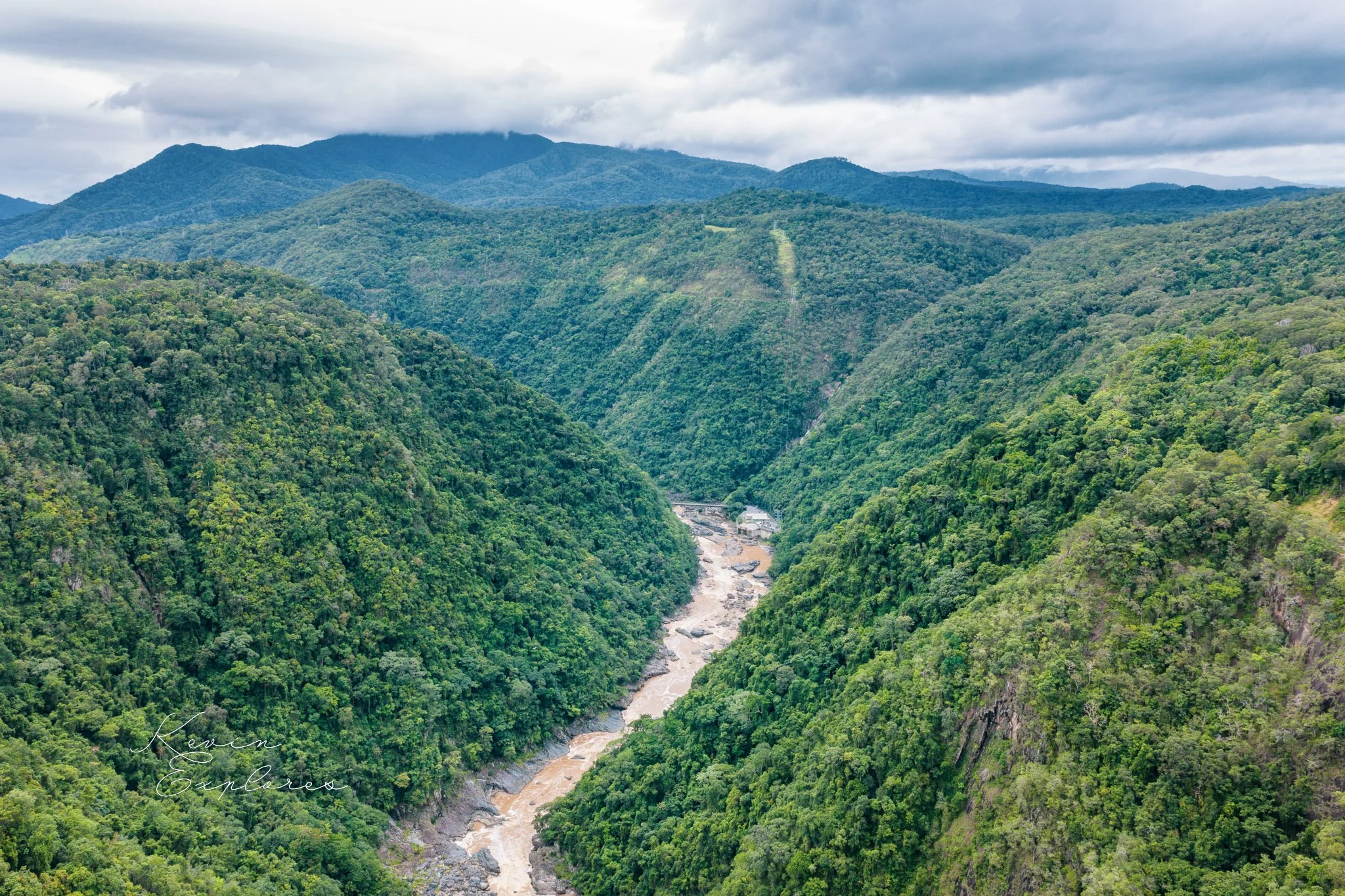
The Eastern Escarpment
The dramatic eastern escarpment represents the boundary where the tablelands plateau drops steeply toward the coastal plain. This feature reflects both structural geological controls (faulting and differential erosion of rock types) and the ongoing process of escarpment retreat as erosion works headward into the plateau. In places, the escarpment exposes the geological layer cake - volcanic rocks above, metamorphic basement below.
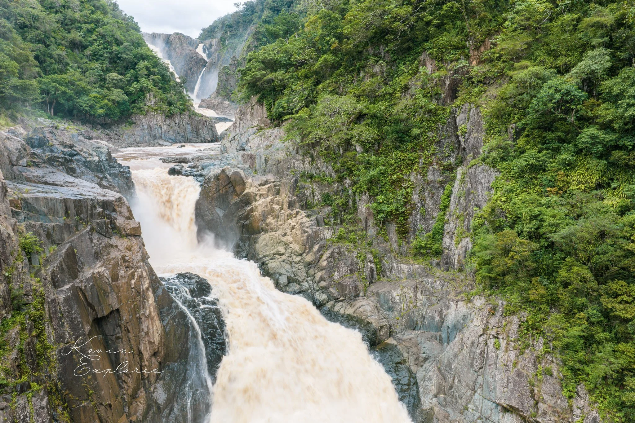
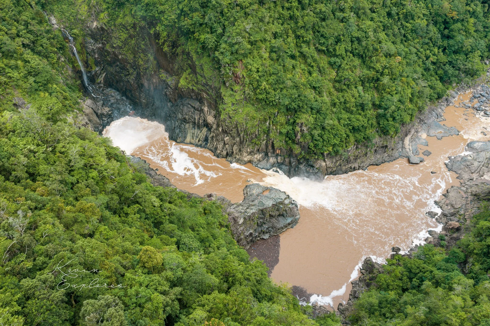
River Capture and Accelerated Incision
The Barron River's dramatic gorge cutting was significantly accelerated by river capture caused by volcanic activity. Originally, the paleo-Barron flowed westward from the Atherton Tablelands toward the Gulf of Carpentaria as part of what would become the Mitchell system. However, basaltic lava flows from Bones Knob filled the ancient river channel near Biboohra, blocking the westward drainage route. This volcanic damming forced the river to find a new course, diverting it eastward toward the coast. This capture event dramatically increased the hydraulic gradient - instead of the gentle westward slope to the Gulf, the river suddenly had the steep eastern escarpment to descend. The increased stream power from this much steeper gradient accelerated downcutting deep into the metamorphic basement, carving the dramatic gorge we see today.
The timing of this capture - relatively recent in geological terms, post-dating the lava flows that caused it - helps explain the gorge's youthful, actively incising character. The Biboohra lava flows thus represent a critical moment when volcanic activity fundamentally re-organised the regional drainage pattern and set in motion the aggressive erosion that created Barron Falls and Gorge.