Zenadh Kes
Torres Strait
Eight thousand years ago, none of this was sea. The strait that separates Australia from New Guinea is one of the youngest bodies of water on Earth — and the islands within it are the high ground of a drowned landscape.
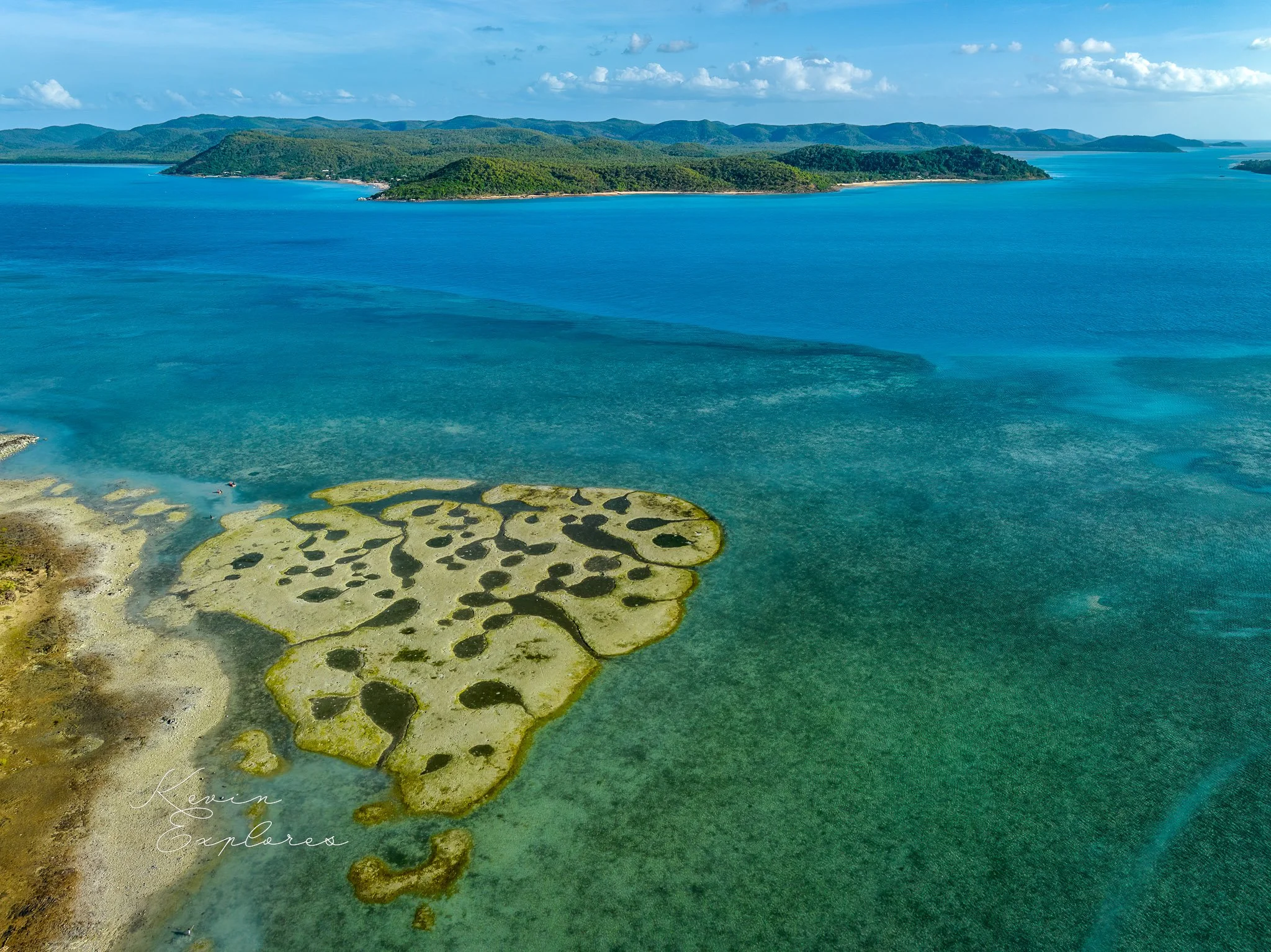
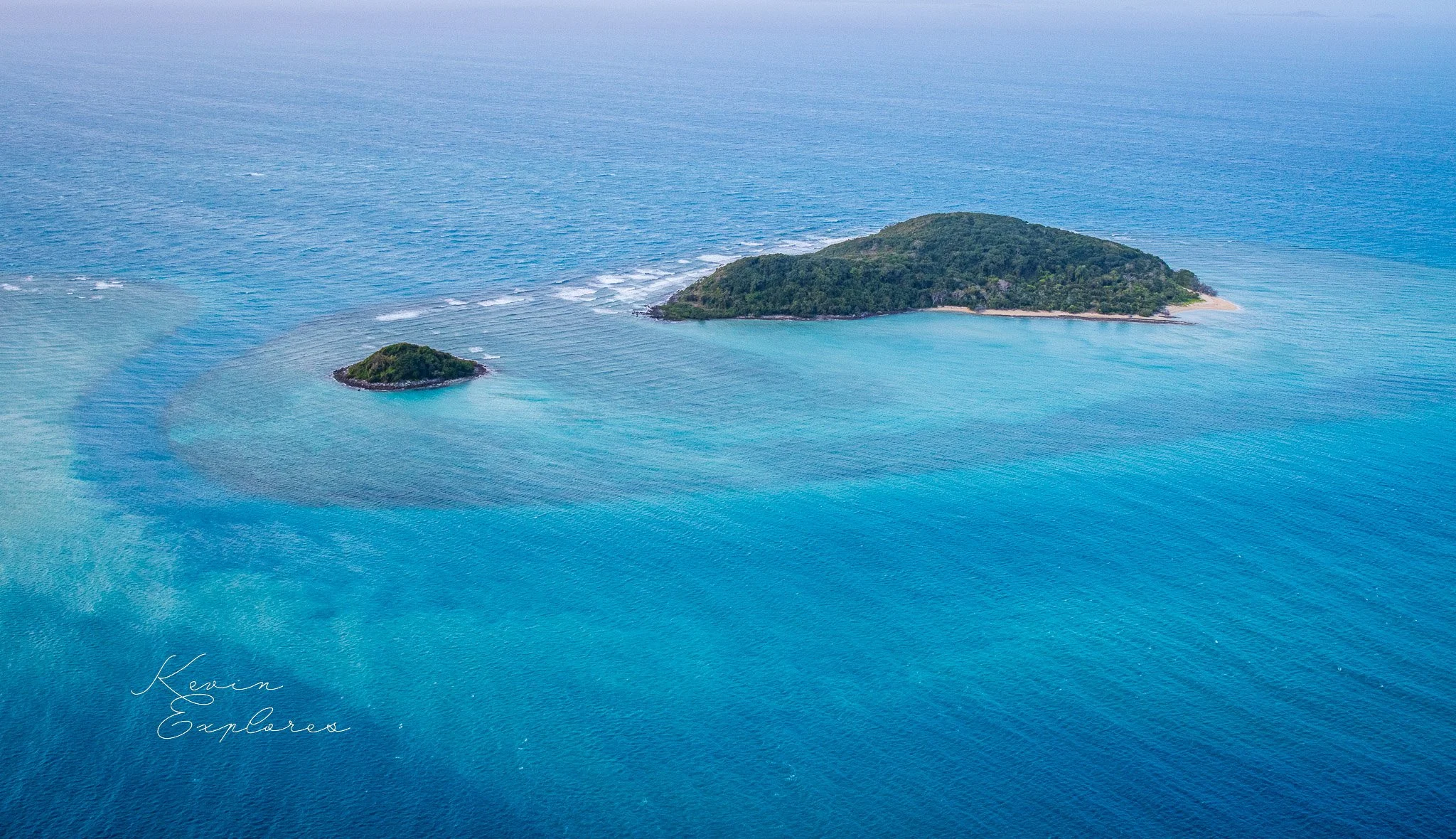
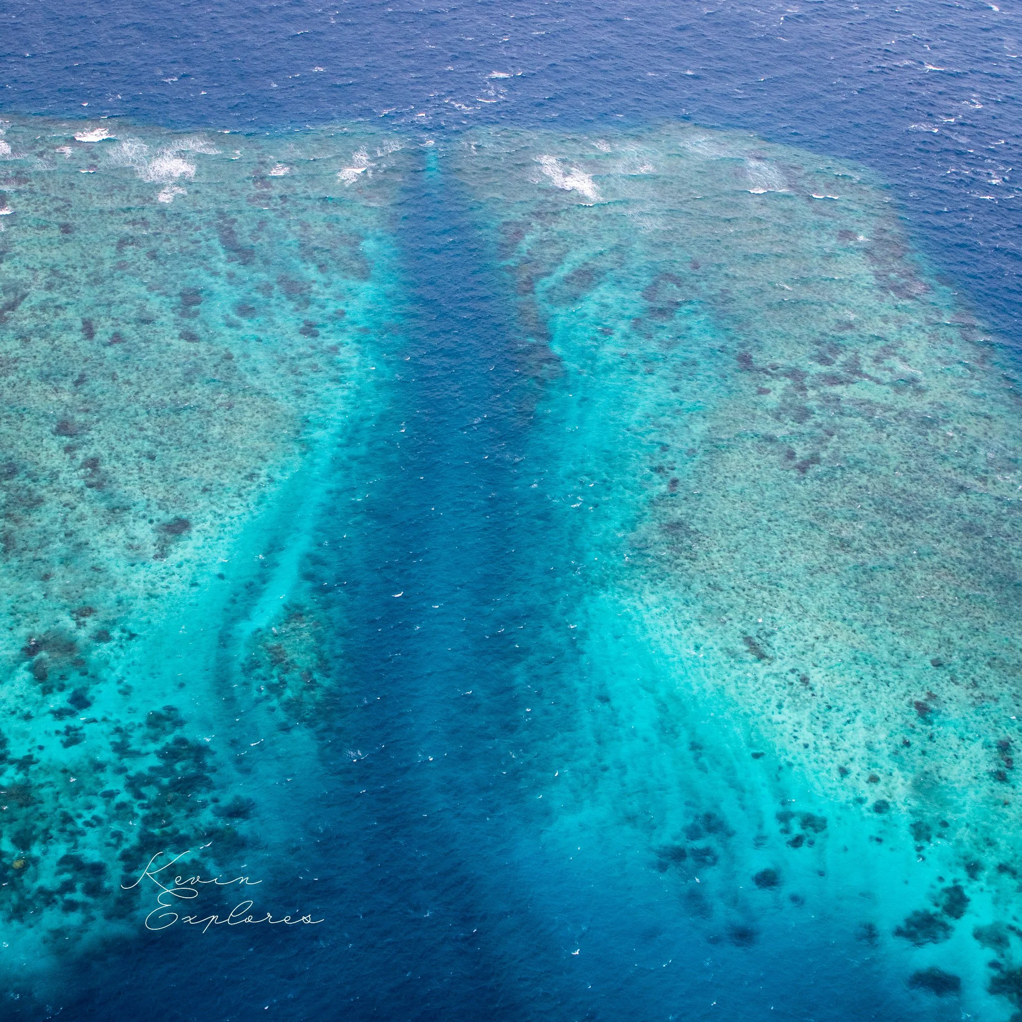
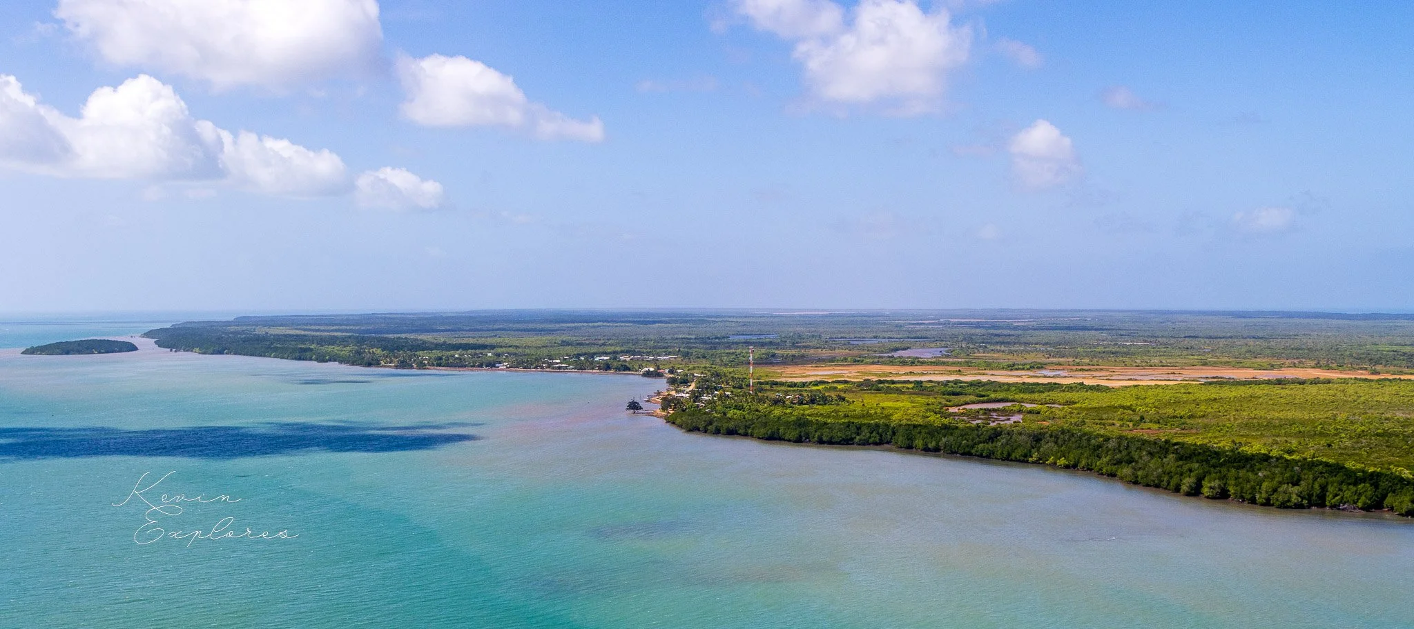
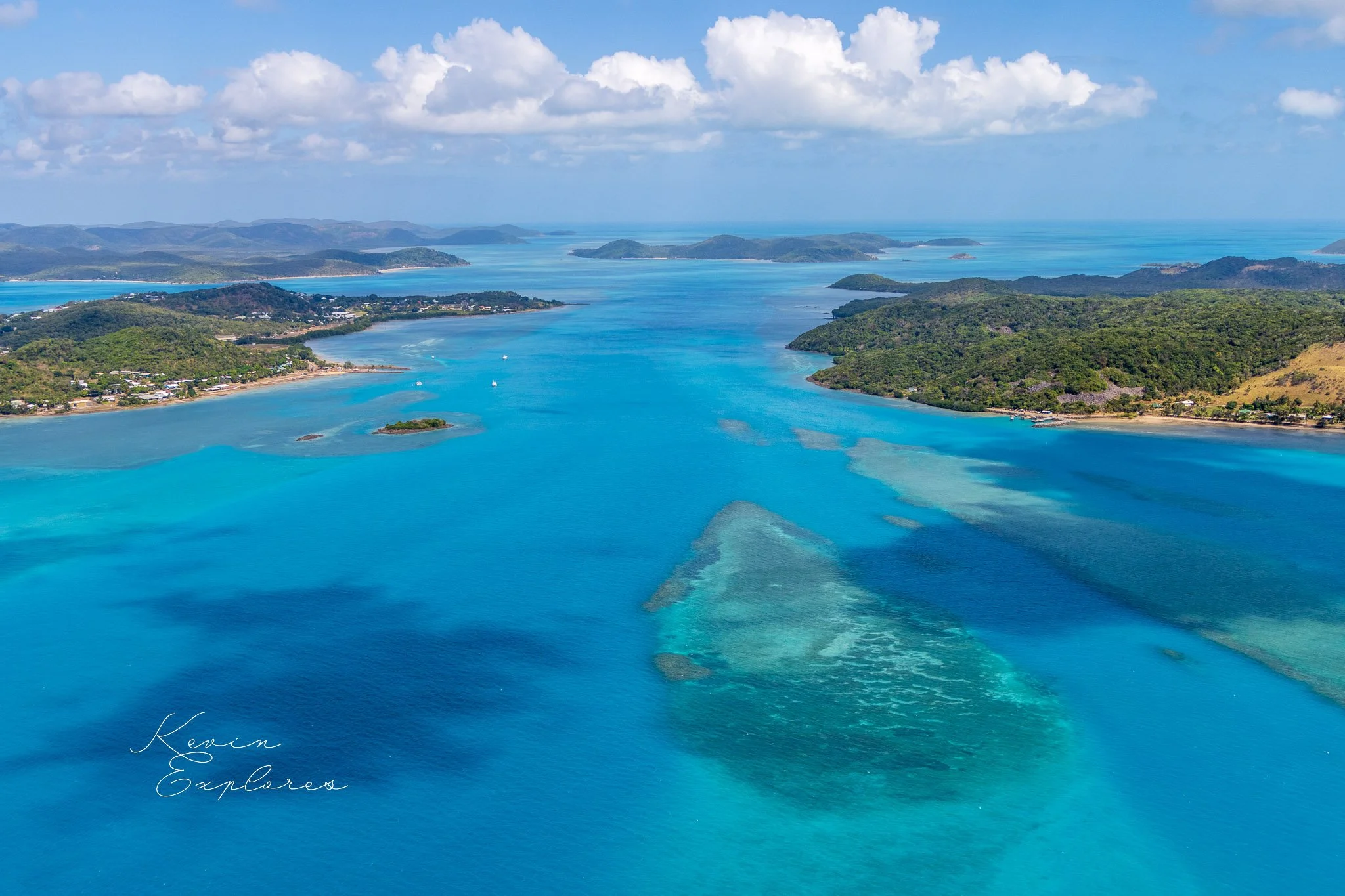
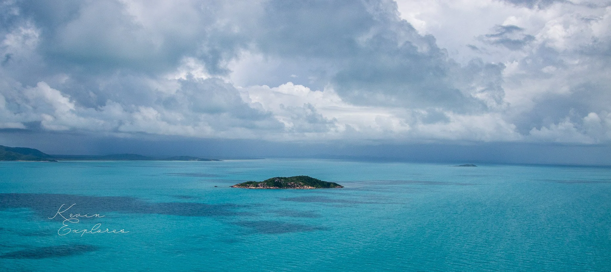
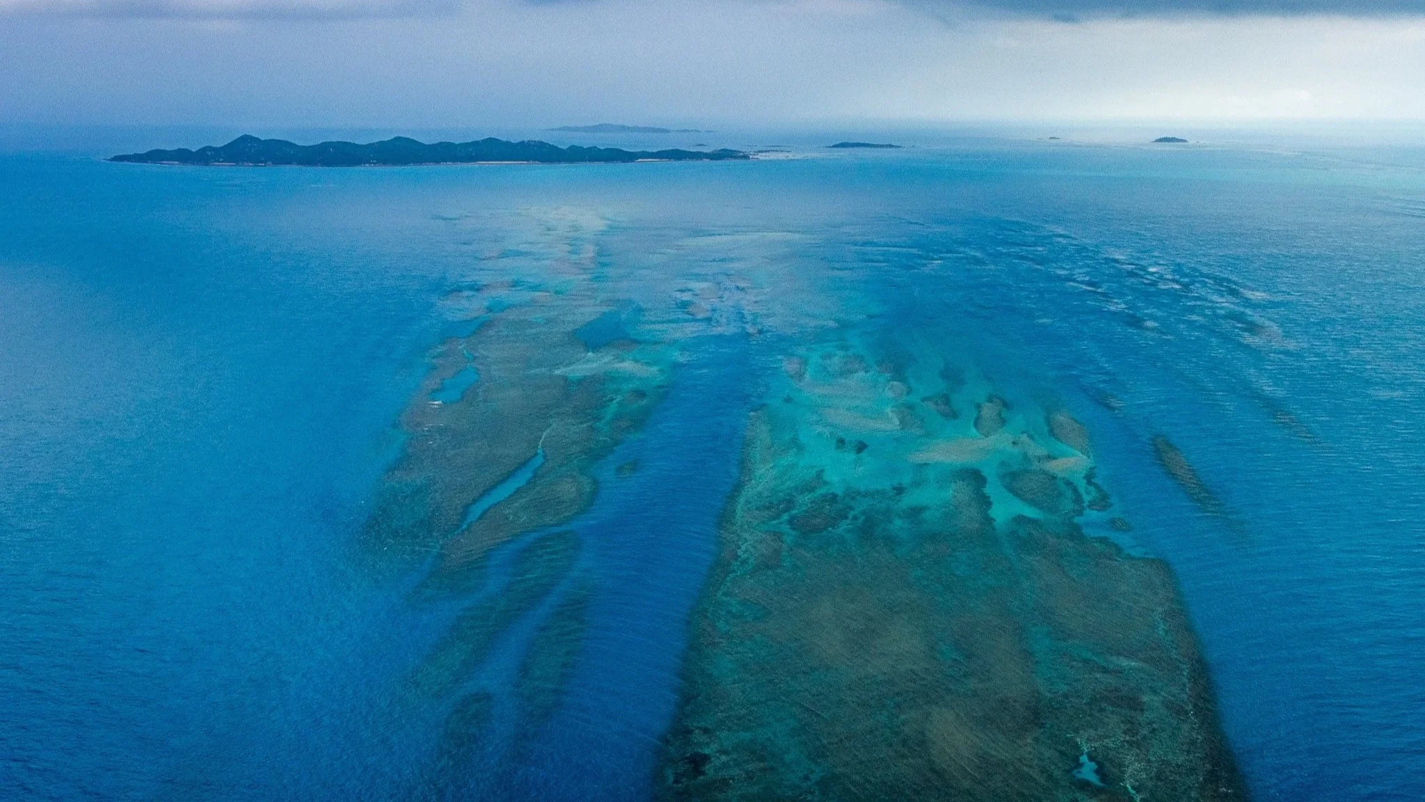
Flying over Torres Strait, the colours of the water tell the whole story if you know how to read them. Deep cobalt blue means depth — open ocean, the drowned plain. Vivid turquoise means shallow — five metres or less, the submerged surface of a landscape that was above water when the first Australians arrived. The islands are simply the parts that didn't go under.
At the last glacial maximum, roughly 20,000 years ago, sea levels across the world were approximately 120 metres lower than today. The continental shelf between Cape York and New Guinea was dry land — a broad, flat plain crossed by rivers, supporting savannah and woodland, inhabited by the ancestors of both Australian Aboriginal and Torres Strait Islander peoples and the people of Papua New Guinea.
As the climate warmed and the great ice sheets of the northern hemisphere melted, sea levels rose — not suddenly, but steadily, over thousands of years. The low-lying plain began to flood from both sides simultaneously. Rivers became estuaries. Estuaries became bays. Bays merged into a continuous shallow sea. By approximately 8,000 years ago, Torres Strait had formed as a recognisable body of water. By 6,000 years ago, sea levels had broadly stabilised at close to their present position.
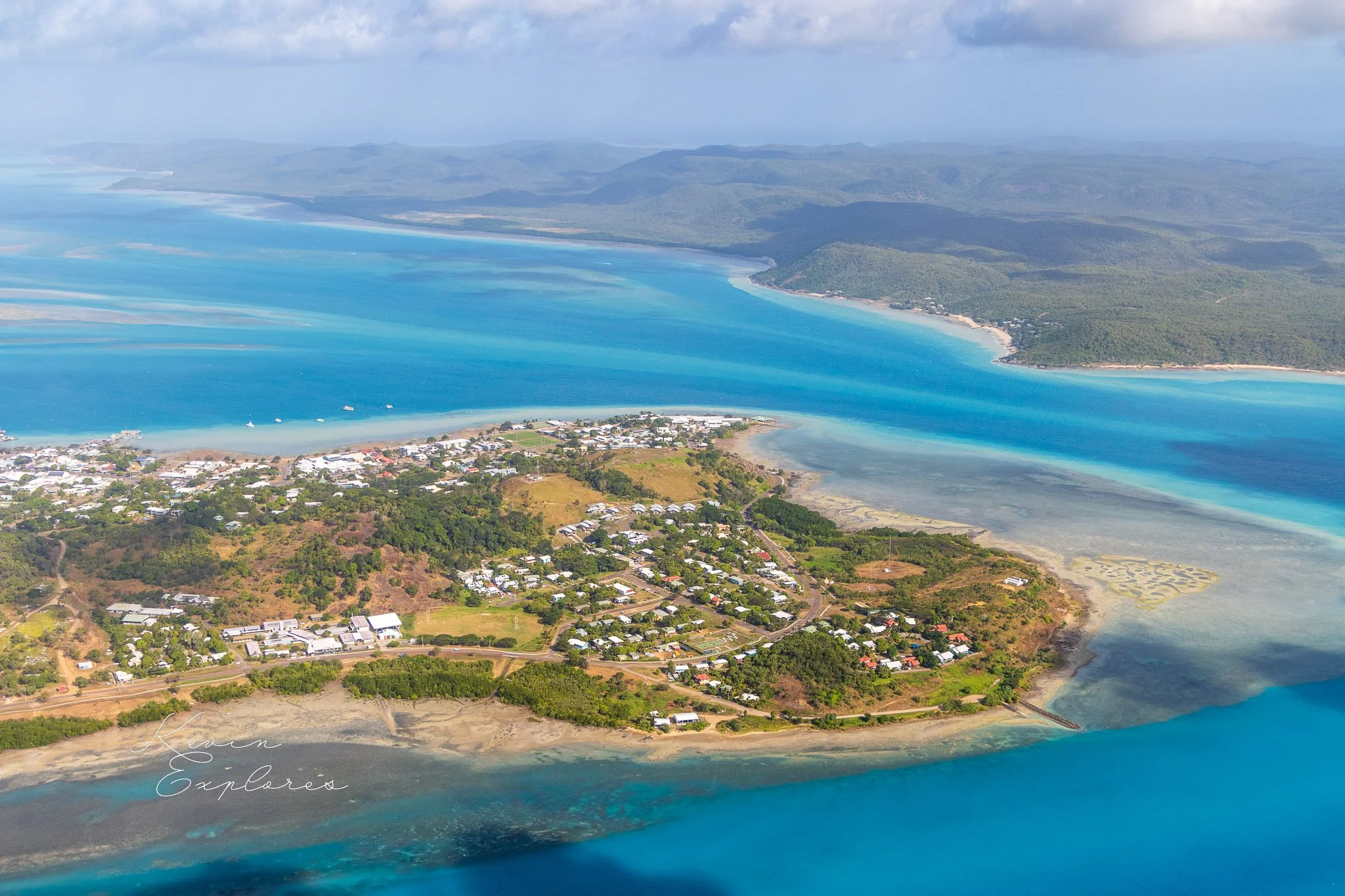
The islands of Zenadh Kes are the high points of the old landscape — granite hills, limestone ridges, and sand accumulations that remained above water as everything around them flooded. From the air, the shallow-water zones around each island map the shape of that old landscape with extraordinary clarity. Every pale turquoise patch is former land. Every deep blue channel is a former valley.
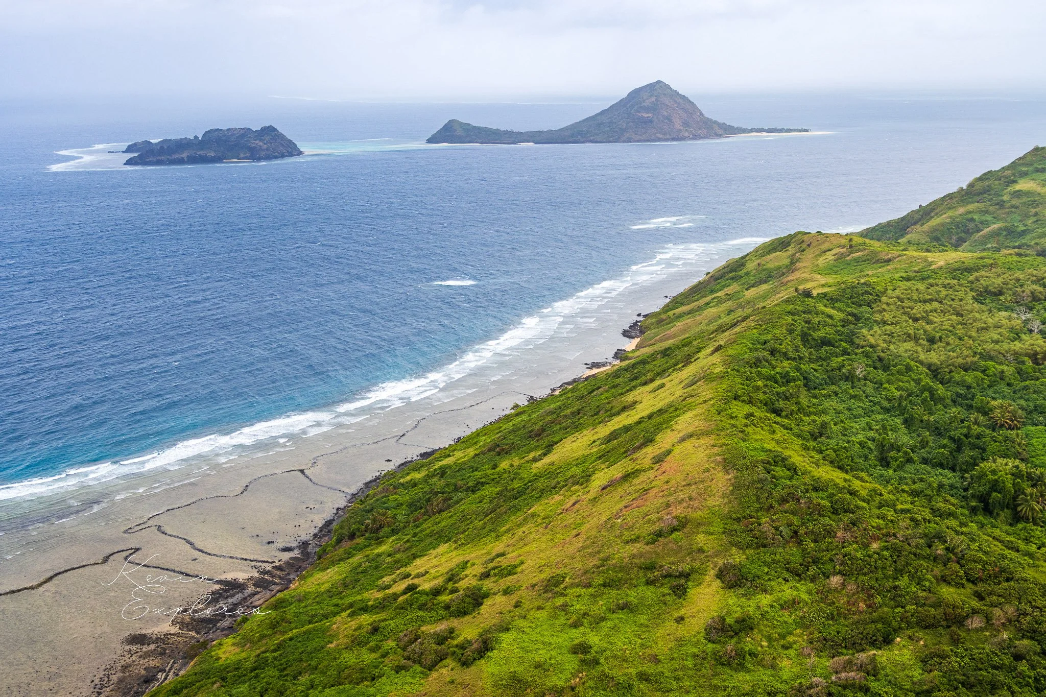
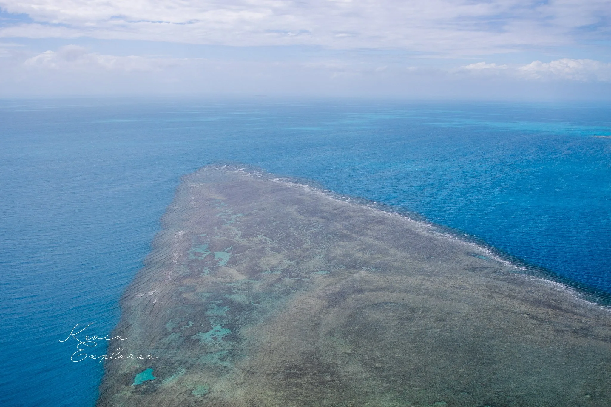
One of the things that makes Torres Strait visually extraordinary from the air is that it contains three fundamentally different types of island — each the product of completely different geological processes — within the same body of water.
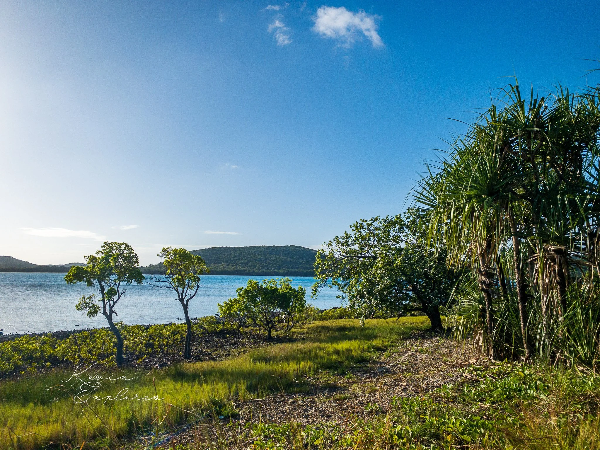
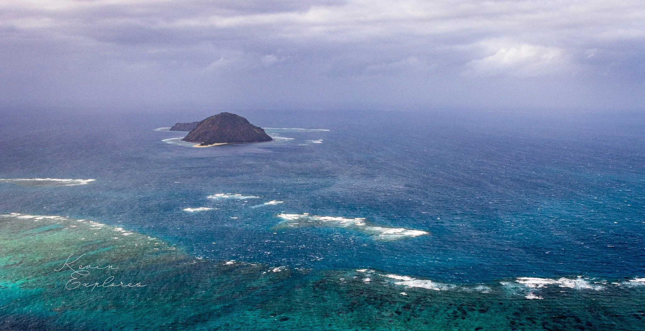
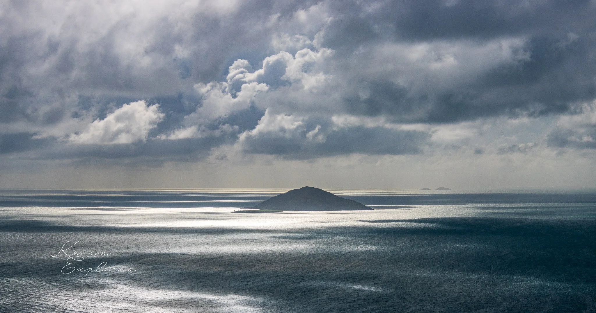
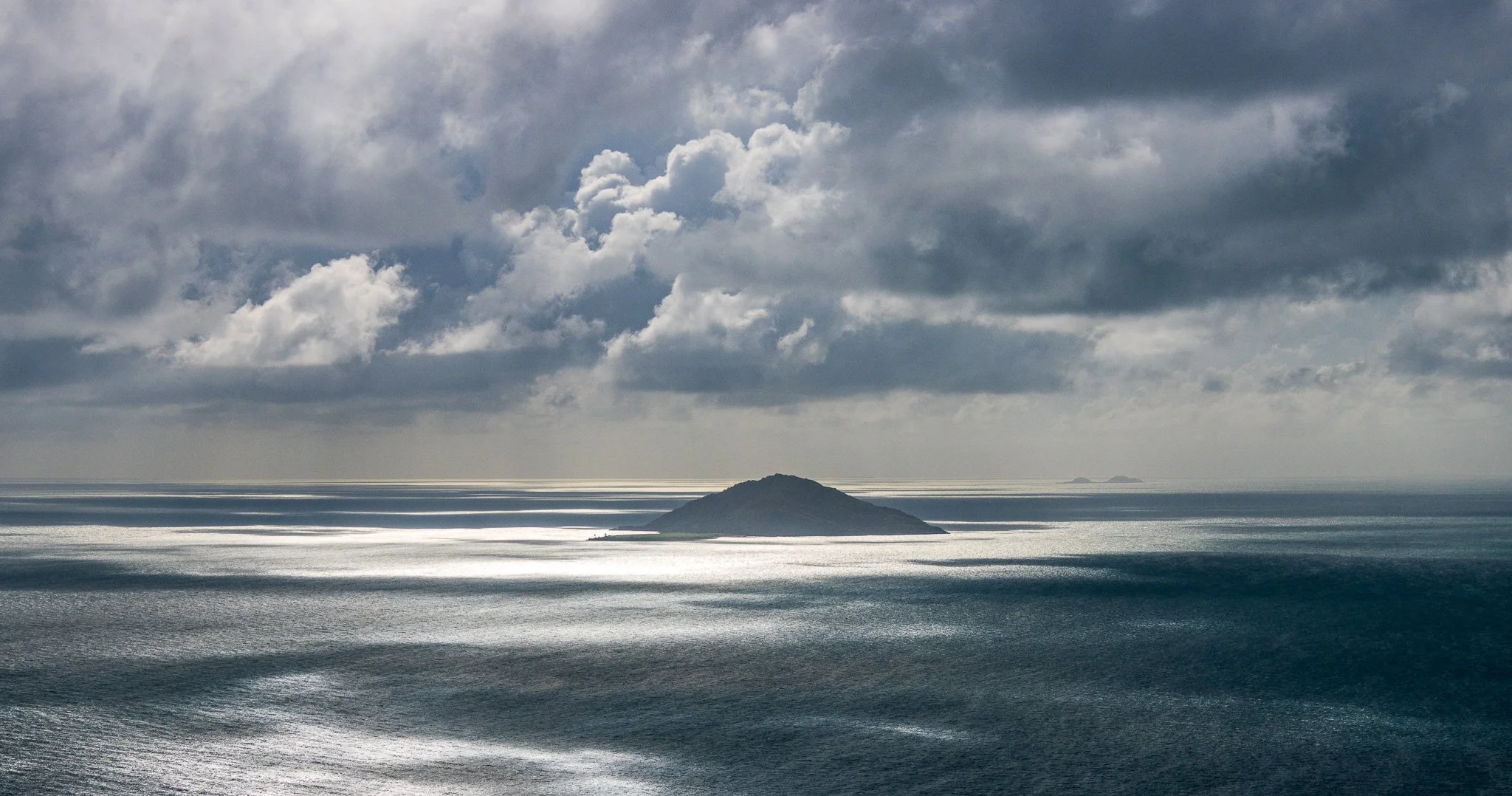
The eastern islands are continental — granite and metamorphic rock, the same ancient geological formations that underlie Cape York Peninsula. They are steep, forested, and geologically old: high ground that has been above water far longer than the strait has existed. Murray Island (Mer), the home of Eddie Mabo, is of this type — a volcanic island rising steeply from deep water on the eastern margin of the strait.
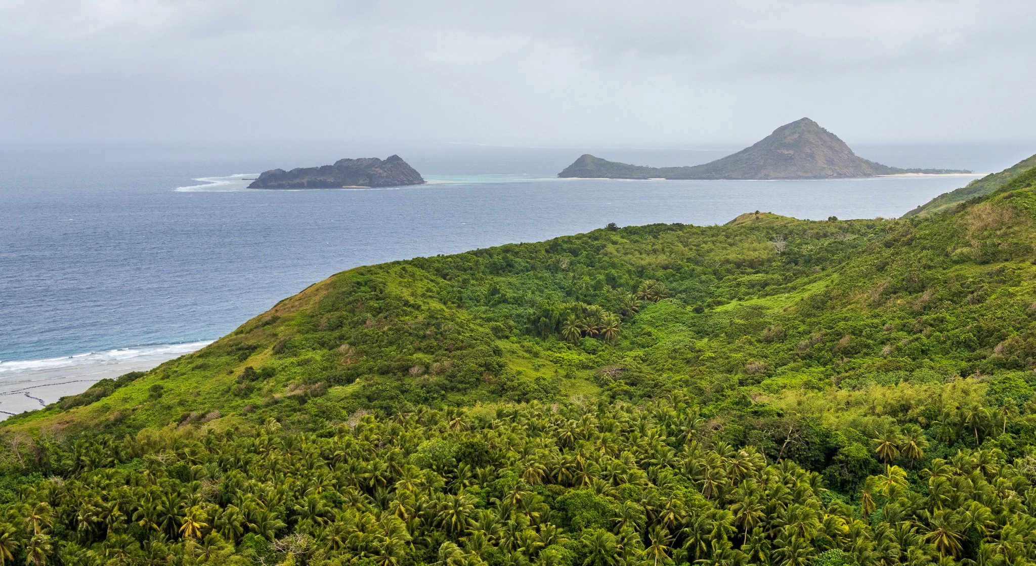
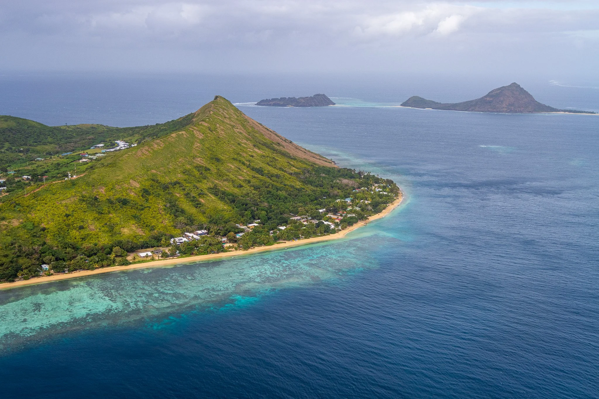
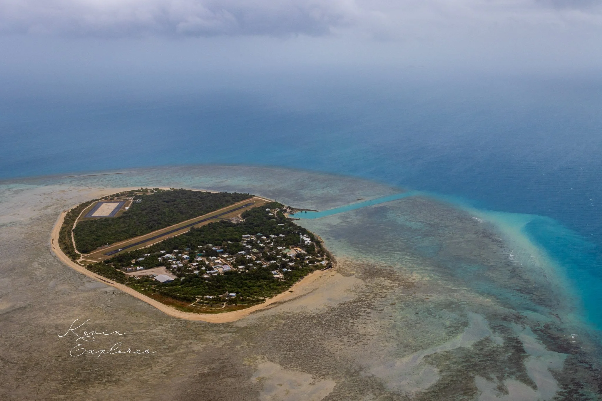
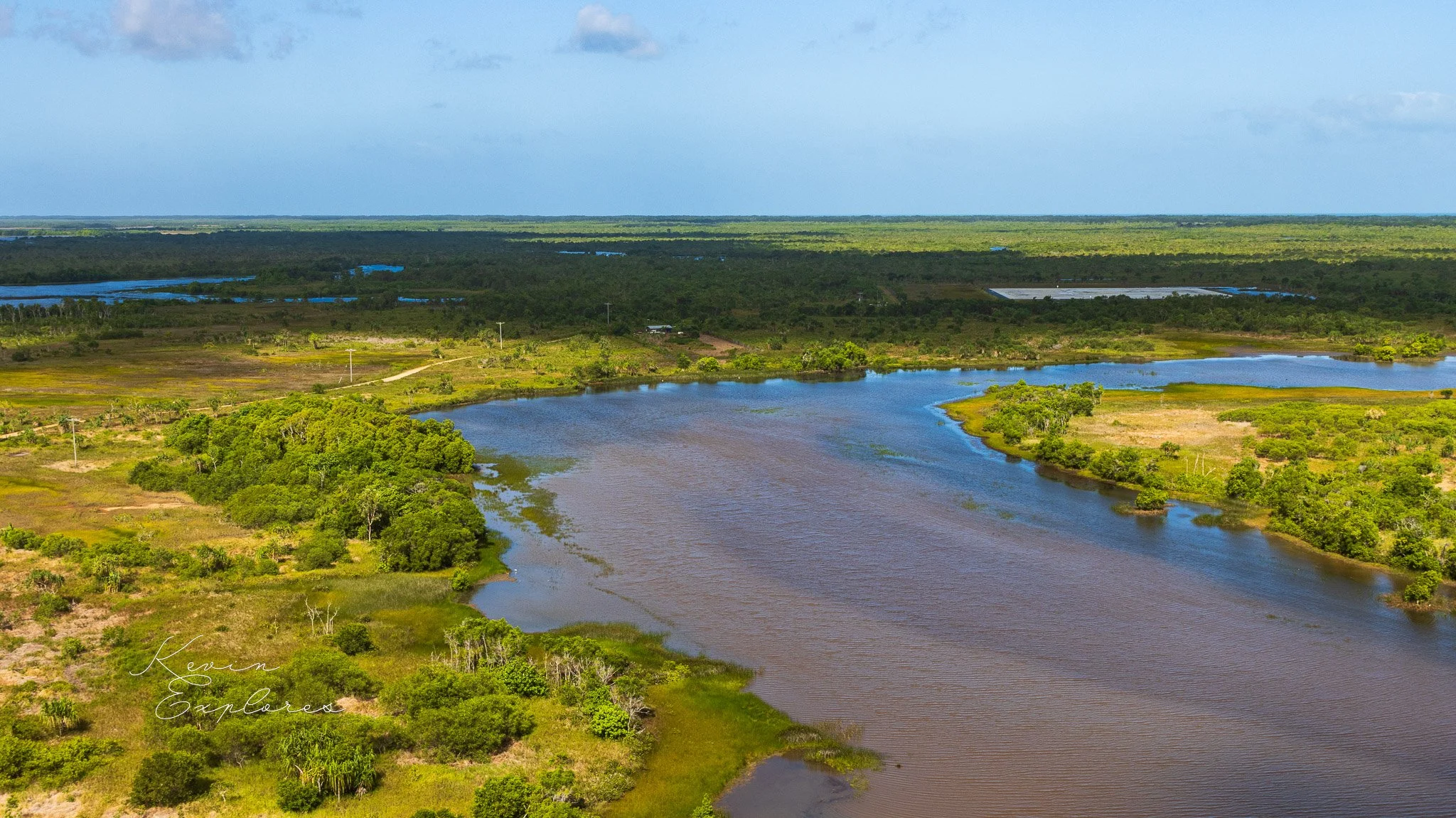
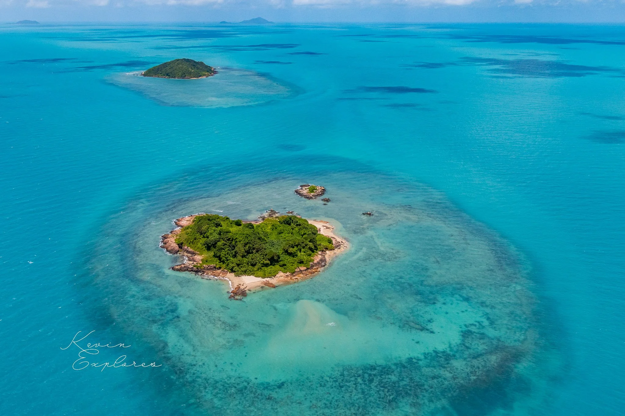
The western and central islands sit on the shallow continental shelf platform — lower, flatter, surrounded by extensive reef systems. These are the islands most dramatically affected by the post-glacial sea level rise, and the ones most exposed to current climate-driven sea level change. Their low elevation reflects the flat terrain of the old drowned plain on which they sit.
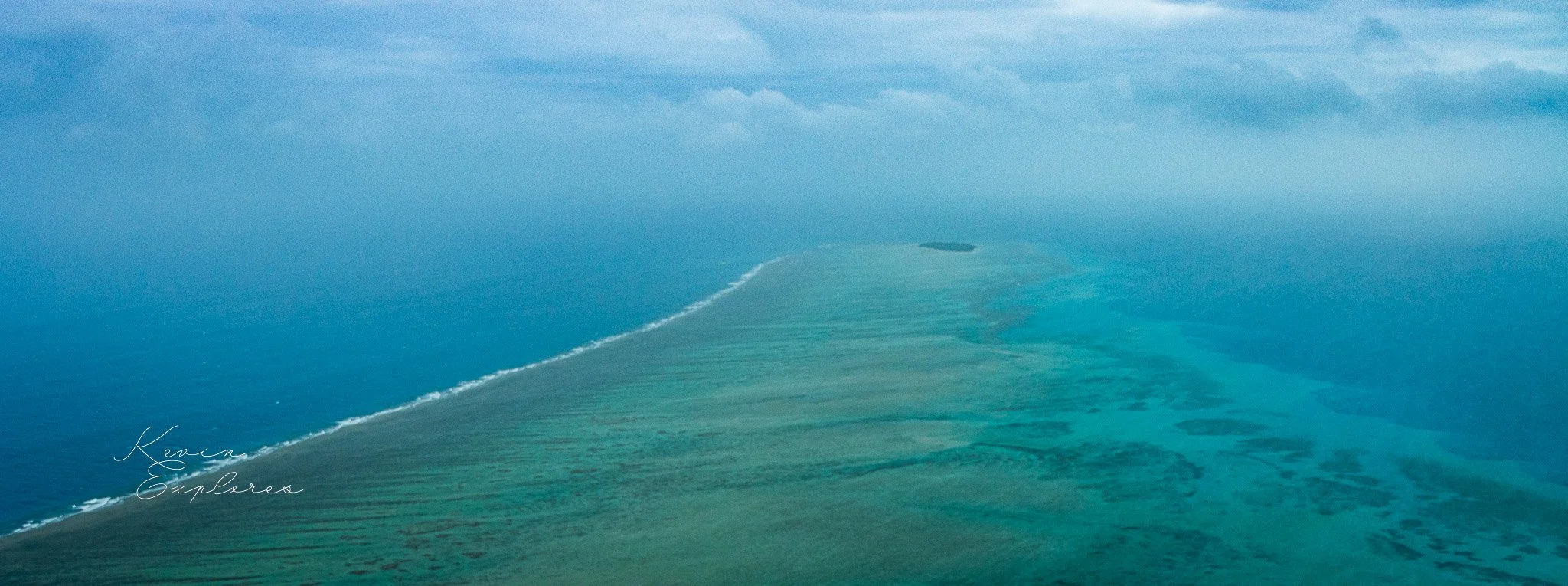
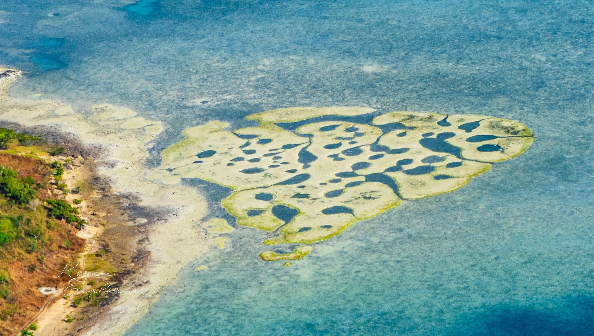
The coral cays are the youngest islands of all — accumulations of reef-derived sand and rubite that have built up on reef platforms over the last few thousand years. They have no geological foundation older than the reef itself. They are, in a real sense, still being made — and can be unmade by sustained changes in wave energy, sediment supply, or sea level.
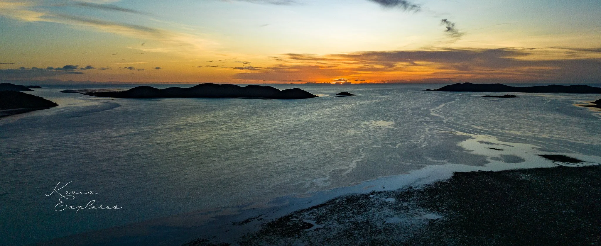
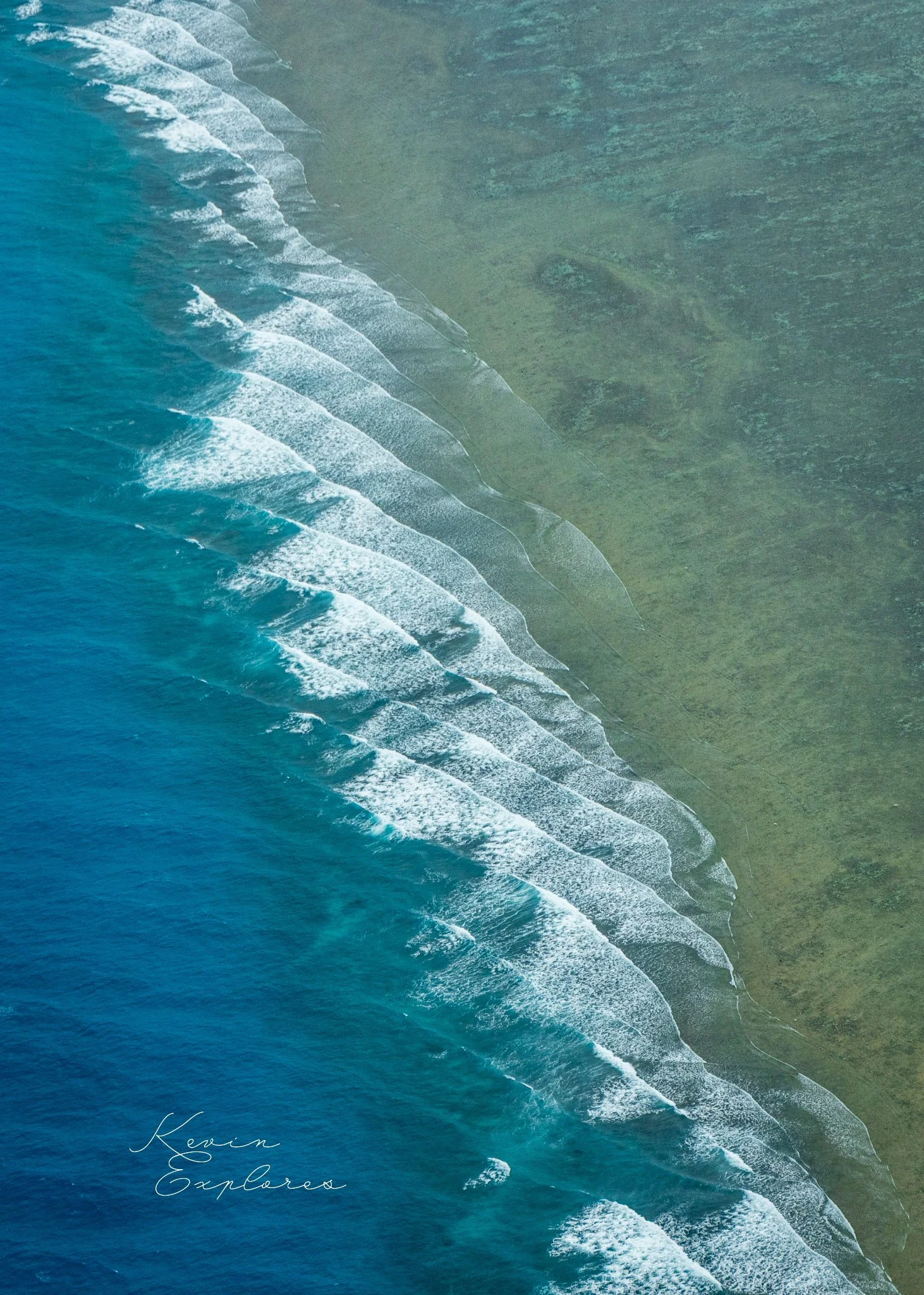
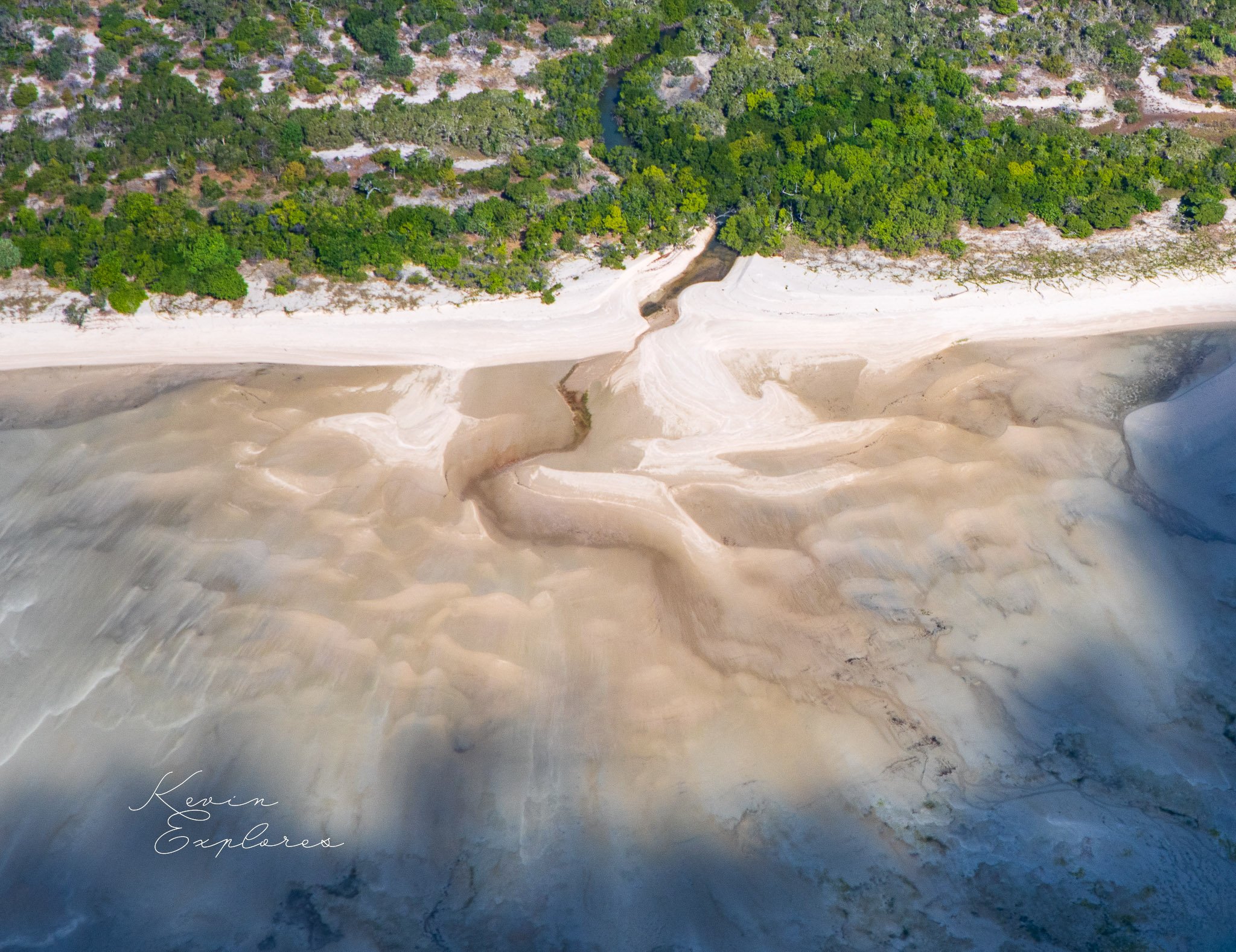
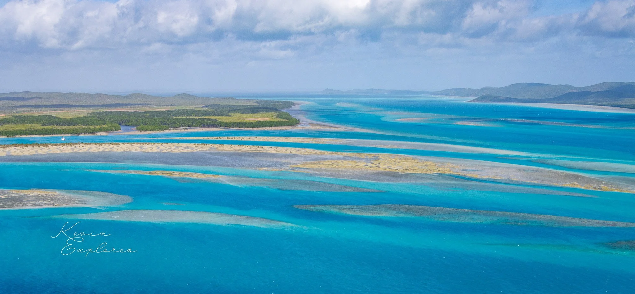
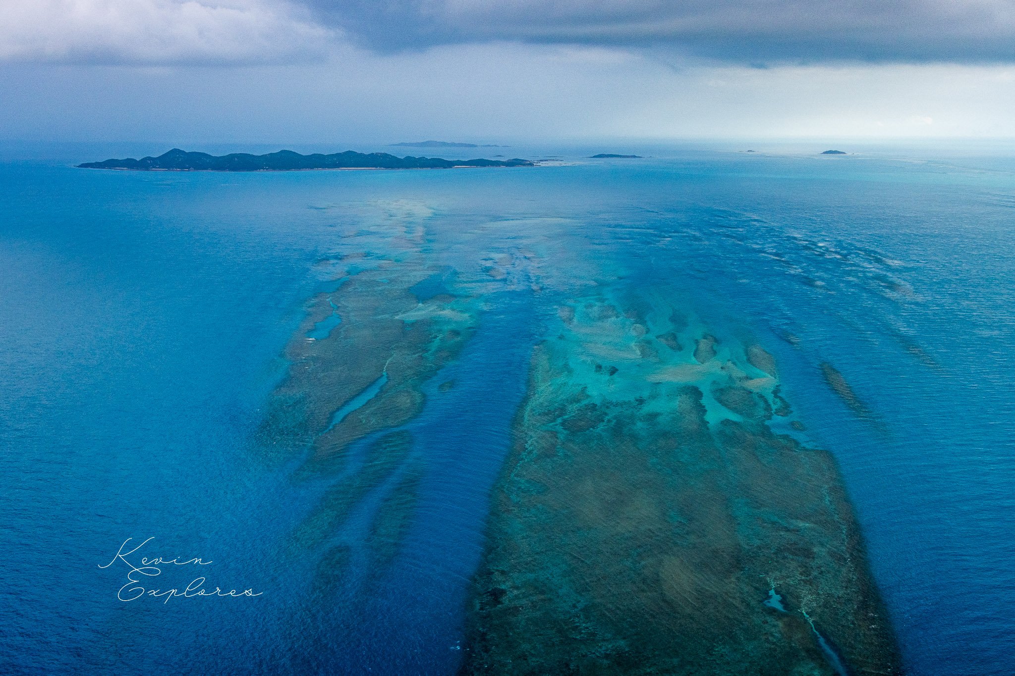
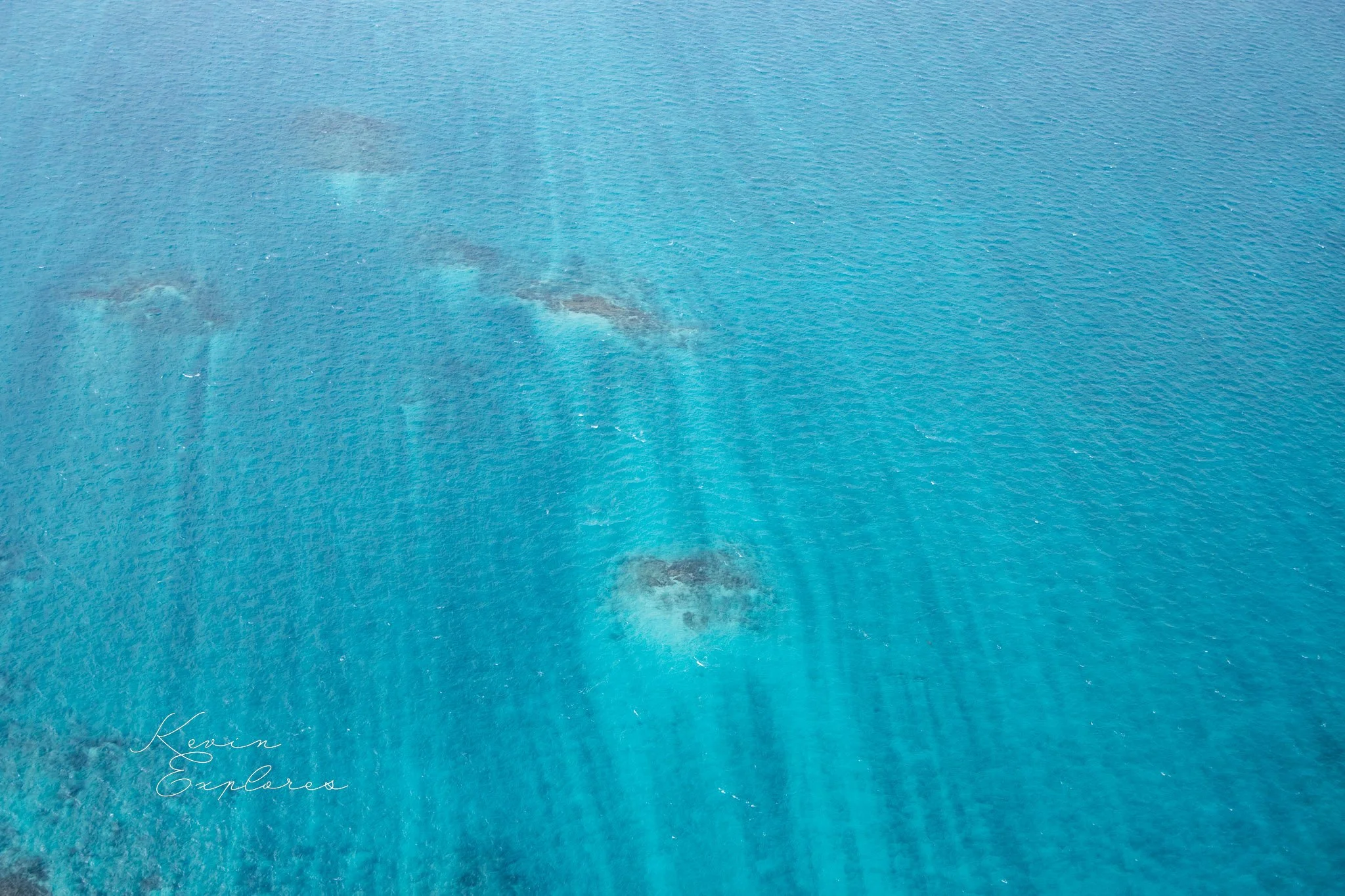
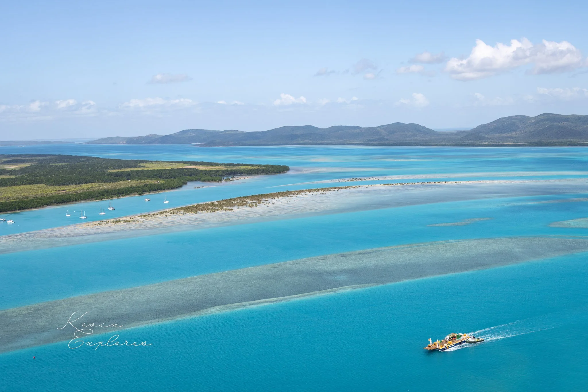
Torres Strait is not a static body of water. The shallow platform that covers much of the strait's area experiences significant tidal movement — the tide rises and falls across a vast, nearly flat reef surface, generating tidal currents that move sediment continuously. From the air, the evidence of this movement is everywhere: sediment plumes extending from island shores, sand lobes building and migrating on reef surfaces, tidal channels shifting their courses across the platform.
The trade winds — predominantly south-easterly — drive a consistent swell pattern across the strait that shapes beaches, builds sand spits, and determines which side of every island is sheltered and which is exposed. The asymmetry of islands, visible from the air in the distribution of reef, beach, and vegetation, is a direct record of the dominant wind and wave direction.
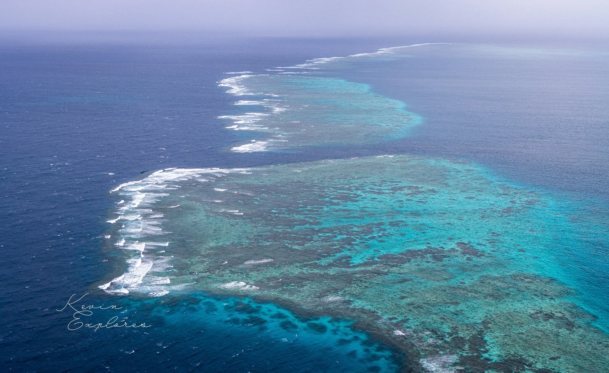
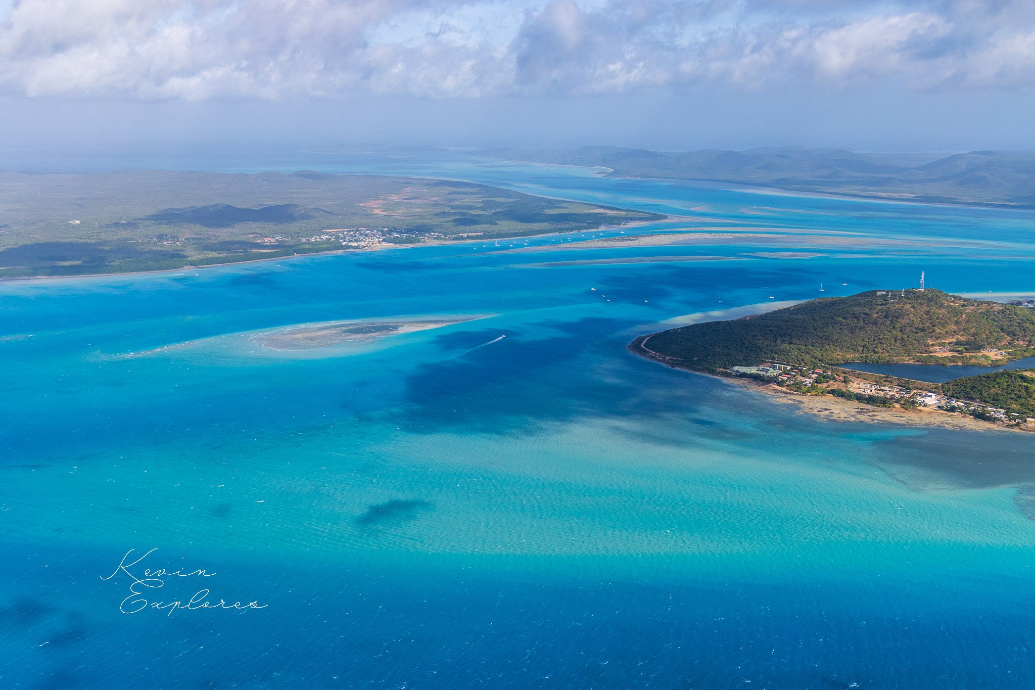
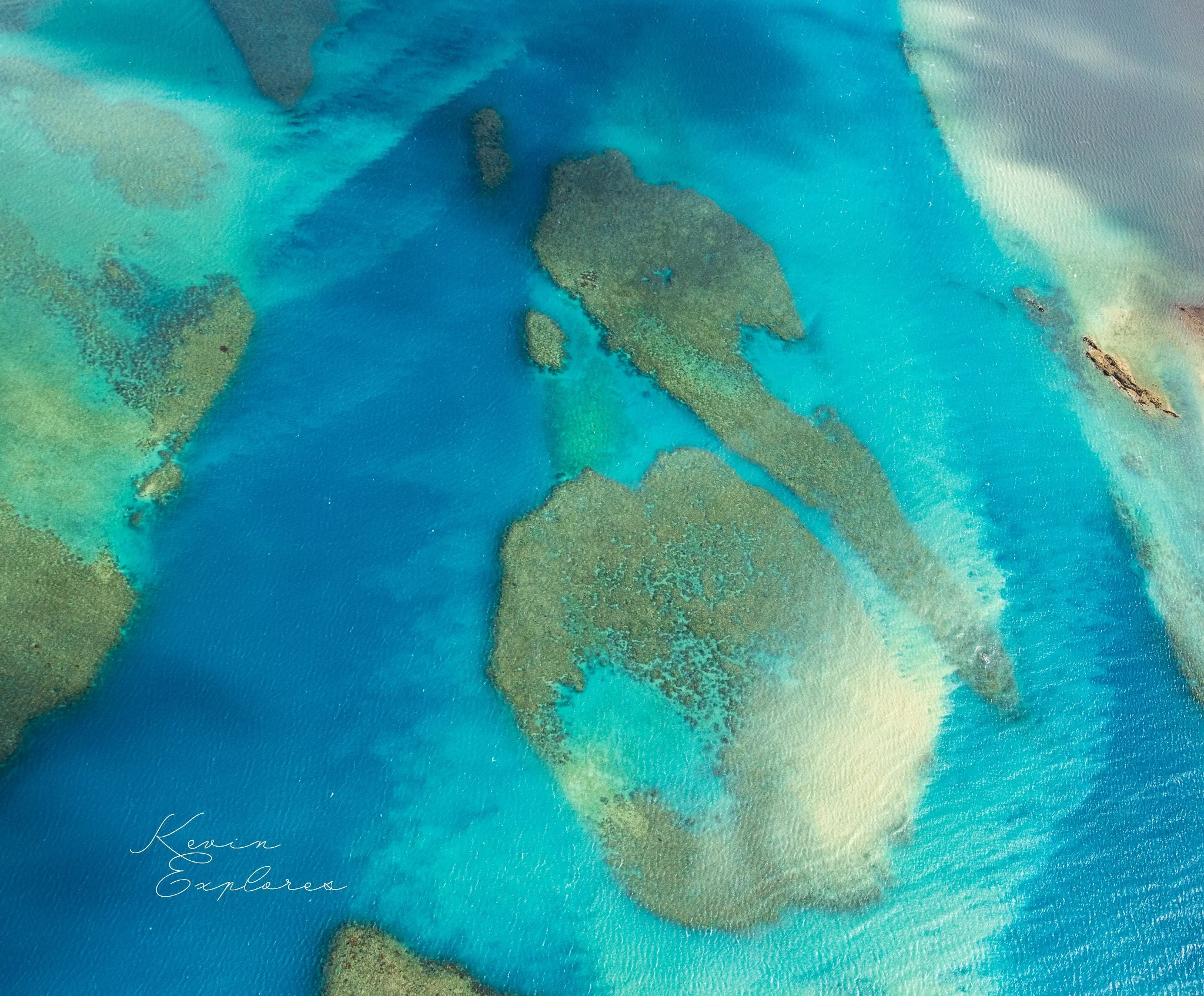
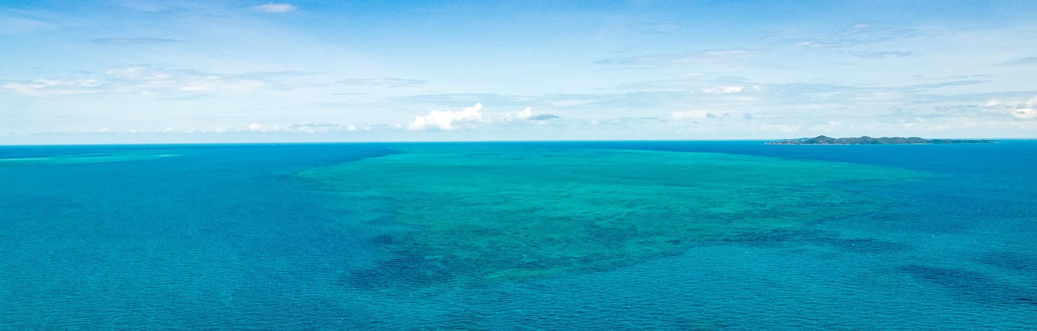
The coral reef systems of the strait are among the most extensive and least disturbed in Australia — a consequence of the region's remoteness and low population density. From the air, the full spatial extent of the reef is only comprehensible from altitude: reef structures that appear as isolated patches from the water surface reveal themselves from above as continuous systems covering hundreds of square kilometres of the shallow platform.
The Torres Strait Islander peoples — the Zenadh Kes people — have inhabited these islands since before the strait fully formed. Their connection to this sea country is among the longest and most continuous relationships between a people and a marine environment anywhere on Earth. The knowledge systems that developed over this time — reading tides, currents, seasonal wind patterns, reef behaviour, fish movements — represent an understanding of this environment that no scientific survey has yet fully captured.
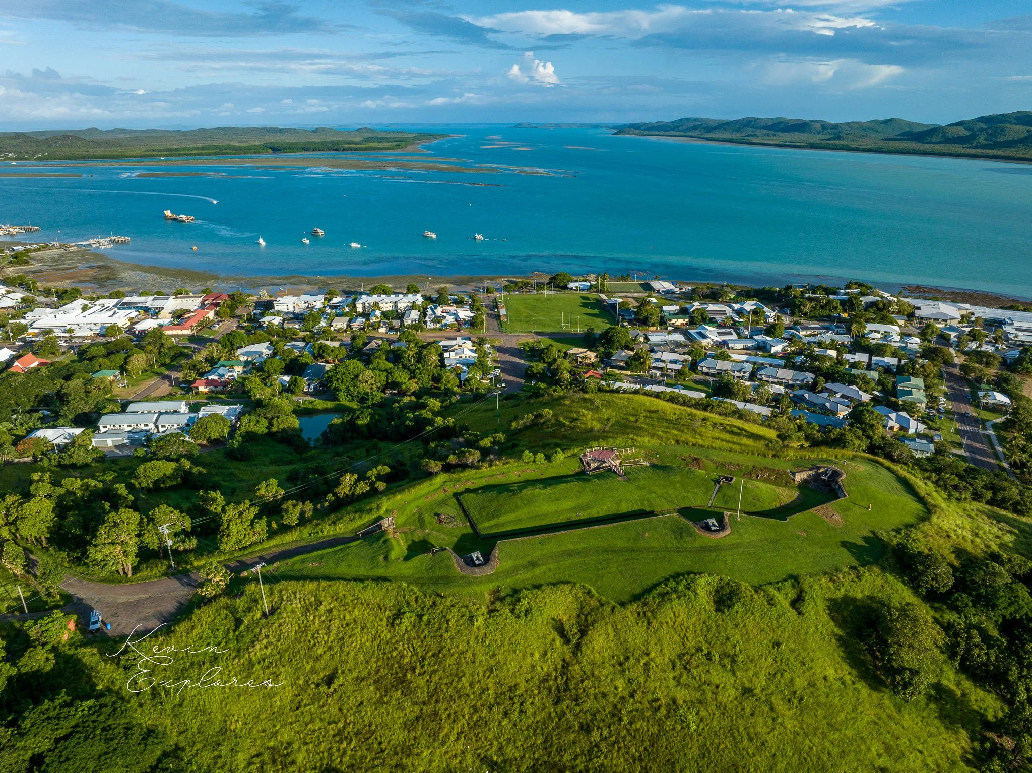
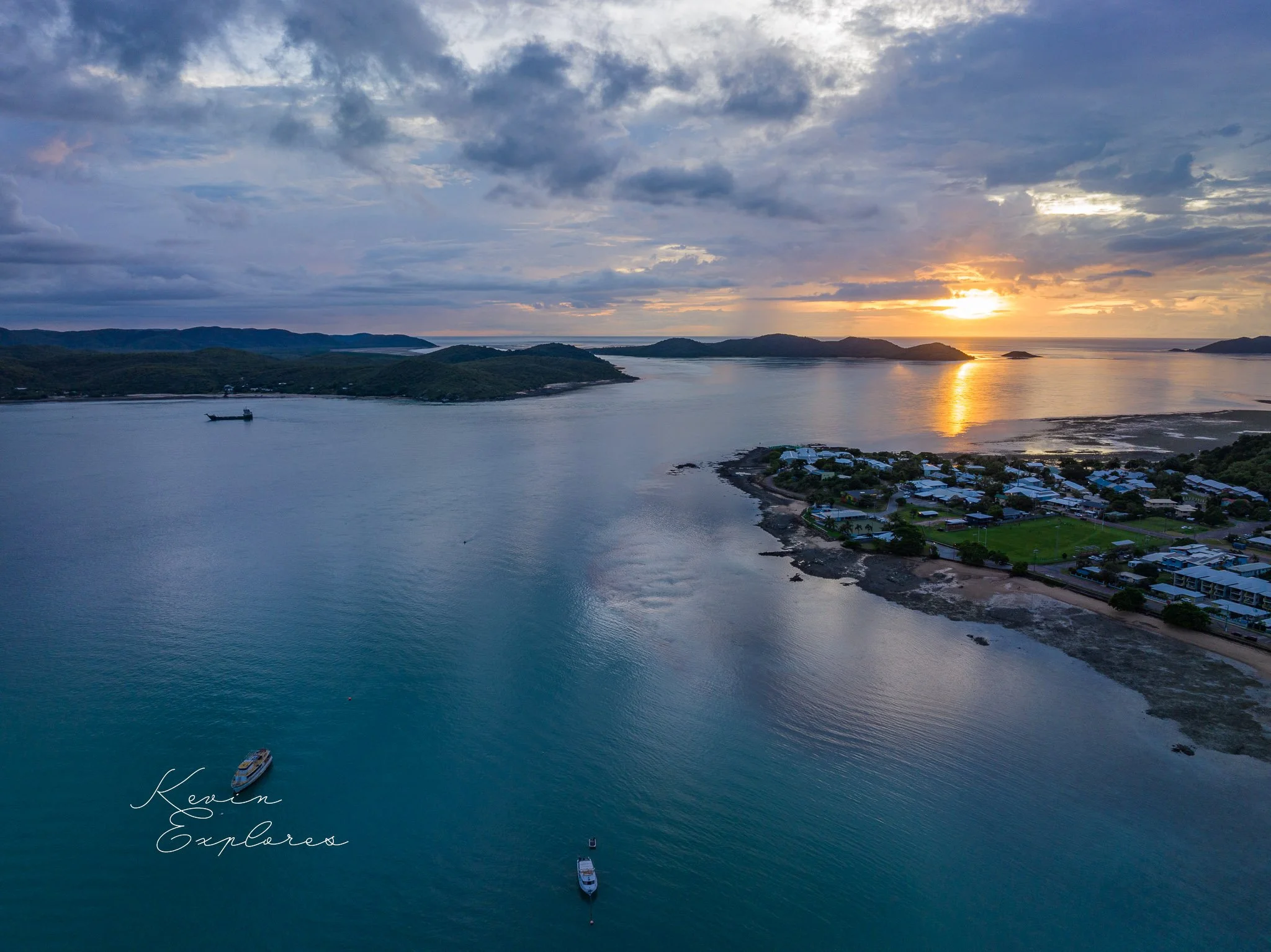
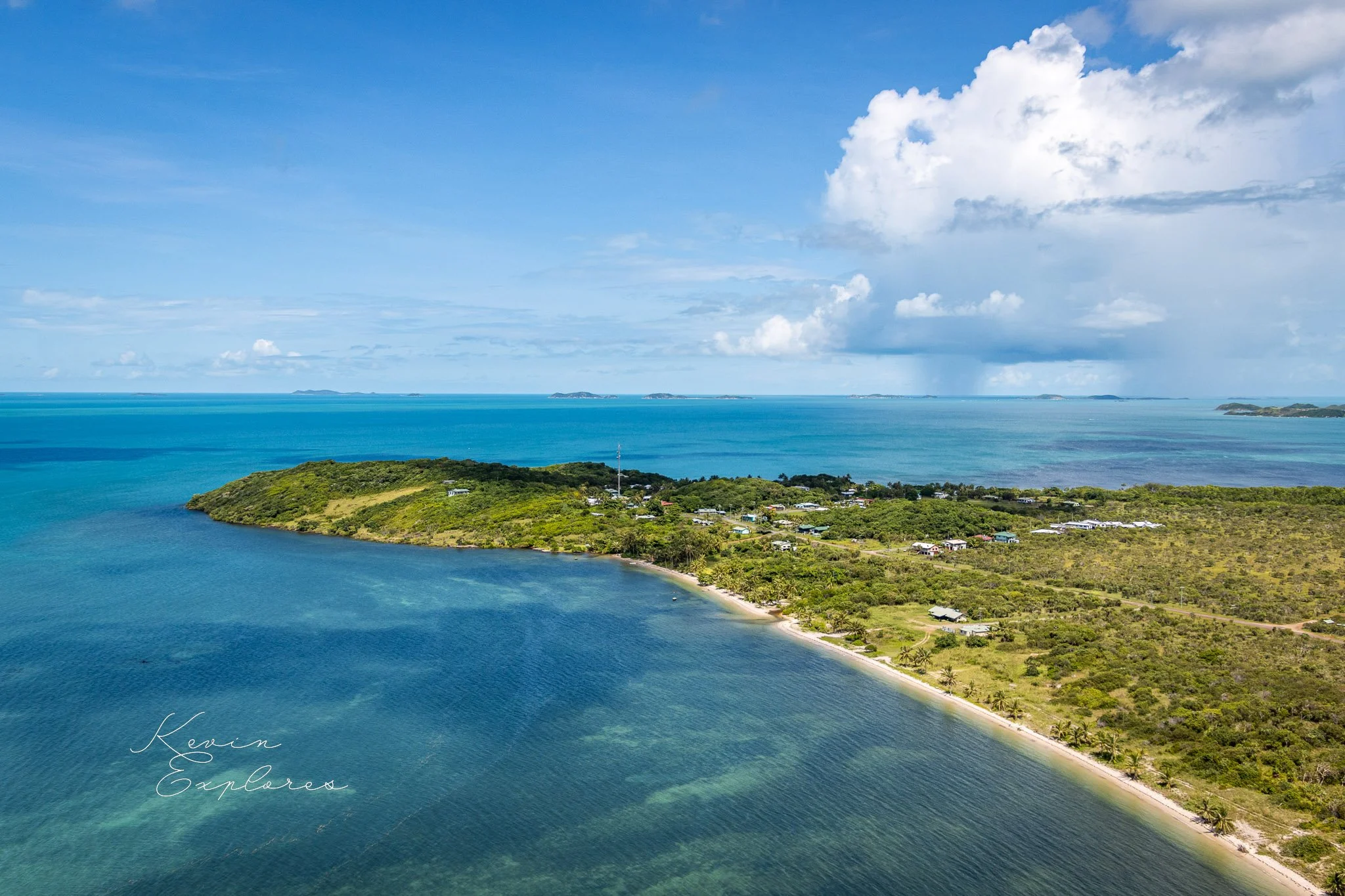
From the air, the human geography of the strait is immediately visible: communities on low-lying islands, surrounded by shallow reef on all sides, with the open ocean never far away. The vulnerability of these communities to current sea level rise — which is measurably faster in the Torres Strait region than the global average — is not an abstract projection. It is visible in the relationship between the elevation of the land and the level of the water that surrounds it on every side.
This is not a place to visit with only geological curiosity. It is a living sea country, inhabited and managed by communities with deep and specific relationships to every reef, channel, and island. The aerial perspective reveals the physical geography. Understanding what you are looking at requires engaging with the human and cultural geography as well.
What to look for
Water colour as a depth map — the transition from pale turquoise to deep blue is a direct reading of the drowned landscape. Turquoise means less than five metres; the old land surface is just below. Deep blue means the valleys and plains of the former terrestrial landscape.
The three island types — compare a steep, forested granite island with a low wooded island on the shallow shelf with a bare sand cay. Each is the product of completely different geological processes operating across very different timescales.
Tidal channel patterns — the dark sinuous lines cutting across pale reef surfaces are tidal channels. Look for the sediment plumes at their mouths that record the direction of water movement.
Sand spit asymmetry — on cays and low islands, the elongated sand spits extending from the leeward end point directly downwind. They are a physical record of the dominant trade wind direction, built grain by grain over centuries.
The shallow platform extent — from altitude the full scale of the continental shelf platform becomes visible. The reef structures that look isolated from the water surface reveal themselves from above as parts of a continuous system covering vast areas of the strait floor.