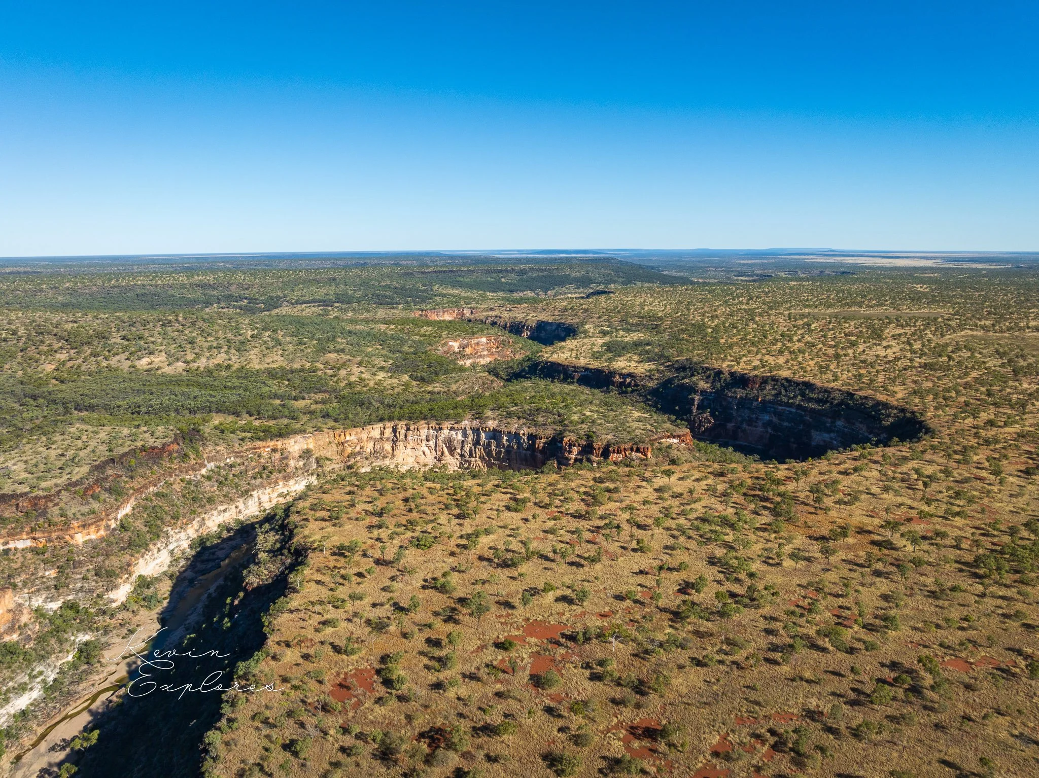
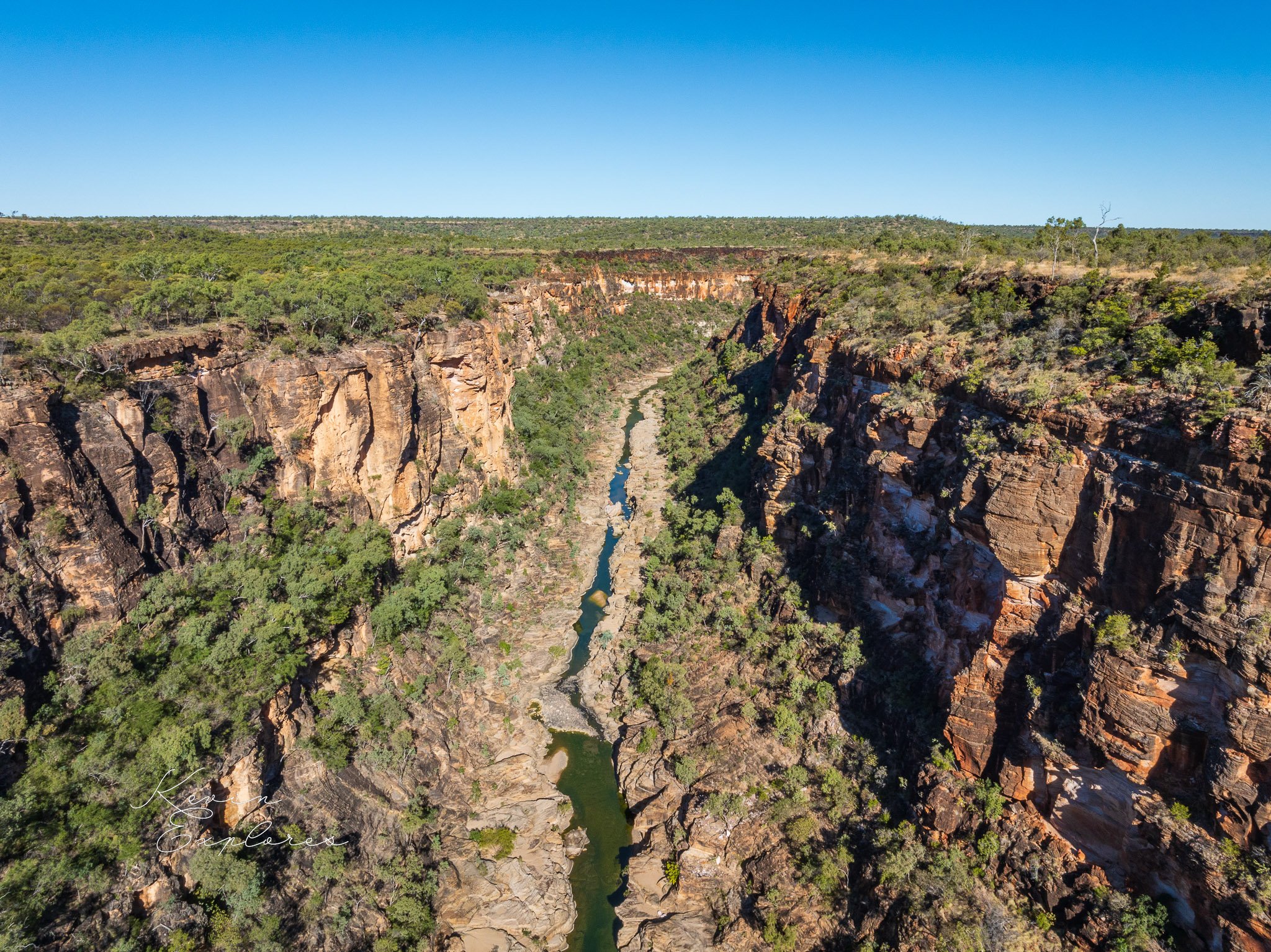
Porcupine Gorge near Hughenden


Warwick Willmott in his guide Rocks and Landscapes of the National Parks of North Queensland interprets the geomorphology as follows:
Driving north from Hughenden on the Kennedy Development Road to The Lynd, you notice that the road rises on to a broad plateau of basalt lavas, which belong to the Sturgeon Volcanic Province (see Chapter 7). Black basalt boulders lie scattered in reddish soil.
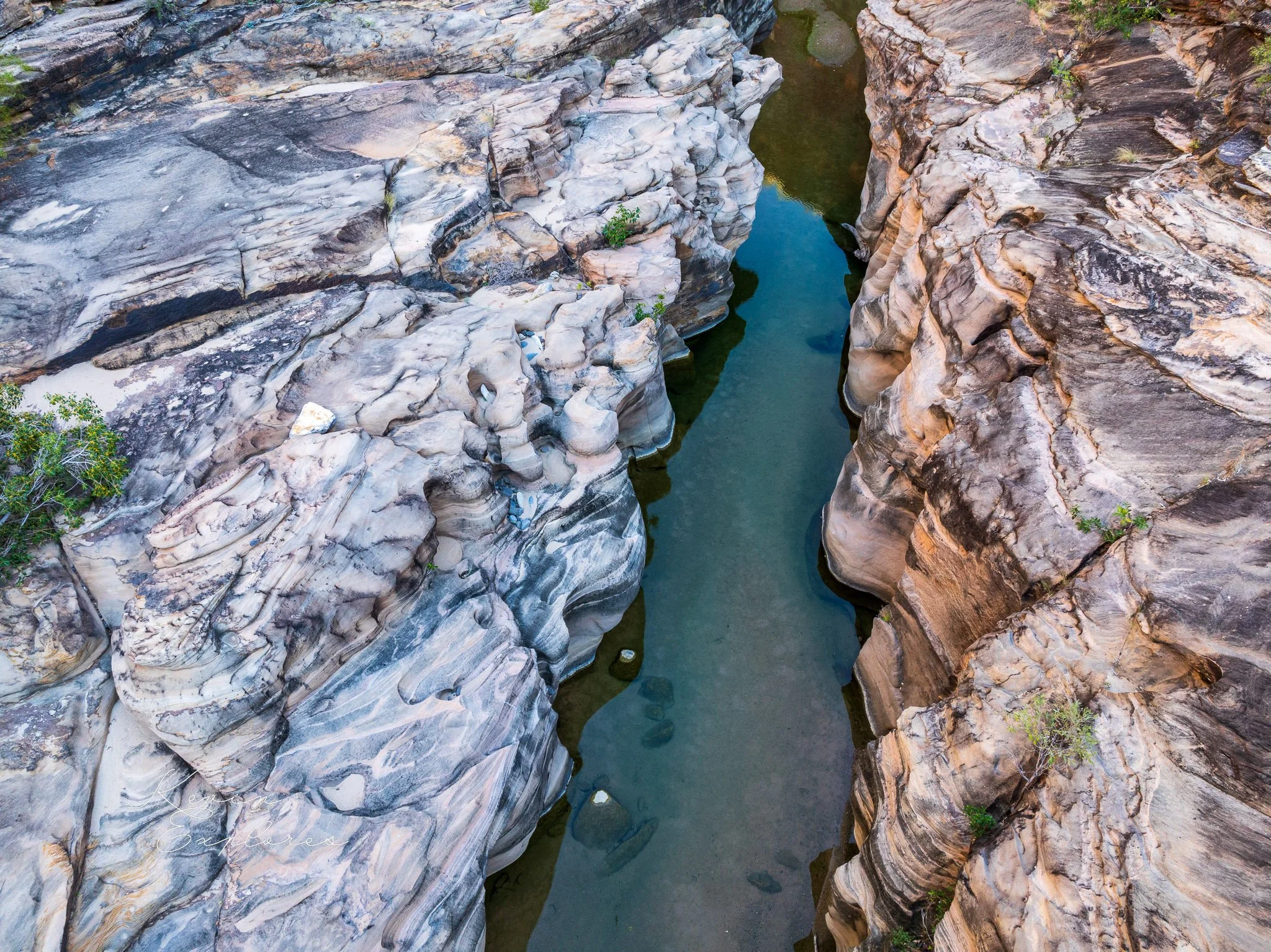
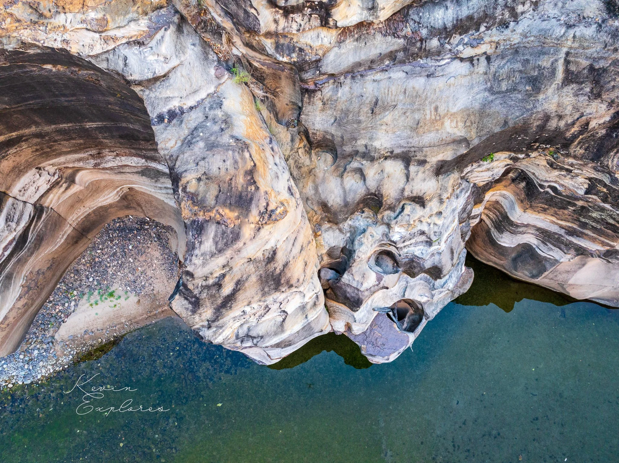
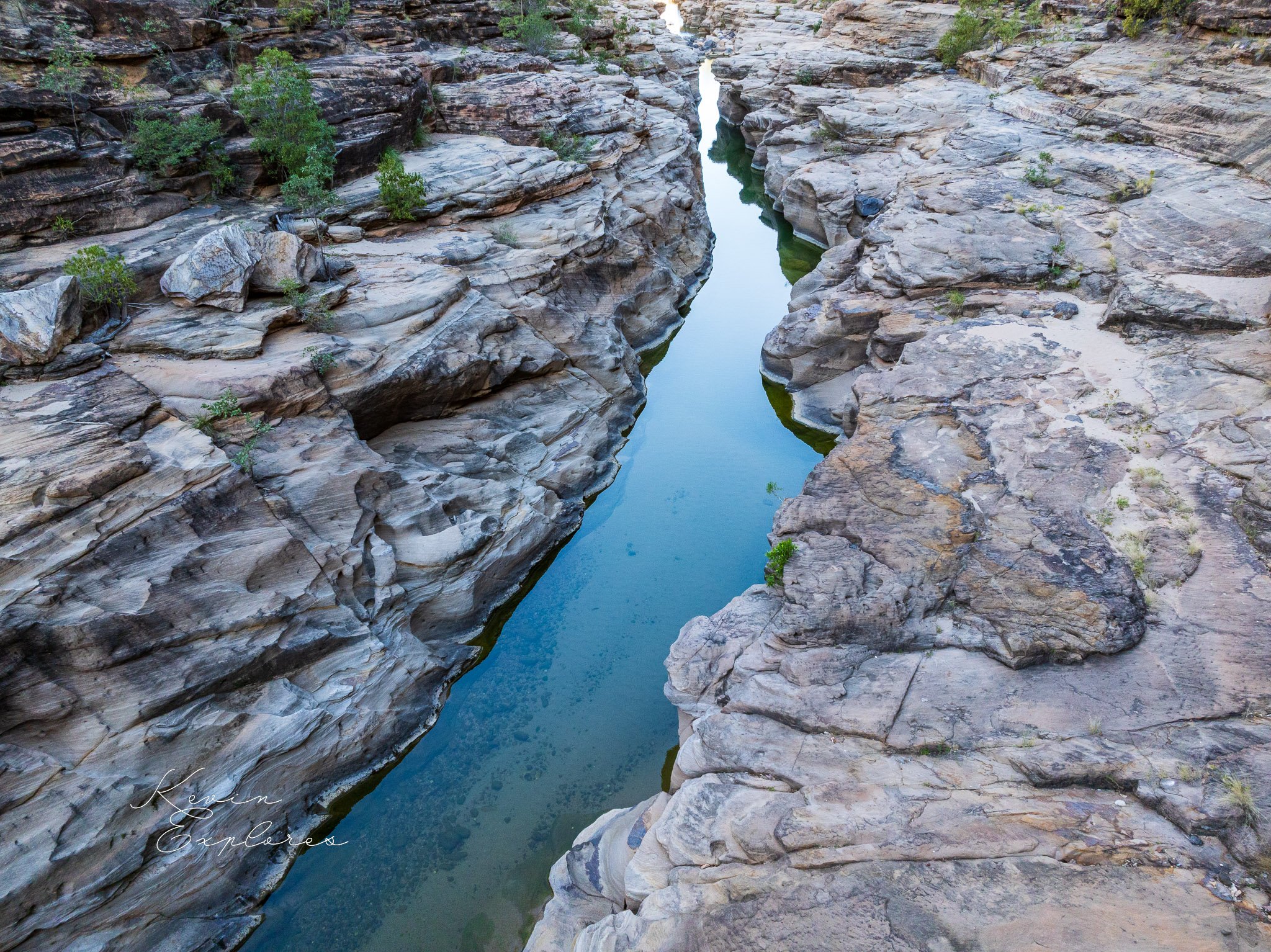
Suddenly, on the right you come across vantage points perched on the edge of a great narrow gash in the plateau, the gorge of Porcupine Creek. This stream has gradually cut through the hard basalt cap to encounter softer sandstones beneath, which it has then eroded rapidly. The ages of the basalts of the plateau near the gorge range from 5.9 million to 890 000 years, so the gorge may have formed quite recently in geological time. The creek and other adjacent streams are in the process of cutting down to the level of the low country around Hughenden. It has been proposed that the basalt plateau has been uplifted in the past, providing opportunities for the streams to cut deeply into it, but whether or not any such uplift occurred either before or after the eruption of the basalts, and the mechanisms for it, remain unclear.
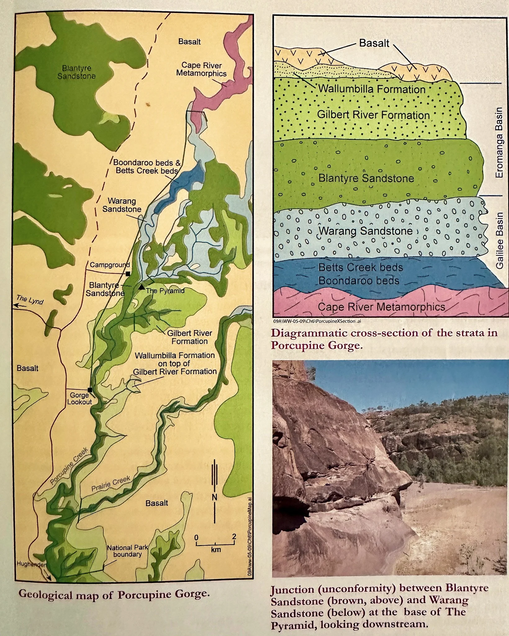
Porcupine Gorge National Park is a narrow zone protecting the middle and upper part of the gorge. Apart from its scenery, it is noteworthy for the great range of geological units of different origins exposed along its length. Beneath the young basalts on top are sedimentary rocks of the Carpentaria-Eromanga Basins. These include the Wallumbilla Formation (siltstone deposited in the great inland sea of Cretaceous times), and the Gilbert River Formation and Blantyre Sandstone (from sands deposited on broad river plains in Jurassic to Cretaceous times). Below and older than these again are sedimentary rocks of the Galilee Basin: the Warang Sandstone, deposited on river plains in mid-Triassic times; the Betts Creek beds deposited in swampy conditions, and the Boondaroo beds deposited from glacial streams, Permian times. Forming the base to these in the upper gorge are the Cape River Metamorphics of the Charters Towers Province, thought to have originated in latest Precambrian to Cambrian times (600 to 500 million years ago, Episode 2, Chapter 1).
These units lie one on top of the other and slope gently to the south, resulting in successively older units being exposed as you go northwards up the gorge (see figure). A walk up the gorge is, in a sense, a journey back in time.