Millaa Millaa Falls
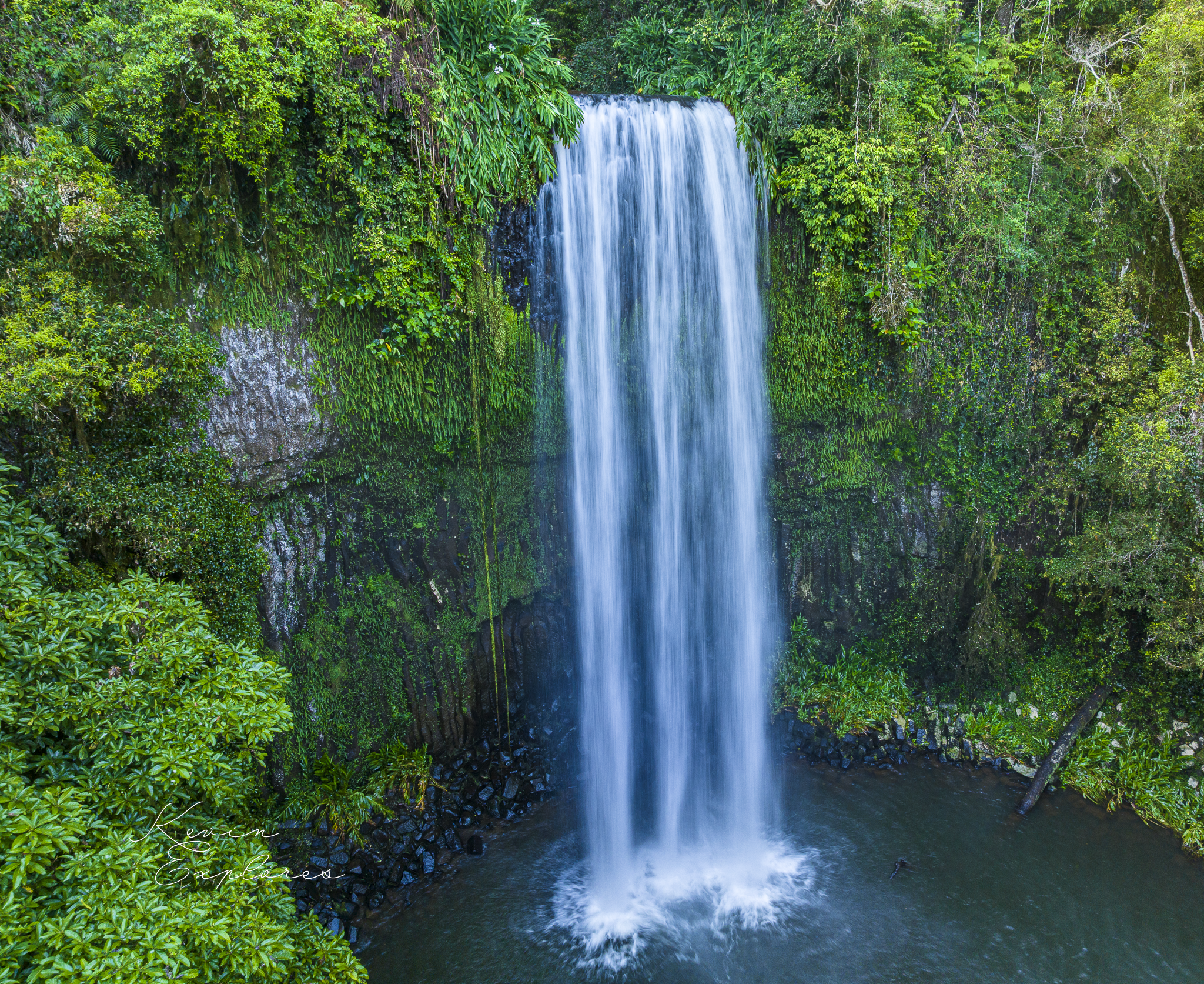
From the ground, Millaa Millaa Falls reads as one thing: a single curtain of water — 18.3 metres of it — over a single dark wall. It is not one thing, and the water is how you can tell. Behind the curtain the wall is two separate lava flows, stacked one on the other, and Theresa Creek is doing two jobs at once. It is the only reason that record is visible. It is also the reason the record is disappearing. What you photograph is a single frame of a demolition that was running long before anyone was here to watch it.
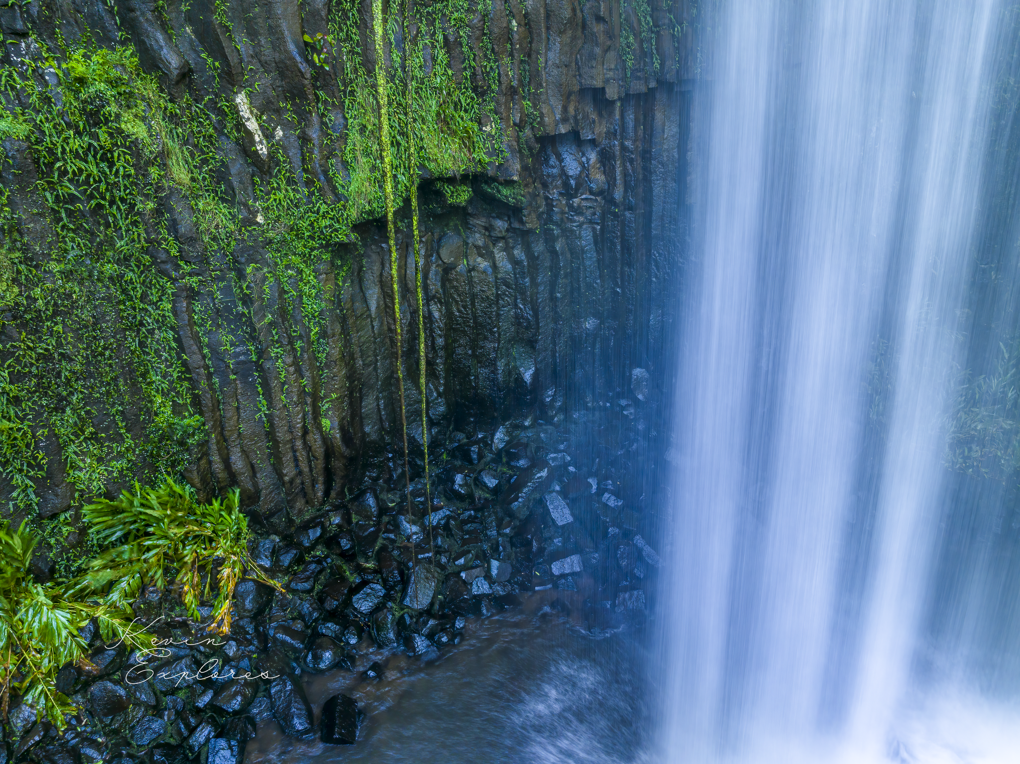
Look first at the rock. It is the Atherton Basalt — dark, fine-grained olivine basalt, and the olivine matters: it is among the first minerals to crystallise out of a cooling magma, and its presence marks a melt drawn from the mantle rather than the crust. This is about as direct a sample of the Earth's deep interior as you will ever stand beneath. As a thick flow of it cools, it shrinks, and shrinking rock cracks — in the most economical pattern it can find, a mesh of near-vertical joints growing inward from the cooling surfaces. Those are the columns behind the water. And here is the catch that makes them worth more than their looks: the joint that records how the lava cooled is the same joint the rock will one day break along. The columns are both the evidence and the fault line. What makes the face legible is exactly what will bring it down.
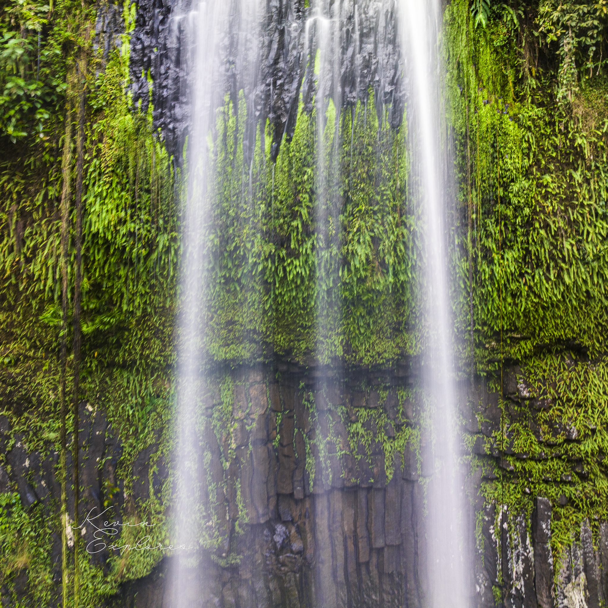
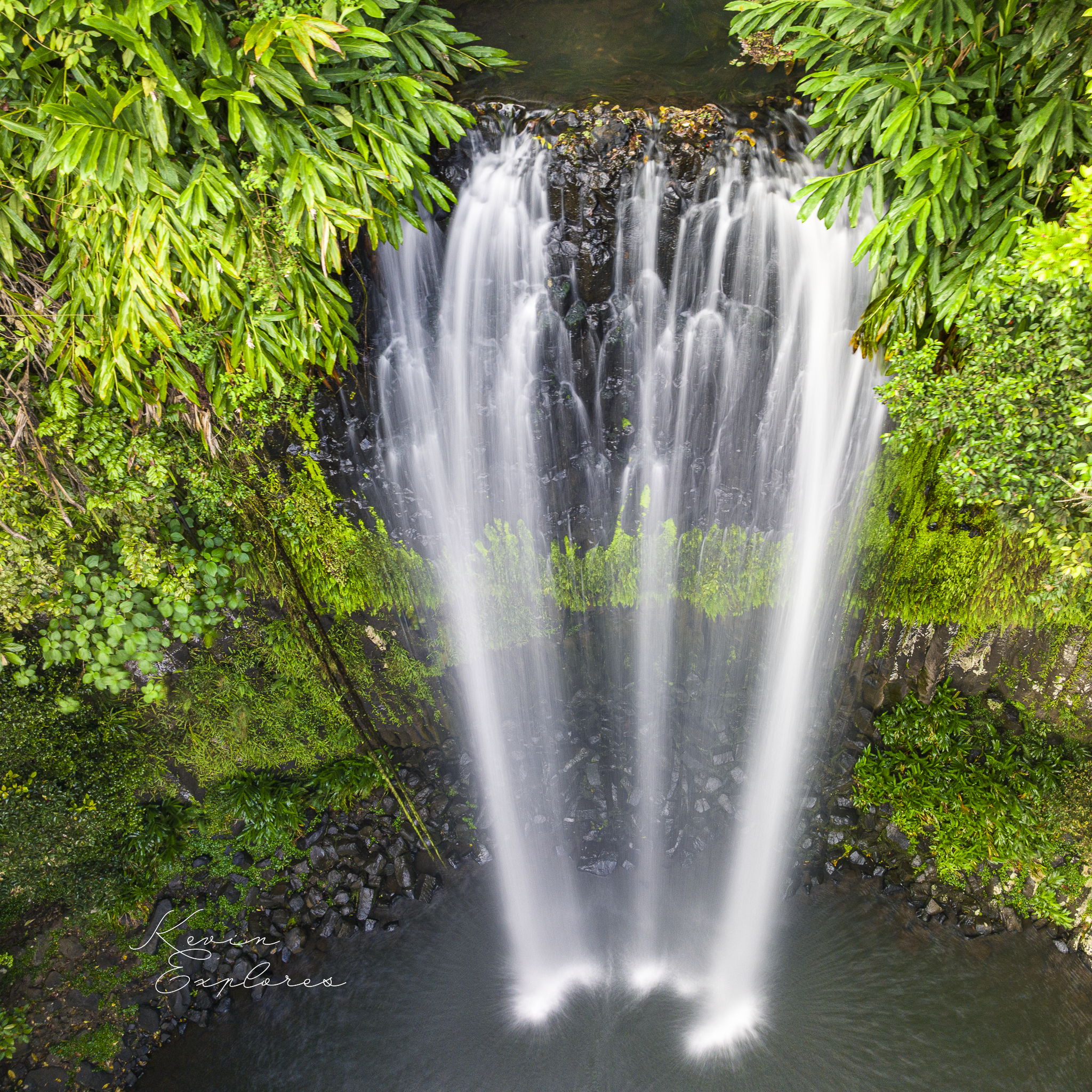
Now find the join. Partway down the face the rock changes character. Warwick Willmott, whose Rocks and Landscapes of the National Parks of North Queensland is the standard reference for this country, records two separate flows here — easily told apart, with the columns strongest in the lower one. That boundary is the buried top of an older flow that had already cooled and begun to weather before the next lava arrived and covered it. From the viewing platform it hides under moss and spray. From a drone hovering at the face it resolves into a horizontal band — a line of brighter green where water seeps out along the contact and ferns have taken hold — one eruption sitting on the ruins of another. You are not looking at a wall. You are looking at a stack, and the seam is where one lava flow was buried by the next.
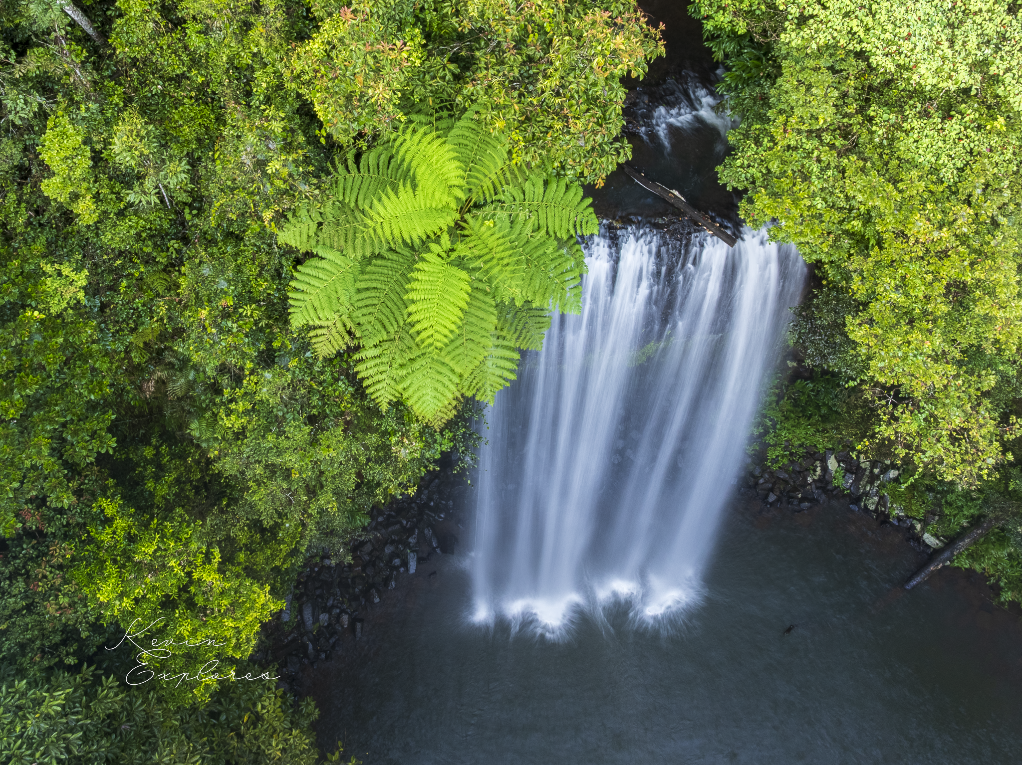
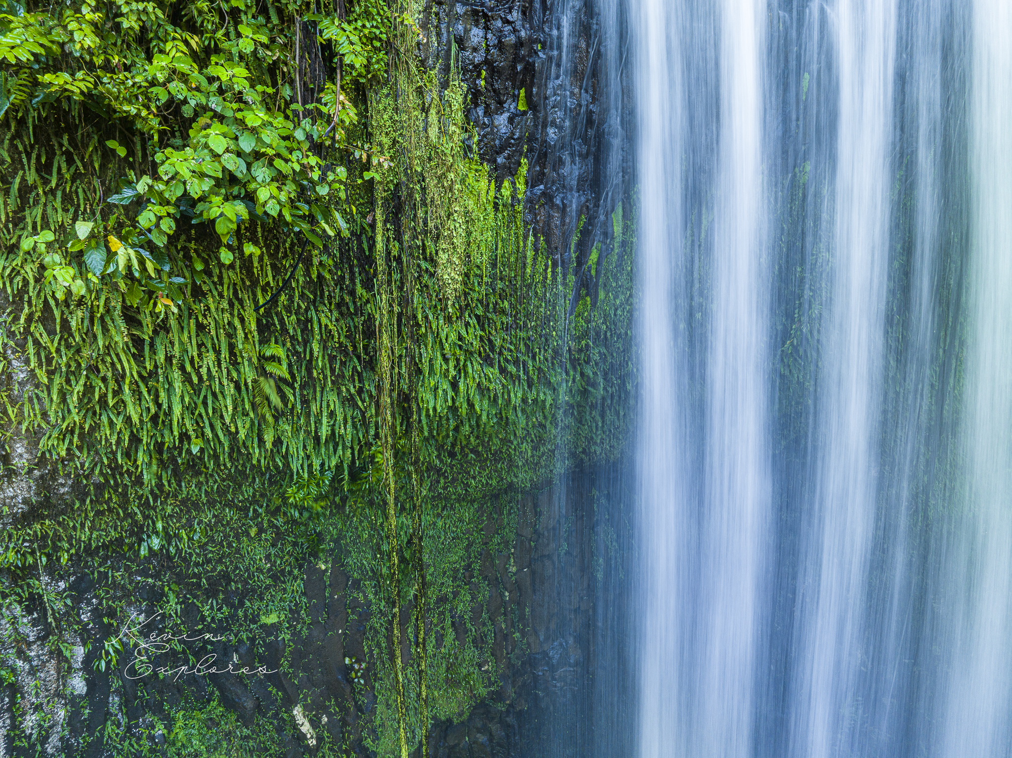
Step back from the face, and notice what's missing everywhere else. Across the rest of this tableland, this same basalt is nowhere in sight — weathered, over the ages, to the deep red soils the rainforest and dairy paddocks grow on. Bare black rock is the rare thing here; red soil is the rule. So why is it bare at the falls?
The question has two possible answers, and they run opposite ways. Either the rock here was always bare, with the creek somehow holding weathering off — or it rotted to soil like everywhere else, and something later uncovered it. The contours settle the order. The plateau all around is a mature, deeply weathered surface; the valley biting into it is younger. So the sequence runs like this. First the basalt weathered from the surface down — across this tableland, commonly to depths of tens of metres — leaving fresh, columnar rock only far below. Then Theresa Creek cut in, down through the soft weathered material until it reached fresher, harder basalt: the kind of resistant rock that can hold a step in a creek's descent. The face you photograph is that fresh rock, uncovered from under its own weathered skin — and it stays bare only because the creek now works it faster than it can weather again. The creek and waterfall exposed it.
Look up from the falls and there are volcanoes on the skyline nearby — two of them close enough to have built the rock you're standing before. Bradleys Hill rises less than two kilometres to the east, a shield volcano dated to about a million years ago. Trace its drainage on a map and you can see it: streams fanning off the hill in every direction, and the falls sitting inside that fan. That makes Bradleys Hill the likeliest source of the upper flow in the face — the lava ran off this volcano, and the creek is now cutting back down into it. The Millaa Millaa volcano stands a little over two and a half kilometres off on the other side, an older, lower shield; it may be where the deeper flow came from, or that one may belong to another vent again.
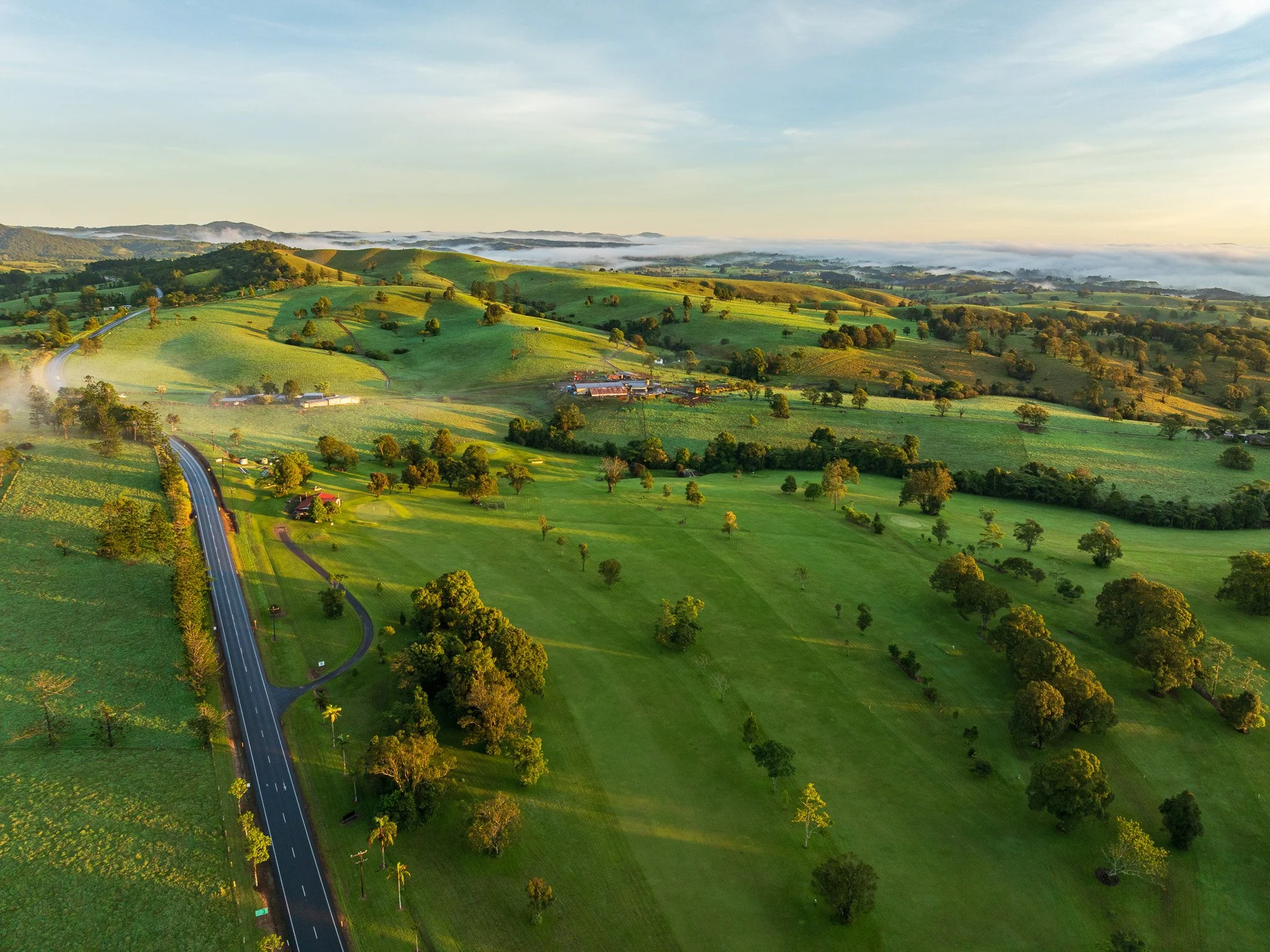
The Millaa Millaa volcano (top left) with Theresa Creek (tree line running centre to centre right)
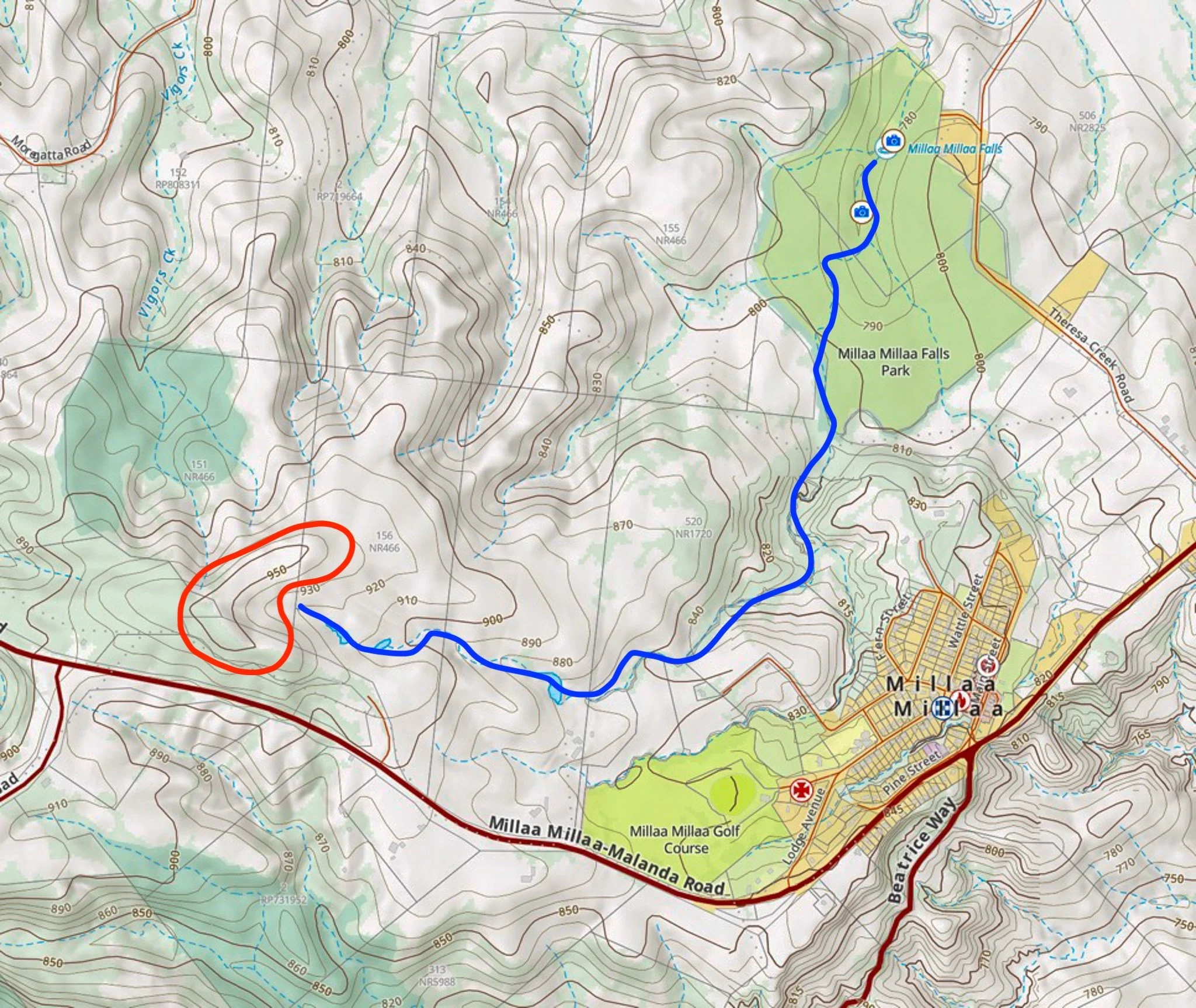
A topographic map showing the location of the Millaa Millaa volcano and path of Theresa Creek
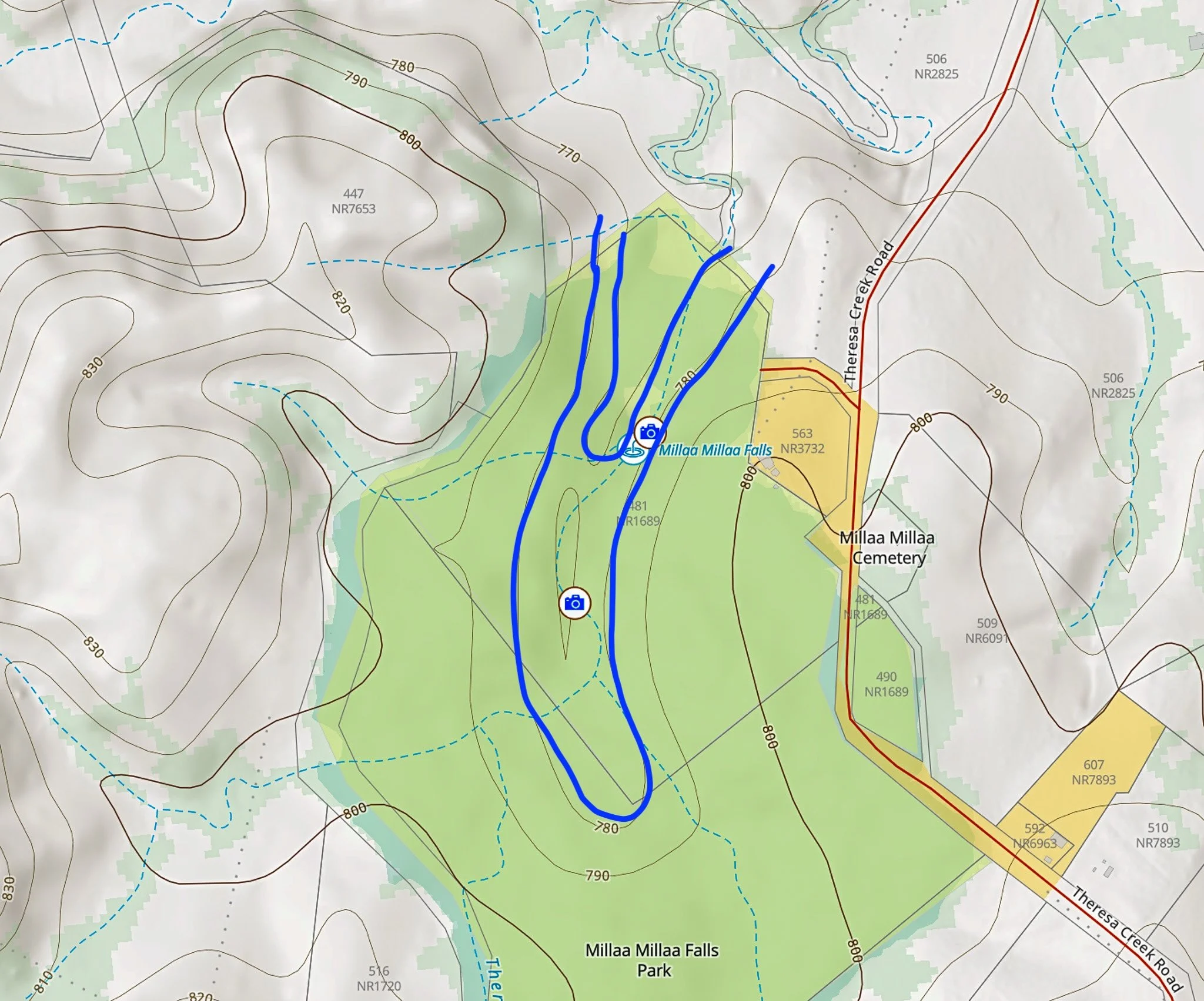
Close up showing the topographical profile in the vicinity of the falls
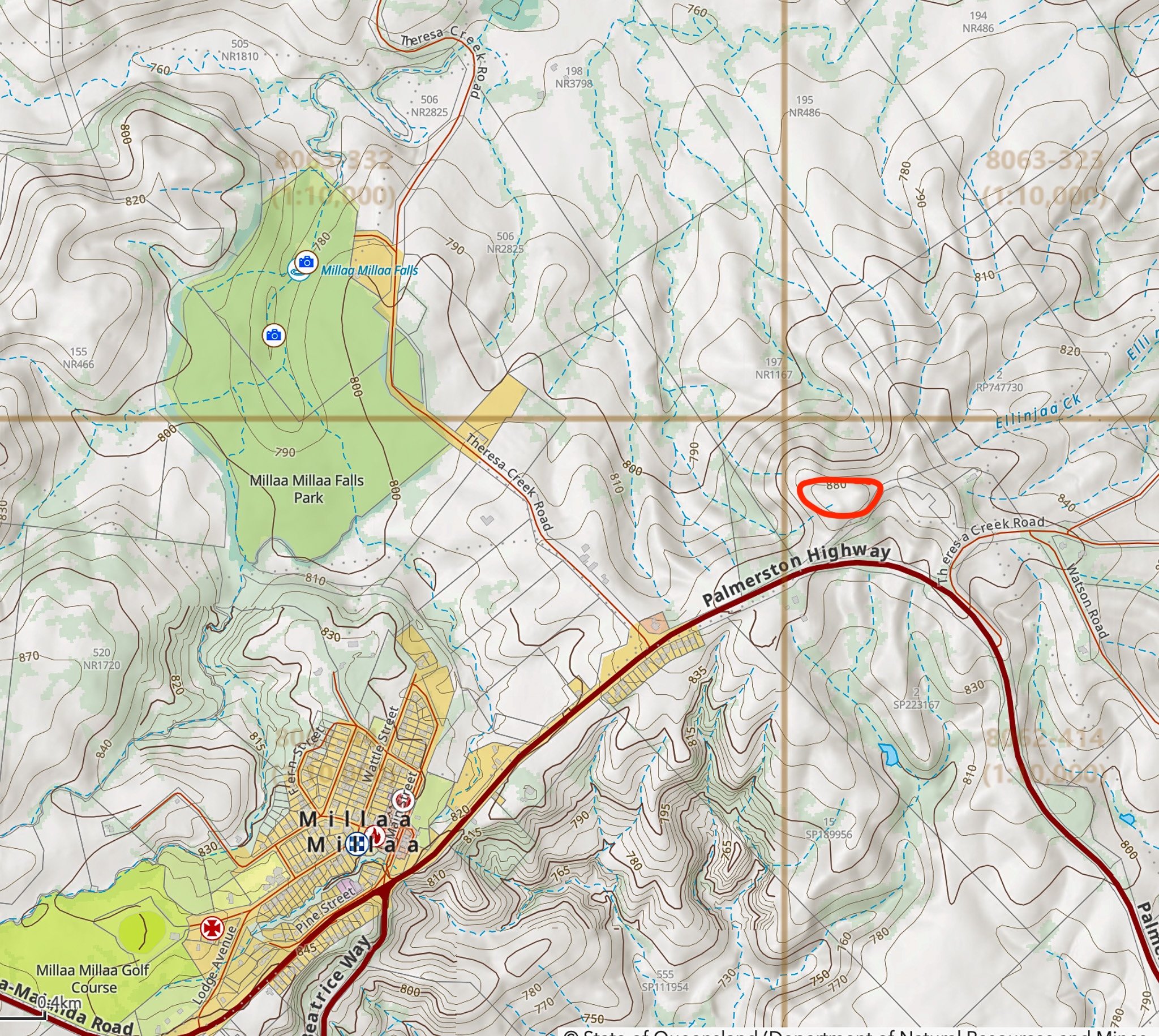
Bradleys Hill (880 m, circled) rises just east of the falls. Its drainage fans out across the country — Theresa Creek to the falls, Ellinjaa Creek to the northeast — which is why its lava is the likely source of the rock in the face.
What to look for, from the air and at the face:
The horizontal band of brighter green partway down — the contact between the two lava flows.
Columns straightest and strongest below that band; less ordered rock above it.
The apron of angular black blocks ringing the pool — the face, coming apart.
The dry jointed rock in the car park cut — the same columns, without the spray, close enough to touch.
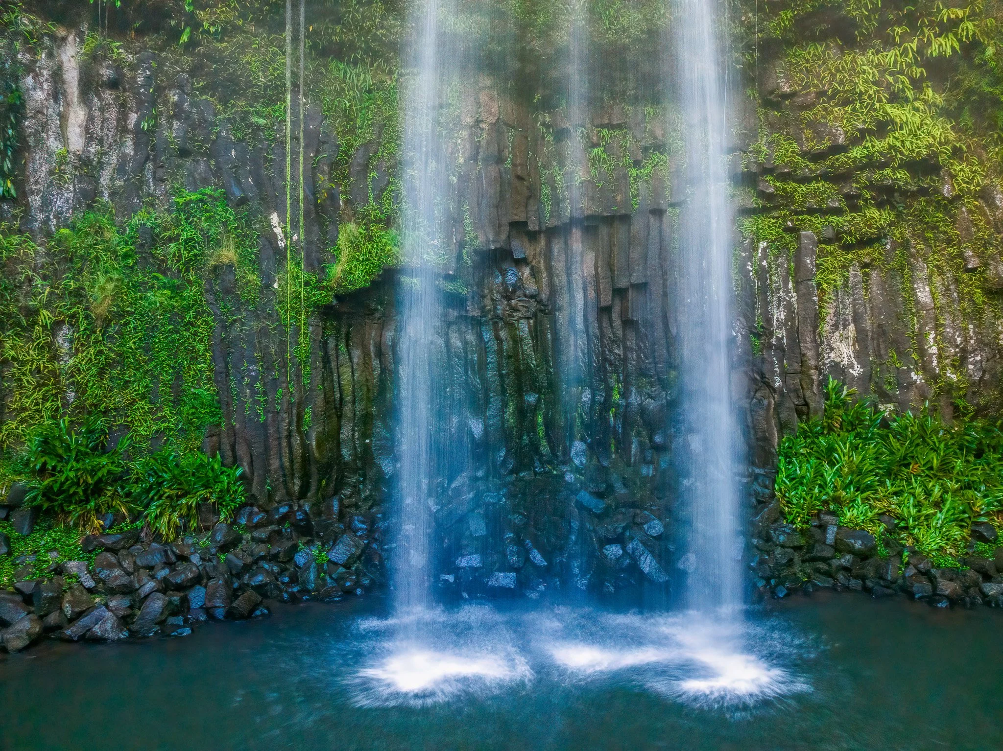
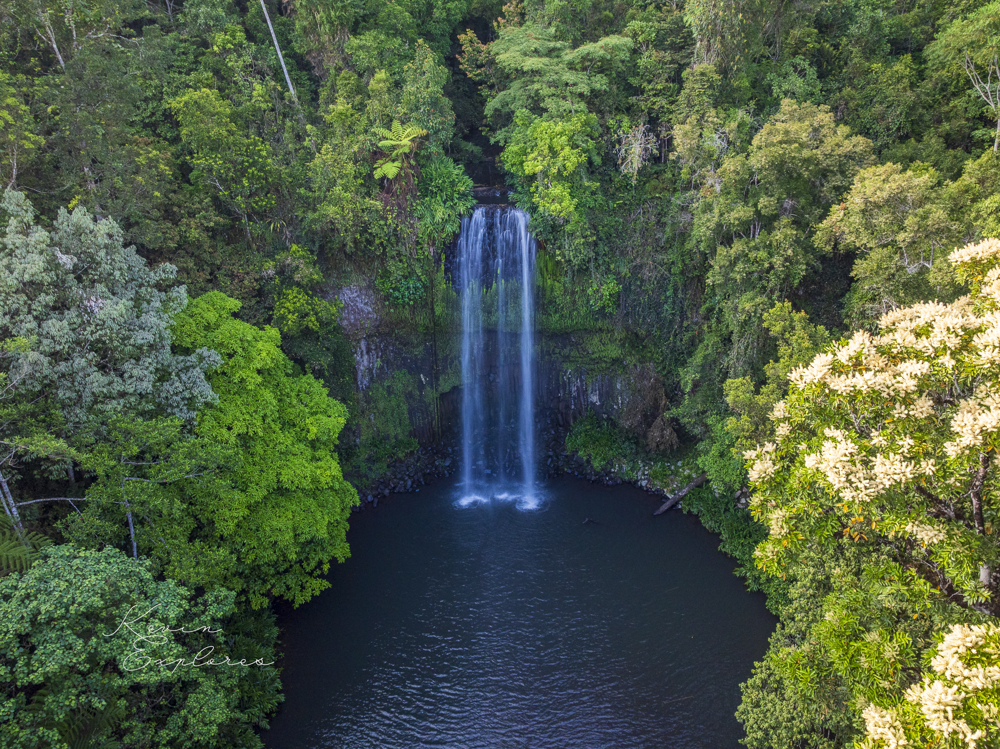
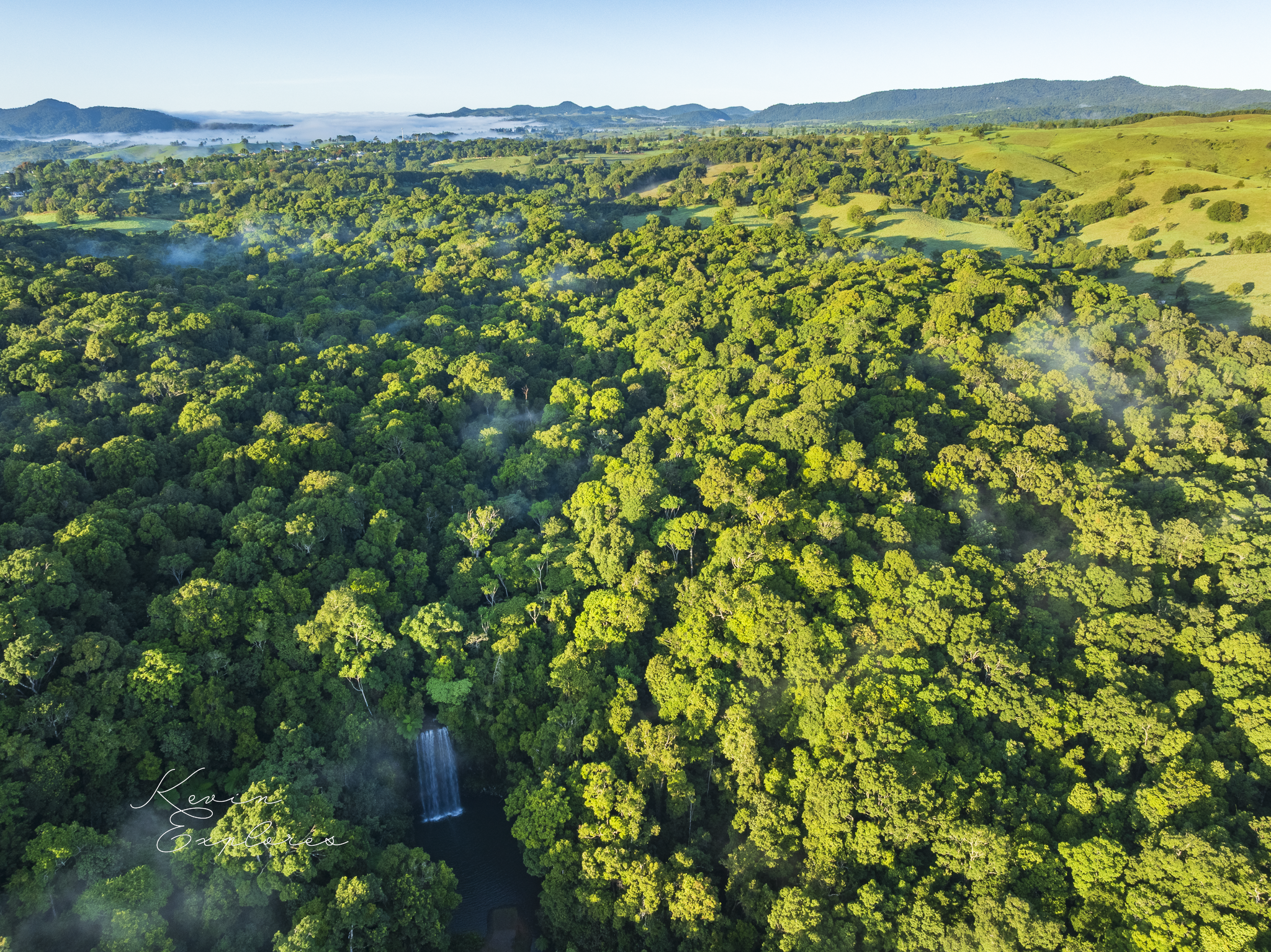
And the stack is coming apart while you watch. Where water and weather work into the joints near the base of the face, blocks eventually loosen and drop — which is why the pool is ringed with angular black blocks rather than rounded river stones. That heap is not debris. It is the face itself, arriving in instalments — each block a piece of wall the water has prised loose. The exposed rock is breaking down, so slowly that a century of photographs catches no change, but breaking down all the same. A waterfall is not a fixed thing to be looked at. It is a working edge — and it can show you the record inside the rock only by taking the rock apart to do it. What you carry away is not just a photograph of a waterfall — it is a cross-section of the Atherton Tablelands' volcanic past, two lava flows laid open by the single creek that, in the same motion, is wearing them away. See that once, and you can't unsee it. The image never changes. How deeply you can read it does.
What I'm still working out
A page like this is a progress report, not a conclusion. Here is what the rock is yet to reveal to me — and what I'll be chasing on the next visits.
Which volcano made which flow. Two shields stand within a few kilometres. Bradleys Hill, to the east and dated to about a million years, sends its radial drainage right across the falls — so the upper flow is most likely its lava. The lower flow is the puzzle: it could be an earlier flow from the same hill, or something older from a vent further off. The two flows in the wall have never been dated, so I can't yet prove the pairing — only read it from the shape of the land.
How far apart in time the two flows are. They might be near-continuous — two pulses of one eruptive episode — or separated by a long stretch of the district's volcanic history, whose lavas run from around three million years ago to roughly one. Dating the two flows would place them, and tell me whether that green seam marks a brief gap or a vast one.
Why the drop is here. Most waterfalls last because something hard sits at the lip, resisting the creek that would otherwise grind the step flat. My reading is that here it is the columns themselves. They stand vertical, so the creek runs out across their tops — the ends of the colonnade — with the joints running downward, into the rock, roughly the way the water falls. That orientation should make the lip hard to prise apart: rather than levering a block off the top, the creek tends to undercut the base until blocks loosen from below. If that's right, the same cooling geometry that makes the face beautiful is what holds the fall up. What I still can't say is why the step sits at this exact point rather than a little up or down the creek — which I could test against the other falls on the circuit, if they stall on the same kind of rock.
Whether the falls are creeping upstream. The apron of fallen blocks shows the face has shed rock — that much is plain — but a century of photographs shows the falls essentially unchanged. So whatever movement there is, it is very slow. Whether the whole fall is inching back up the creek, or the face is simply crumbling in place, I can't yet say.
Where the water comes from in the dry. The catchment above the falls is small, yet the falls keep running when the surface stream below the park has stopped — so something must be storing wet-season water and letting it out slowly. My best guess is the basalt itself: weathered and fractured lava makes a good aquifer, and most of the tableland's groundwater comes from basalt. If that's the story here, rain soaks into the rock across the plateau and drains back out through the dry as springs and seepage where the creek has cut down into it — the same porous, jointed basalt that the columns record, that the creek exhumed, and that the falls are slowly dismantling, would also be the sponge that keeps them running. I'd like to walk the creek in the dry and find where the water actually appears.
Millaa Millaa Falls lies on Mamu Country. Kevin Explores acknowledges the Mamu People as its Traditional Owners and Custodians, and their enduring connection to this land and its waters, and pays our respects to their Elders past and present.
If you know this country, or you read these rocks for a living, I'd genuinely like to hear from you.
Country from above.
New Field Notes delivered directly to you — subscribe free on Substack to follow the journey