Jiigurru Lizard Island
Northern Great Barrier Reef, Queensland
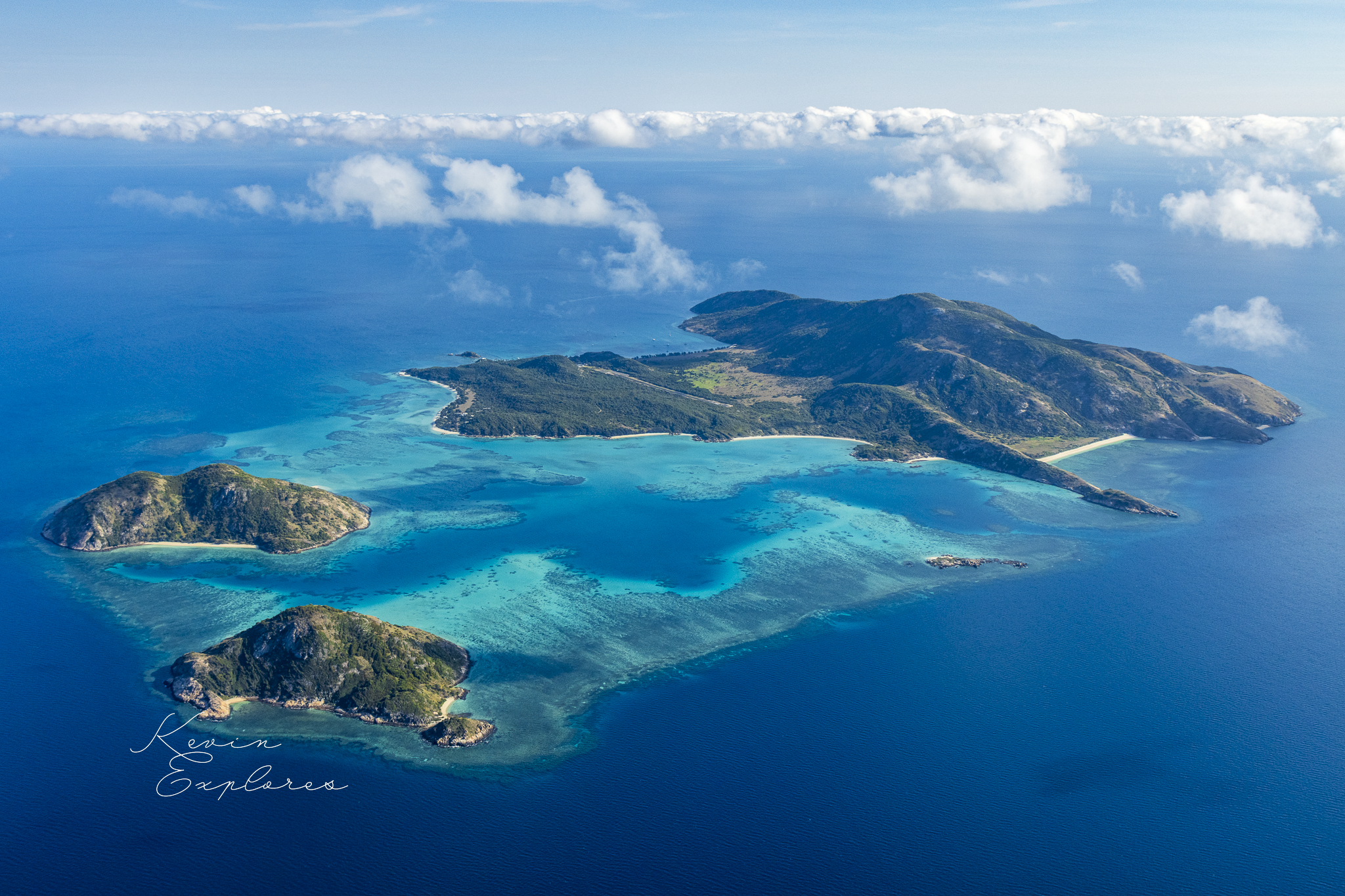
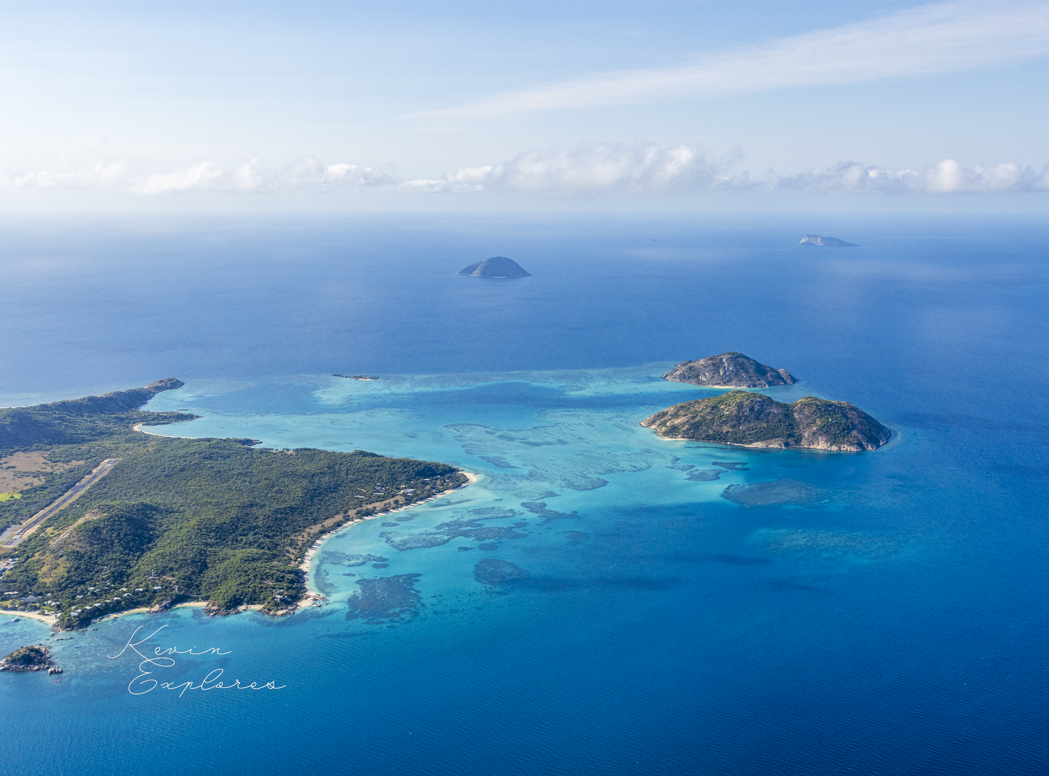
High-altitude wide overview, full island group visible, deep blue ocean, cumulus clouds in upper frame. Both the island's isolation and its turquoise reef fringe should be readable at a glance.
Two hundred and seventy-five million years of granite. Ten thousand years of rising sea. Six thousand years of living reef.
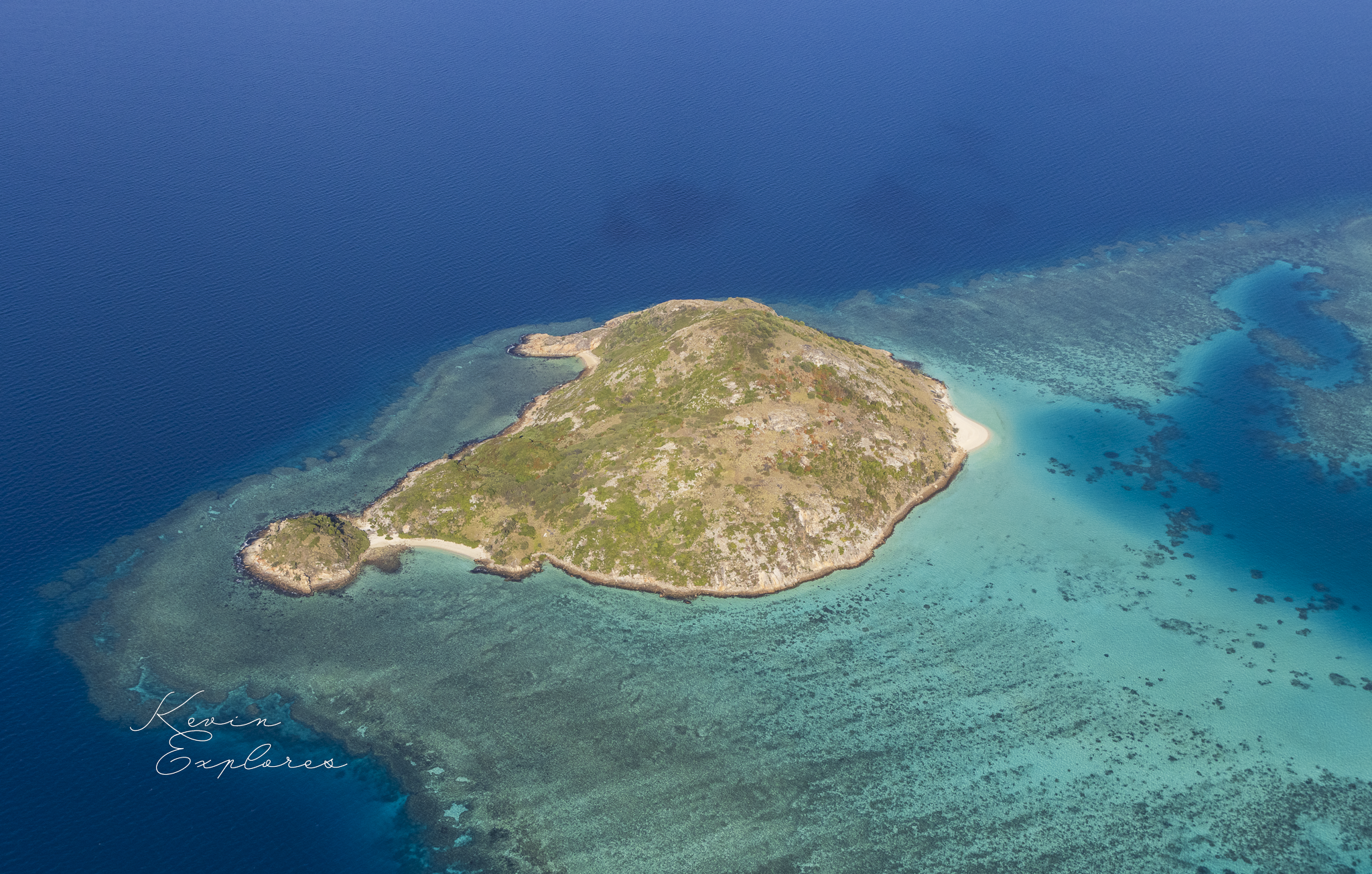
From altitude, Lizard Island looks like a single, self-contained thing — a rugged brown mass ringed in turquoise, sitting alone in the blue of the northern Great Barrier Reef. But the longer you look, the more clearly you can read what you're actually seeing: three completely different geological stories, stacked in the same frame, each operating on a timescale so different from the others that they barely seem to belong to the same planet.
This is one of the most geologically compressed landscapes in Australia. And from the air, every layer of it is visible.
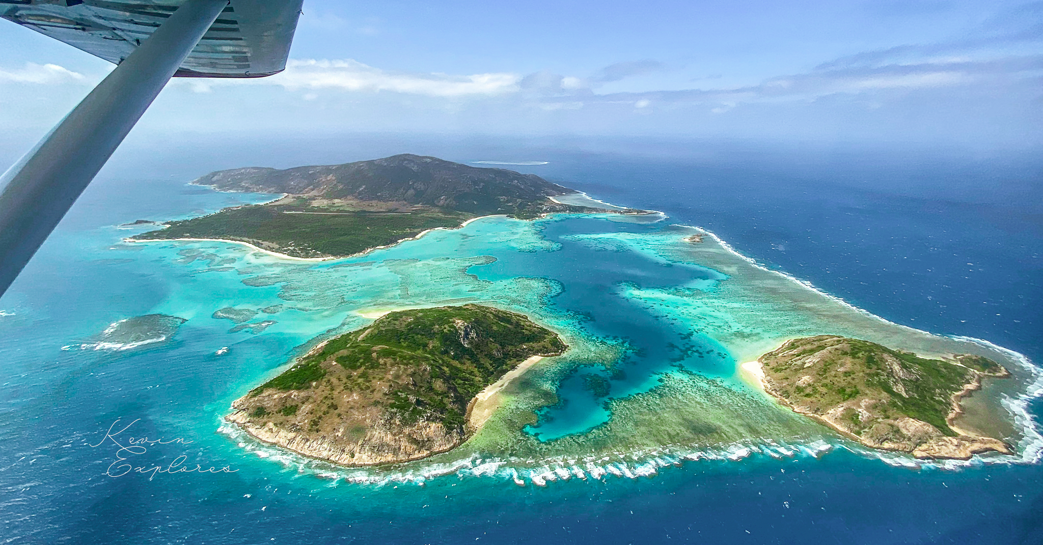
The Lizard Island Group from altitude. Lizard Island (top), Palfrey Island (lower left), South Island (lower centre). The Blue Lagoon — a drowned valley enclosed by reef growth — sits at the heart of the group.
THE ROCK
The island you're looking at is built from granite that belongs to the Cooktown Supersuite — a family of granites emplaced during the mid to late Permian period, approximately 275–260 million years ago, during the Hunter-Bowen Orogeny: a prolonged episode of mountain-building along eastern Australia's ancient margin. The same granite belt that outcrops near Cooktown on the mainland runs offshore to form Lizard Island — a detached outlier of that coastal granite system, now separated from it by 27 kilometres of ocean.
The rock itself is biotite-muscovite granite, ranging from highly porphyritic to even-grained — meaning some of it has large visible crystals set in a finer matrix, and some of it is more uniformly textured throughout. Pink-grey in colour, and extremely resistant to erosion.
That resistance is why the island rises the way it does. Cook's Look — the high point at 359 metres — is not a volcano or a tectonic feature. It is simply what's left after everything softer around it was worn away over hundreds of millions of years. Granite endures.
The island's granitic soils tell the same story. Granite decomposes to an infertile, sandy, free-draining soil — which is why more than half of Lizard Island is covered in grassland rather than rainforest, despite sitting in the tropics. The landscape is shaped by the rock beneath it at every scale, from the island's silhouette down to what grows on its slopes.
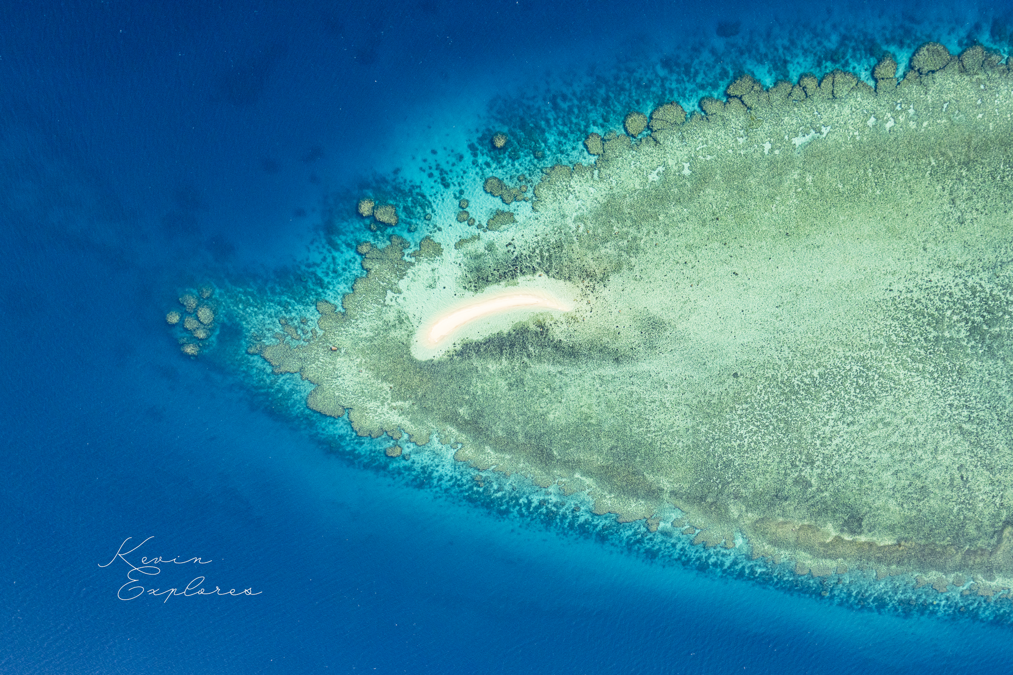
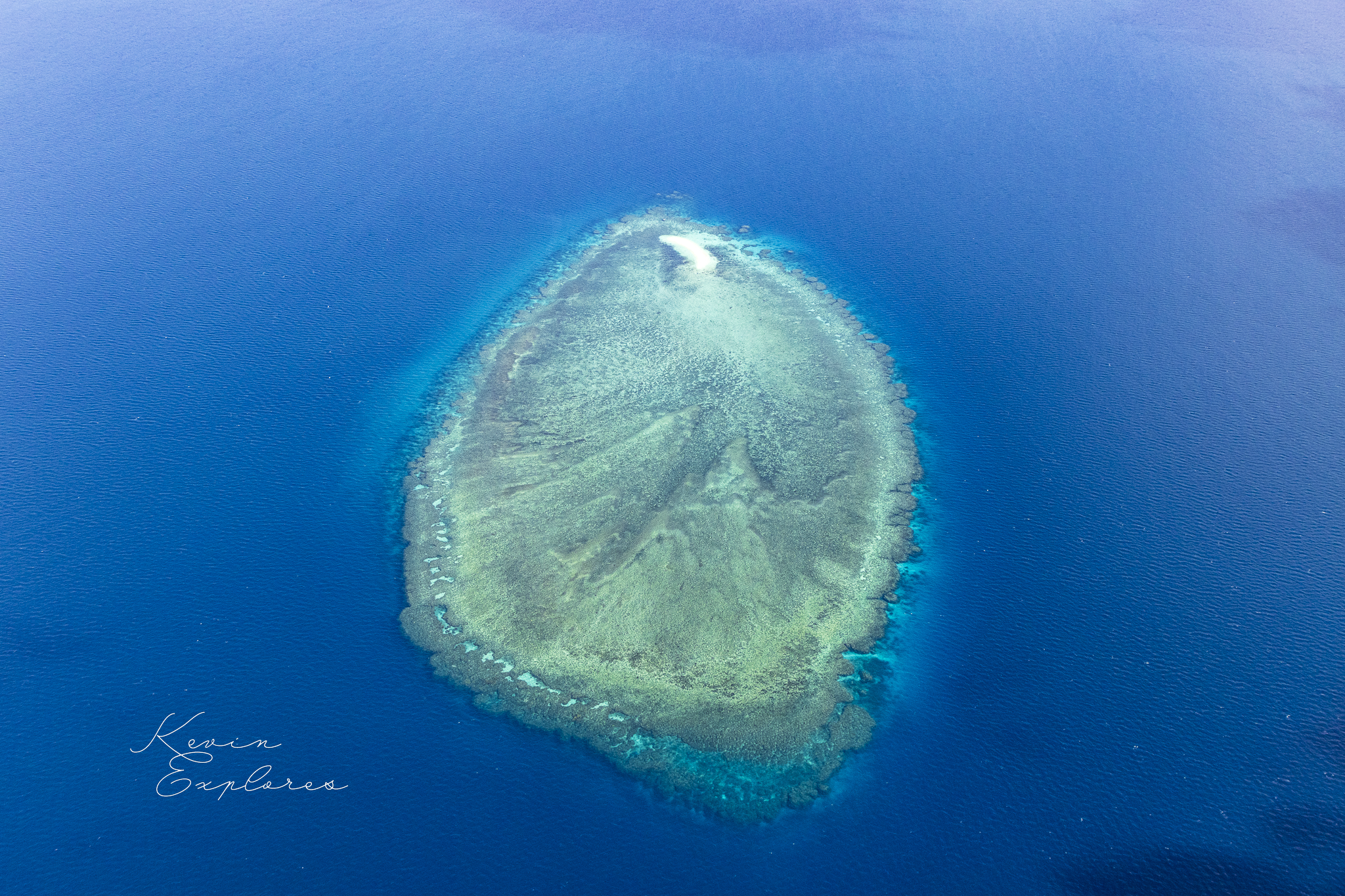
The geological map of the island group tells a story that the aerial view confirms. Every named island in the Lizard Island Group — Lizard Island, Palfrey Island, South Island, and Seabird Islet — shares the same Permian granite foundation, the same Rcci unit that outcrops on the mainland near Cooktown. These are not separate geological events. They are the peaks of a single drowned granite landscape, the high points that remained above sea level when the shelf flooded. Around each of them, Holocene carbonate — reef flat and beach material — has accumulated since the sea rose, mantling the lower margins of the granite and building the broad platform visible from altitude. At least one small reef feature in the group has no granite at all, built entirely from carbonate assembled in the last few thousand years. But for every named island, the foundation is the same ancient rock. The reef is the newest thing here. The granite underneath it has been here since before the first dinosaur.
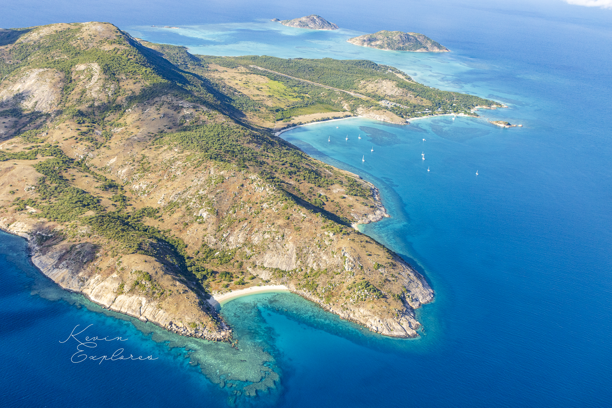
Pink-grey Permian granite — part of the Cooktown Supersuite, approximately 275–260 million years old. The rounded boulder forms are a product of tropical chemical weathering along joint sets, a process that attacks corners and edges faster than flat faces, progressively rounding the rock over time.
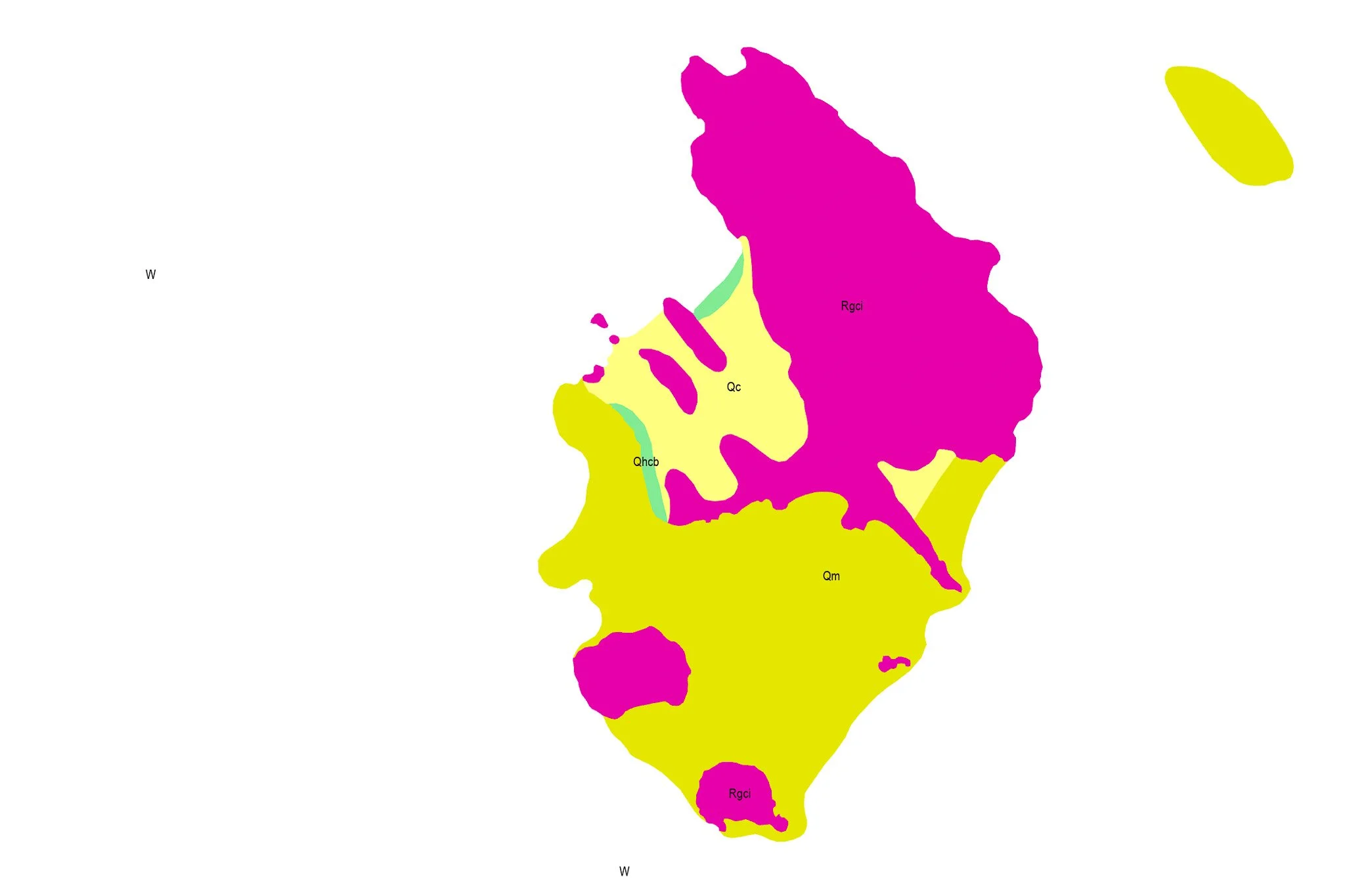
Surface geology of the Lizard Island Group (GeoResGlobe, QLD Geology Detailed). Magenta: Permian granite (Rgci, Cooktown Supersuite) — present beneath every named island in the group. Yellow-green: Holocene coral and carbonate platform (Qc) — reef material assembled in the last 6,700 years on top of a drowned granite landscape.
THE DROWNING
Here is where the story shifts from deep time to something almost within reach of human memory.
Around 20,000 years ago, at the peak of the last ice age, global sea level was roughly 120 metres lower than it is today. The Great Barrier Reef did not exist. The continental shelf was dry land — open grassland and woodland, rivers running to a coastline that lay far to the east of where it sits now. The granite hills of what we now call Lizard Island were inland country, connected to the Cape York Peninsula by grassy coastal plains.
Then the ice began to melt.
Sea level rose rapidly — almost 90 per cent of the total rise occurring between 14,600 and 8,000 years ago. The rate was not gradual in any human sense: coastlines retreated by up to 23 metres per year during the most rapid phases, amounting to roughly 600 metres of land lost every 25-year generation. The flooding of the continental shelf was not a geological abstraction. It was something people watched happen across the course of their lives.
By around 10,000 to 7,000 years ago, the shelf was submerged. The granite hills became islands. The low ground between them — valleys, drainage lines, the spaces between ridges — became the shallow seafloor you can see in turquoise from altitude today.
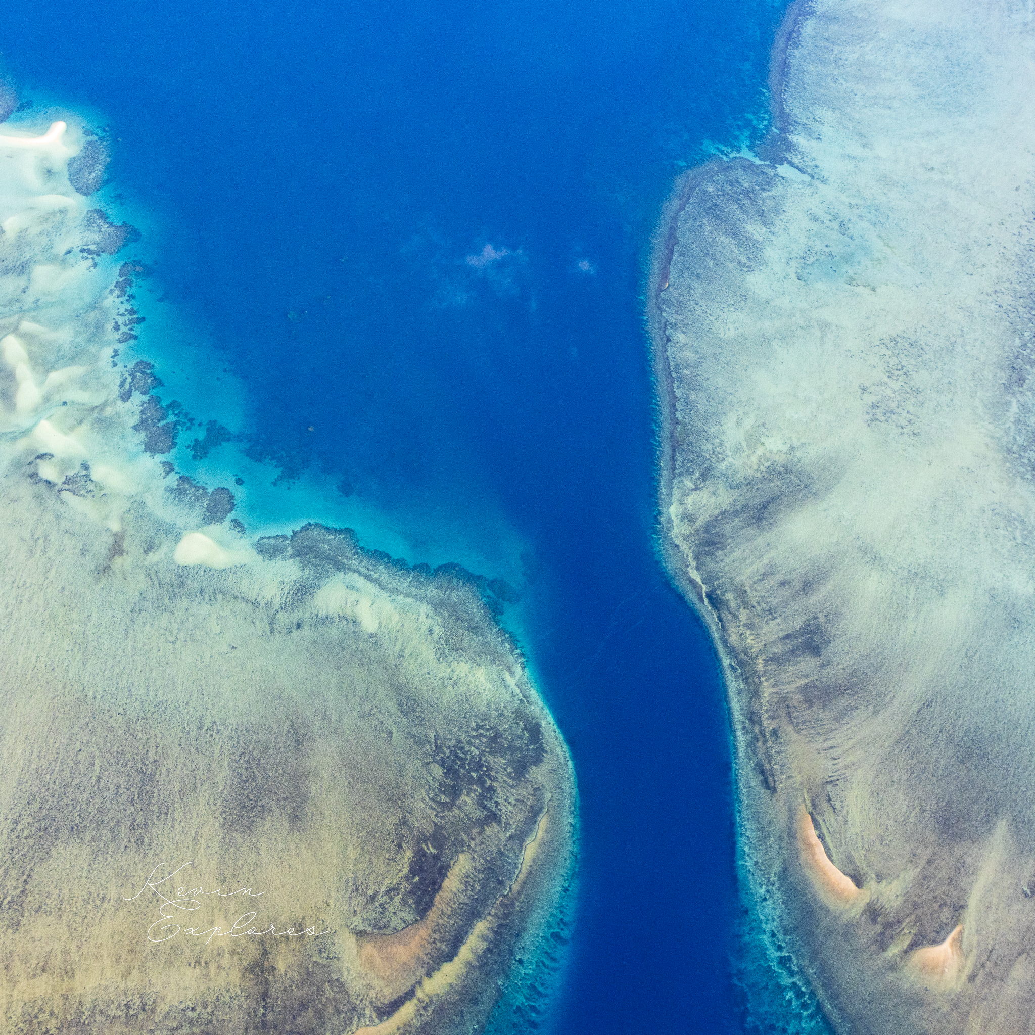
The Blue Lagoon is a drowned valley. It isn't a hole punched through a reef. It isn't a volcanic crater. It is the last remaining water body occupying a space that was once dry land — a valley floor that the sea moved into and has occupied ever since.
THE REEF GROWS
The coral didn't follow the sea immediately. Reef growth requires stable sea level, clear water, and a hard substrate to anchor on. Once the flooding slowed and conditions settled, coral began colonising the newly-submerged granite margins of the island group.
On the windward eastern side of Lizard Island — the face most exposed to the open ocean and the southeast trade winds — fringing reef started growing directly on the granite basement around 6,700 years ago. It grew upward, tracking rising sea level, and reached the surface roughly 4,000 years ago. At that point, the island acquired the turquoise fringe visible from altitude today.
There was no older reef here to build on. Coral grew on naked granite — polyps colonising ancient igneous rock and building a living structure that now extends for kilometres. The fringing reef visible around the island group is entirely a Holocene creation, geologically younger than the last extinction of mainland Australian megafauna.
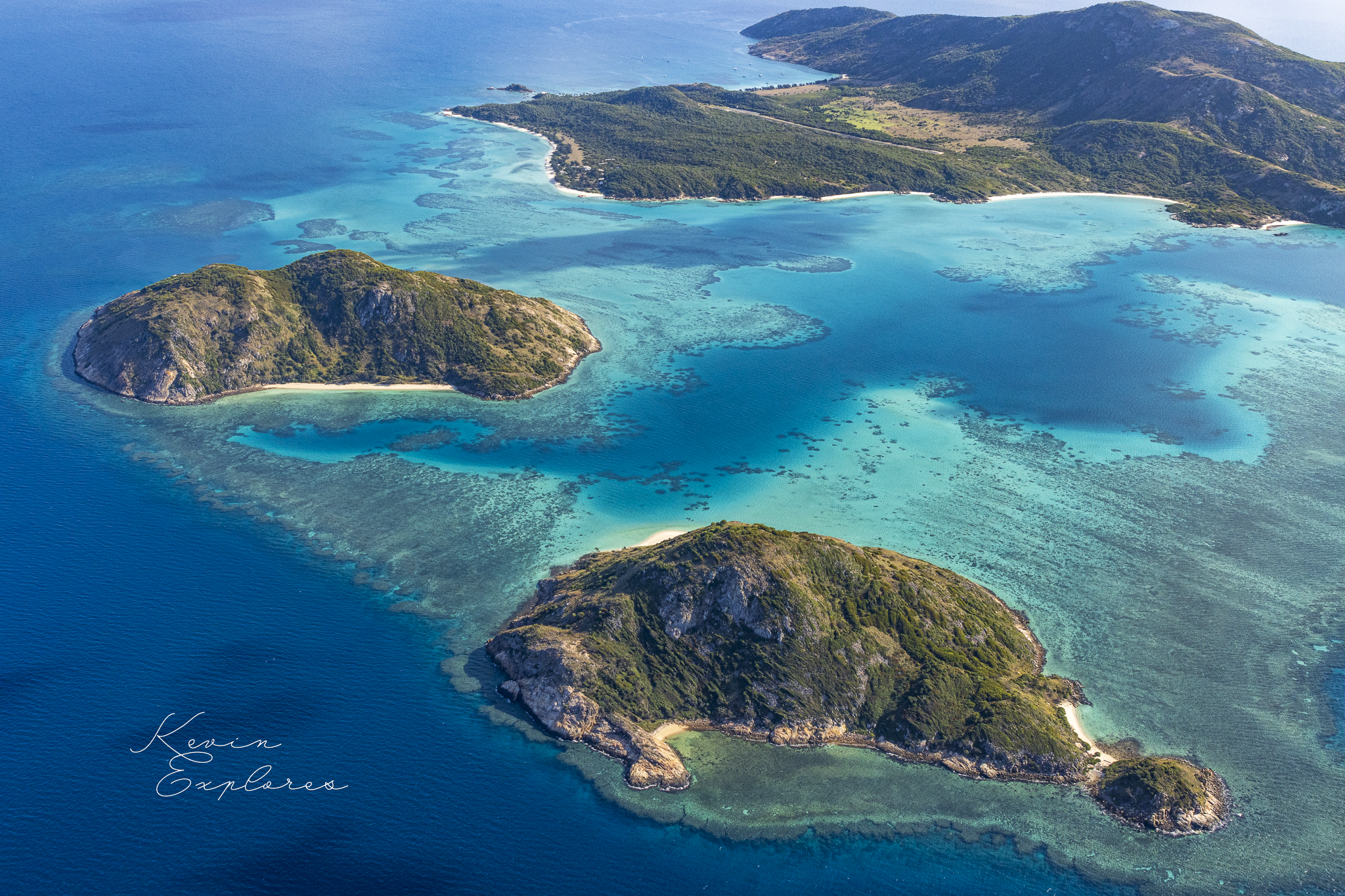
The reef grew independently from each granite island in the group — around Lizard Island, around Palfrey Island, across the shallow connecting shelf to the south. Over thousands of years those independent reef fronts grew toward each other, gradually enclosing the lagoon between them. The passages between the islands, where the reef remains incomplete, are where tidal exchange still connects the lagoon to the open ocean.
The lagoon is a system in the process of being enclosed. It is not finished.
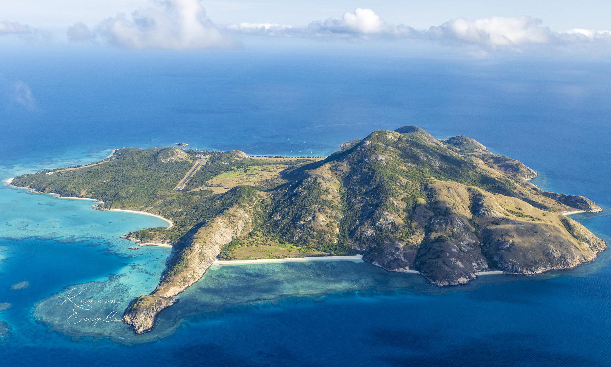
Coconut Bay - mid shot
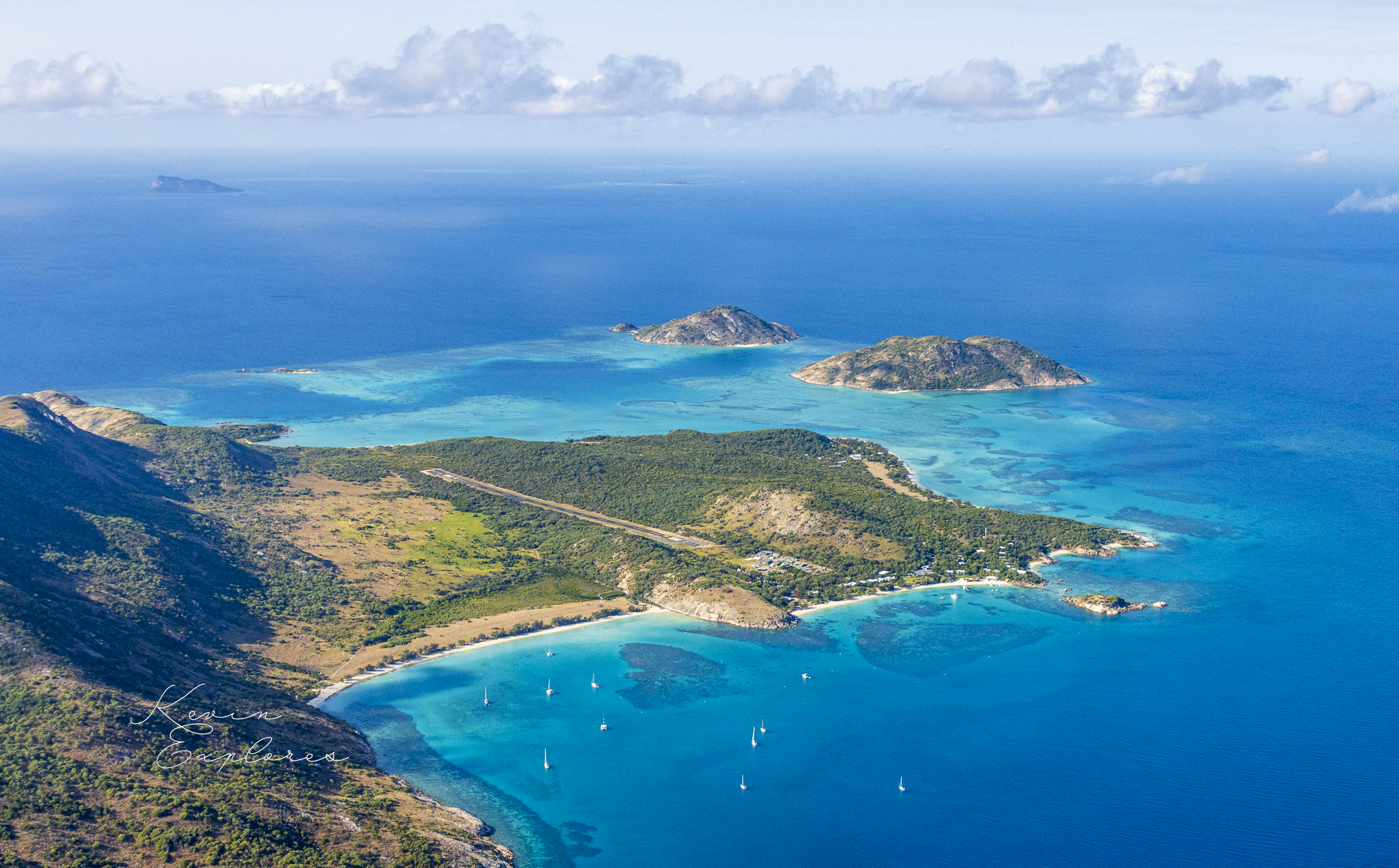
Watson Bay - lower left
TWO BAYS, ONE LESSON
Two Bays, One Lesson
The clearest way to read the island's relationship with wind and ocean energy is to compare its two main bays.
Watson's Bay faces northwest — sheltered behind the island mass, away from the dominant southeast trade winds. Its beach is broad, gently curved, and sand-rich: a low-energy zone where sediment accumulates rather than being swept away. The dense vegetation behind the beach reflects the same shelter — closed canopy, moisture-retaining, protected from salt spray. The sand here is a mixture of decomposed granite and coral and shell fragments, the island's own rock contributing directly to the beaches it forms.
Coconut Bay faces southeast — directly into the trades. Its beach is narrower, steeper, and more dynamic. Wave energy arriving from the open ocean winnows finer material away, leaving a more active beach face. The vegetation behind it is sparser, lower, salt-pruned. The reef flat drops away more steeply on this side, the turquoise shading quickly to deep blue.
One island. Opposite sides. The difference between them is simply which direction they face — and that single variable drives everything: beach width, sediment character, reef structure, vegetation type, even the colour of the water from altitude.
The windward shore generates sediment; the leeward shore accumulates it. The island is running its own internal sediment economy, quietly redistributing itself.
THE PEOPLE WHO WATCHED IT HAPPEN
The Dingaal people — Traditional Owners of Jiigurru — have a relationship with this island that makes the geology feel immediate rather than abstract.
Their ancestors walked to this place. When sea levels were lower, the granite hills of what would become Lizard Island were inland country, connected to the Cape York Peninsula by grassy coastal plains. The Dingaal people and their predecessors moved through that landscape for tens of thousands of years before the sea arrived.
They were here as the flooding happened — not in the sense of a single catastrophic event, but across generations, as the coastline retreated, the low ground became marsh, the hills became headlands, the headlands became islands. The rate of change during the most rapid phases was measurable within a human lifetime. This was not something people read in the landscape afterwards. It was something they lived through.
The oldest archaeological layers on Jiigurru date to between 6,500 and 5,800 years ago — within a few centuries of the island reaching something close to its present form. People were here almost as soon as the island became an island. They came by water, in canoes, navigating open ocean to reach a place that had been accessible Country within living cultural memory. Archaeological evidence from Jiigurru demonstrates sophisticated open-sea navigational skills and engagement in maritime networks connecting northeast Australia with peoples and knowledges across the Coral Sea region.
Jiigurru was a place of ceremony: where young men were brought for initiation, where Elders from neighbouring clans gathered. Shell middens, stone arrangements, and rock art in granite boulder shelters — painted in red ochre — record continuous occupation across thousands of years.
The archaeology here doesn't sit beside the geology as a separate story. It sits inside it. The same sea level rise that created the lagoon and drowned the valley also isolated the island and transformed how people related to it. The landscape change and the human response to it are the same event, seen from different angles.
READING THE COLOUR
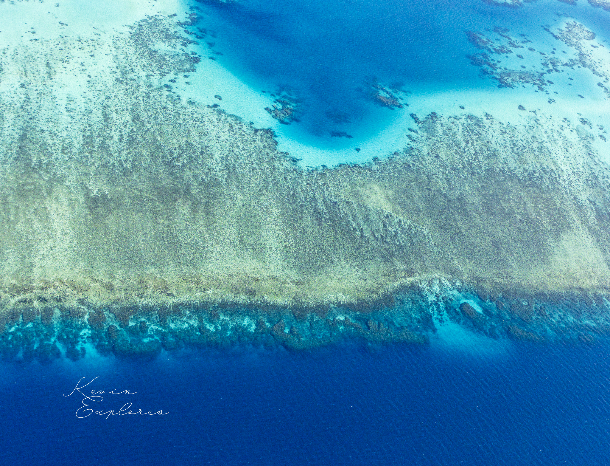
One of the pleasures of looking at Lizard Island from altitude is that the water tells you almost everything you need to know about what's underneath it.
Deep blue at the edges: open water, full ocean depth, no reef influence. The colour of absence.
Mid-blue in the lagoon interior: the Blue Lagoon proper, around 10 metres deep. Semi-enclosed, flushed by tidal exchange through the reef passages, slightly warmer and more settled than the open ocean.
Bright turquoise over the reef flat: shallow water — one to three metres — over living coral and carbonate sand. The colour is refracted light bouncing off a pale substrate through clear tropical water. The darker patches within the turquoise are coral bommies, visible from altitude through the clarity of the water column.
Pale milky turquoise in the very shallows around Palfrey Island: fine sediment in suspension or recently deposited — an active accumulation zone, possibly exposed at low tide.
You're not just looking at colour. You're reading a depth map, an energy map, and a sediment story — all at once, without any instruments. The water is transparent enough that the aerial view is, in its own way, a geological section.
Lizard Island sits 27 kilometres off the coast of Cape York Peninsula, halfway between the mainland and the outer barrier reef. It is the only continental island group in the GBR that sits this close to the reef's outer edge — which means it is the only place where you can stand on mid-to-late Permian granite and look out at coral structures that didn't exist until 6,000 years ago.
That juxtaposition — ancient resistant rock and geologically-infant living reef — is what makes this place unusual. The island isn't just sitting in the reef. It is older than the reef by a factor of more than 40,000. And the full picture is more unified than it first appears: every named island in the group — Lizard, Palfrey, South, Seabird — shares the same granite foundation, the same Permian rock that outcrops on the mainland near Cooktown. What separates them now is not geology but sea level. The reef has grown around all of them. The carbonate platform connecting them is Holocene — assembled in the last 6,700 years on top of a drowned granite landscape that has been here, essentially unchanged, for a quarter of a billion years.
From altitude, the whole story compresses into a single frame: brown granite, blue sea, turquoise reef. Three colours, three timescales, one view.
New Field Notes delivered directly to you — subscribe free on Substack to follow the journey