From a personal journey of discovery to understanding the stories of our landscapes.
Where it began
Kevin Explores started as a personal journey of discovery.
Flying around North Queensland in my aircraft, I found myself looking down at some extraordinary landscapes. Some were spectacular, others less obvious, but many prompted the same questions: What am I looking at? How did it get there? What has shaped it? And what is happening to it today?
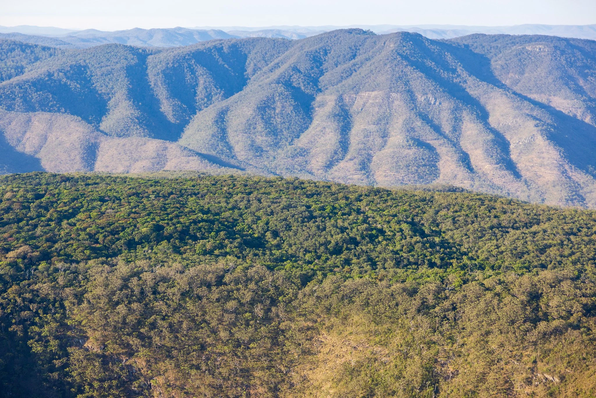
I would return home, research what I had seen and share photographs with family and friends.
There were a couple of immediate challenges.
The first was photography. Before 2000, I doubt I had taken more than 100 photographs in my life. What I experienced from the aircraft and what I managed to capture in an image were often two quite different things. There was a gap between what I could see and what I could communicate through photography. I wanted to close that gap.
The second challenge was understanding the landscapes themselves. Finding geological information that I could readily understand was not easy. I was fortunate to come across Warwick Willmott's regional geological guides, which helped open the door. Much of the academic literature, however, was difficult to navigate. It seemed there was a considerable jump between the relatively basic interpretative information available through National Parks and the technical language of scientific publications.
Many of the places I was exploring weren't covered by National Parks interpretative material at all.
I began to wonder whether other people with an interest in landscapes experienced the same difficulties. Perhaps there was an opportunity to share what I was learning and make some of that information more accessible.
That was the beginning of Kevin Explores: flying over places, researching what I saw, trying to understand what was happening and sharing the discoveries through photographs and social media.
Discovering a deeper purpose
Over the years, my interests have developed, my knowledge has grown and I have been fortunate to receive encouragement and assistance from many people with greater experience and expertise in the subjects I was exploring.
I have also received some wonderful feedback from people who share my interest.
This year, I took the opportunity to slow down a little and reflect on the journey so far. I wanted to think more carefully about why I was doing this, what I had learned and what I would like Kevin Explores to become.
I had always thought that curiosity was the driving force. I would describe myself as someone driven by curiosity.
But I began to ask a more fundamental question.
Why are we curious about the landscapes in which we live? Is there something deeper than simply wanting to know how a mountain, river or coastline was formed?
Perhaps humans have an enduring need to understand the places in which they live.
Think about our early human ancestors. Their survival depended on understanding their surroundings. They needed to recognise opportunities and threats, understand seasonal changes, find water and food, anticipate weather and recognise the behaviour of animals. Their knowledge of the environment was practical and essential.
I don't think that fundamental dependence has disappeared. What has changed is how visible it is to us.
For Indigenous peoples, knowledge of Country has traditionally been intimate, practical and accumulated over generations. It encompasses far more than knowing where food and water can be found. It includes an understanding of seasons, weather, animal behaviour, plant cycles, waterways, fire, soils, landforms and the relationships between them.
That knowledge has been fundamental to survival, cultural continuity and caring for Country. It also represents a depth of connection and understanding from which contemporary society has much to learn. Indigenous knowledge holders must, of course, remain the custodians and authorities of their own cultural knowledge and stories.
For much of contemporary society, our relationship with the natural environment has become less direct.
We have developed infrastructure, technology and institutions that shield us from many of the immediate challenges our ancestors faced.
We turn on a tap without needing to understand the catchment supplying our water.
We buy food without understanding the soils, climate and ecological systems that produced it.
We build houses without necessarily understanding the geology, drainage or flood behaviour of the land beneath them.
We travel through landscapes without recognising the processes that created them.
We clear vegetation without necessarily understanding its role in slope stability, water quality or habitat connectivity.
We experience extreme weather without necessarily understanding the environmental conditions that influence its consequences.
We have become less dependent on our own direct environmental knowledge, or at least less conscious of that dependence.
But we haven't become independent of the environment.
The dangers haven't disappeared. They have become less visible.
Many environmental risks are cumulative, interconnected and slow-moving. They don't necessarily announce themselves as an immediate threat to human survival. Their consequences may emerge decades later, affect communities far downstream or become apparent only when several environmental processes interact.
We can lose the ability to recognise environmental problems long before we experience their consequences.
I think this is an important reason why understanding our landscapes matters. Environmental knowledge and literacy shouldn't be regarded as something reserved for scientists, environmental professionals or people with a particular interest in nature. It is part of understanding our neighbourhood, our region and the world we inhabit.
Learning to read the landscape
In presentations I have recently given to groups on the Atherton Tablelands, I have explored the idea of learning to read the landscape.
I see this as having three levels:
Seeing: Recognising the features, patterns and characteristics of a landscape.
Understanding: Knowing how geology, landforms, water, vegetation, climate and human activity interact to create the landscape we see.
Significance: Recognising why those relationships matter to our lives, our communities and future generations.
Consider a river.
We can see its channel, bends, sandbanks and surrounding vegetation. But understanding it involves much more: the geology of its catchment, the landforms through which it flows, the movement of water and sediment, the relationship with surrounding ecosystems and the influence of human activity.
Understanding its significance takes us further. It connects the river to water quality, biodiversity, agriculture, infrastructure, communities and the health of the wider catchment.
The more we see and understand, the more deeply we connect. And the deeper the connection, the more we care.
I think this is a worthwhile ambition for Kevin Explores: helping people move beyond simply looking at landscapes towards understanding them.
The value of the aerial perspective
Aerial imagery provides an extraordinary starting point for this exploration.
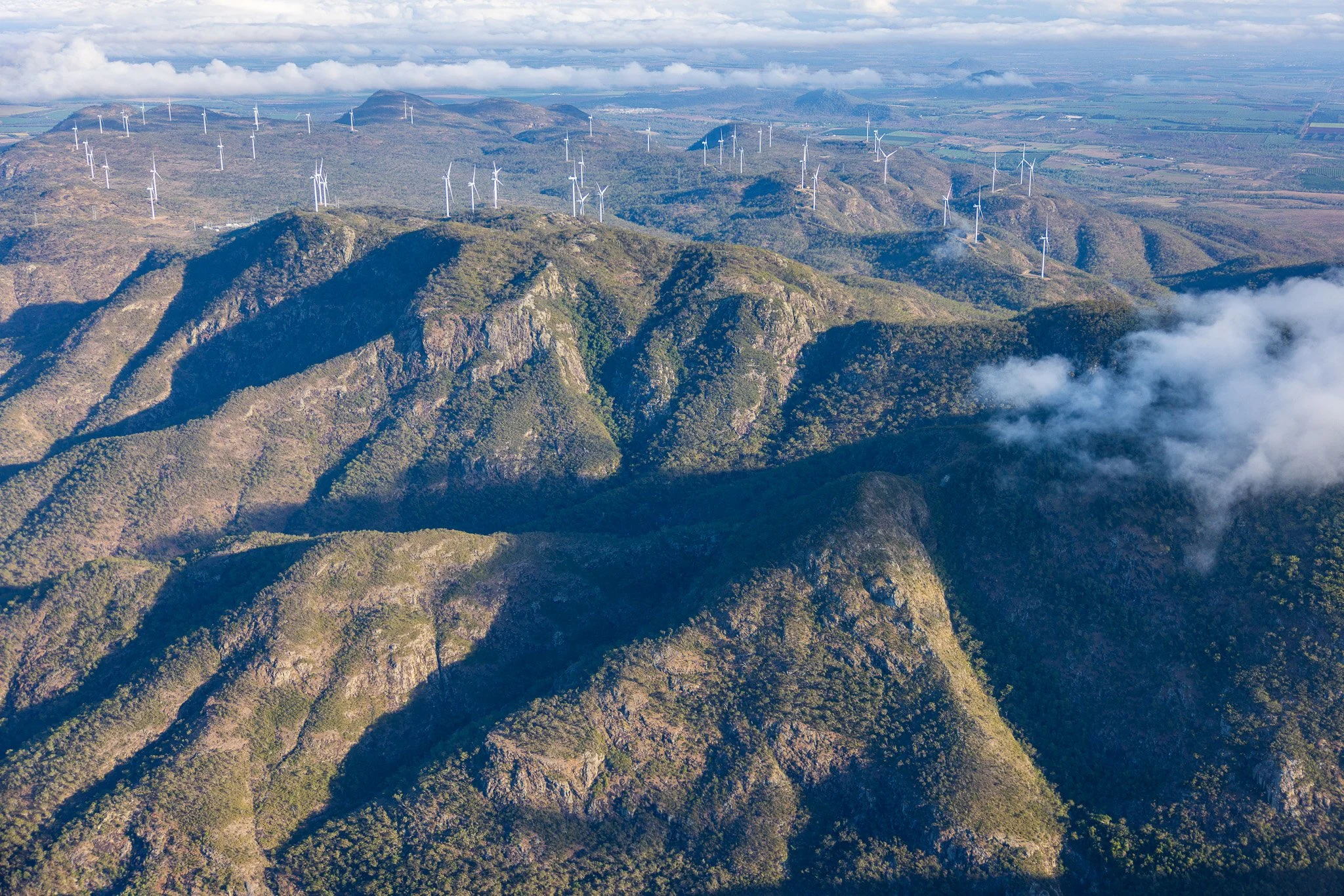
From the air, we can see things that are difficult, sometimes impossible, to appreciate from ground level. Individual features become part of a much larger picture. Patterns emerge. Relationships become apparent. Features that might otherwise seem unrelated begin to make sense.
There are several particular advantages.
Seeing patterns
Aerial imagery can reveal geological structures, landform patterns, vegetation boundaries, drainage networks and other features that are not readily apparent from the ground.
Understanding scale
We can move between an individual feature, the landform containing it, the surrounding catchment and the broader regional landscape. This helps place local observations within a much larger context.
Recognising connections
We can see how geology, landforms, water, vegetation and human activity interact. A change in one part of a landscape can influence what happens elsewhere.
Recognising change
Comparing imagery from different periods can reveal changes in vegetation, waterways, coastlines, land use and development. It can also help us distinguish between natural processes and human-induced change.
Discovering the less obvious
Patterns of shape, colour, texture and spatial relationships can provide clues to features and processes that might otherwise go unnoticed.
Of course, an aerial photograph doesn't necessarily tell us what we are looking at. It raises questions and provides clues. Ground observations, research and specialist knowledge are often needed to establish what those clues mean.
That is where interpretation becomes important.
From photography to landscape interpretation
As my interests have developed, I have become increasingly interested in bringing together aerial imagery, research and interpretation.
Rather than simply photographing interesting places and describing what is visible, I want to explore the underlying stories: how landscapes formed, how they have evolved, the processes that continue to shape them and the ways in which people and nature interact.
My research and interpretation are developing around five complementary perspectives.
Geology
Understanding the foundations upon which our landscapes are built. The rocks, geological structures, mineral composition and geological history that provide the framework for the landscapes we see today.
Geomorphology
Understanding how landscapes evolve. The landforms and processes associated with weathering, erosion, transportation and deposition, and the continuing influence of water, gravity, climate and other natural forces.
Ecology
Understanding the living systems that occupy and depend upon landscapes. The relationships between vegetation, wildlife, habitats, soils, water and climate, and how these systems respond to natural and human influences.
Indigenous Cultural Knowledge
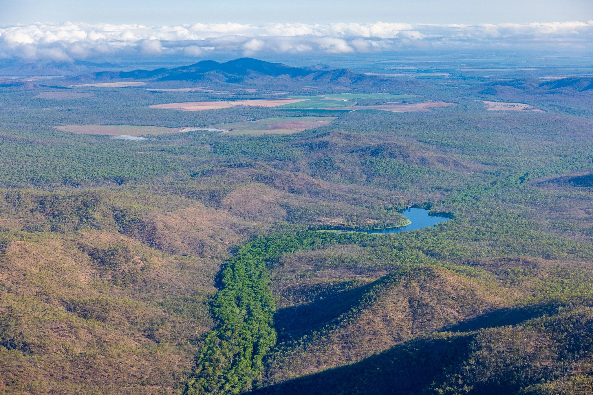
Recognising that landscapes have cultural histories, meanings and relationships that extend far beyond their physical characteristics. I am particularly interested in how aerial imagery and perspective might support Indigenous-led interpretation and storytelling. These are their stories to tell, and I would welcome opportunities to collaborate in providing imagery and spatial perspectives that support that work.
Human impacts
Understanding how people have occupied, used, modified and continue to influence landscapes. This includes agriculture, urban development, infrastructure, resource extraction, land management and the cumulative consequences of human activity.
These perspectives are not isolated from one another. In fact, their greatest value often comes from bringing them together.
A river, for example, has a geological foundation, a geomorphological history, an ecological system, cultural significance and a continuing relationship with human activity.
The aerial perspective provides an opportunity to explore those relationships as part of a connected landscape rather than as separate subjects.
Connecting the stories
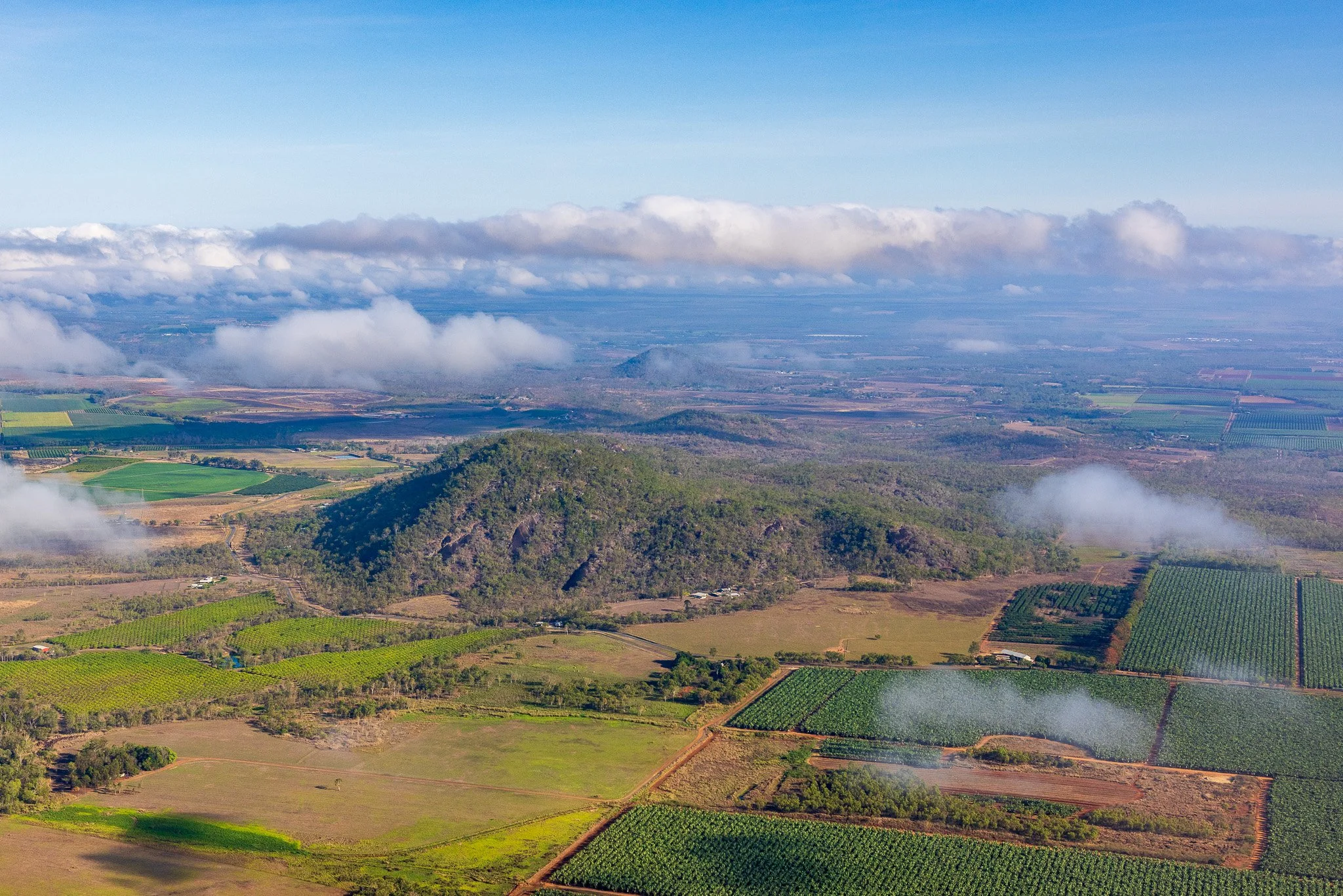
As the collection of photographs and interpretative material on the Kevin Explores website has grown, I have become increasingly conscious of the need for a more considered approach to presenting it.
Initially, the website was largely a collection of photographs organised around places and activities. I subsequently introduced Field Notes to share some of the research prompted by observations made during my explorations. Later, I began adding interpretative text to image galleries to provide more context and tell the stories behind particular places.
That evolution brought its own challenges.
I found myself repeating geological explanations across different locations. Many places share a common geological history, and explaining that history separately on every location page wasn't particularly effective. Equally, a visitor interested in one particular location shouldn't have to navigate elsewhere to understand its broader context.
There is also the problem of looking back.
After several years of researching and developing my understanding of landscapes, I can now see things in some of my earlier photographs that I didn't recognise at the time. A photograph that initially seemed interesting for one reason might reveal an entirely different story when viewed with a better understanding of the underlying geology, geomorphology or ecology.
It has become apparent that I need a more disciplined and comprehensive approach to researching, interpreting and presenting the material.
I am therefore developing a more structured approach to the way Kevin Explores researches and shares its discoveries.
I have used the textbooks and other resources I have accumulated to establish a working guide to the subjects within each of the five interpretative perspectives that are relevant to North Queensland and lend themselves to exploration through aerial imagery.
This provides a framework for identifying subjects, recording research, retaining references and developing interpretative material.
When an interesting feature or pattern catches my attention during an exploration, I can investigate it against this framework. If it is something I haven't previously researched, I can develop a research note, record the supporting information and references, and then prepare an interpretative note to explain the discovery in accessible language.
The intention is to connect these individual discoveries to the broader stories of the landscapes in which they occur.
Consider Bromfield Swamp.
Its story might include the swamp itself, its geological setting, pollen records and evidence of past environmental conditions. But it also belongs to the much broader story of the Atherton Volcanics, the development of the surrounding landscape and, further back, the evolution of the Eastern Uplands and Great Escarpment.
These connections provide opportunities for people to explore beyond the immediate subject.
Someone might simply enjoy the photographs and read about the swamp. Another person might follow the geological connections and discover an entirely different perspective on the region.
I want the website to make those connections possible, allowing people to explore as broadly or as deeply as their curiosity takes them.
Where to from here?
I see Kevin Explores developing along three complementary paths.
A growing visual archive
I want to build a valuable collection of aerial imagery documenting the landscapes of North Queensland. Not simply as a collection of beautiful photographs, but as a visual record of geological features, landforms, ecosystems, human activity and landscape change.
An interpretative resource
I want to develop an accessible and increasingly comprehensive body of material that helps people understand the stories behind those images. A resource that encourages curiosity, makes scientific knowledge more accessible and helps people discover connections between individual places and the broader landscapes of which they are part.
A distinctive interpretative practice
I also see an opportunity to bring together aerial observation, photography, research and interpretation in ways that might be useful to tourism organisations, environmental organisations, regional communities and other place-based organisations.
My contribution isn't necessarily about being the expert in every subject. It is about recognising what an aerial perspective can reveal, knowing how to investigate it, bringing together relevant knowledge and expertise, and communicating the resulting discoveries through imagery and interpretation.
There are opportunities to collaborate with geologists, geomorphologists, ecologists, historians and Indigenous knowledge holders, each contributing their particular expertise and perspectives.
I have already had some encouraging experiences where an initial request for photographs has developed into broader discussions about the stories that could be told and the opportunities that might otherwise have been overlooked.
I find that particularly exciting.
An ongoing journey of discovery
I don't see this as a project with a defined end point.
My knowledge will continue to develop. New explorations will raise new questions. New research will change how I understand places I have already visited. And as I become more experienced, I will undoubtedly discover things in earlier photographs that I hadn't recognised before.
There will always be more to see, more to understand and more to share.
The original motivation remains. I still love flying over North Queensland, discovering interesting places and wondering what is happening beneath, around and beyond what I can see.
But I now have a much clearer idea of what I want to do with those discoveries.
I want to use exceptional imagery to create curiosity, then interpretation to deepen understanding.
Ultimately, I hope Kevin Explores will help people discover the stories of our landscapes, appreciate the relationships and processes that have shaped them, and develop a deeper connection with the places in which they live.
Because the more we see and understand, the more deeply we connect. And the deeper the connection, the more we care.