Baker Blue Mountain: An Island of Green in a Dry Landscape
Reading geology, boulder fields and forest from the air
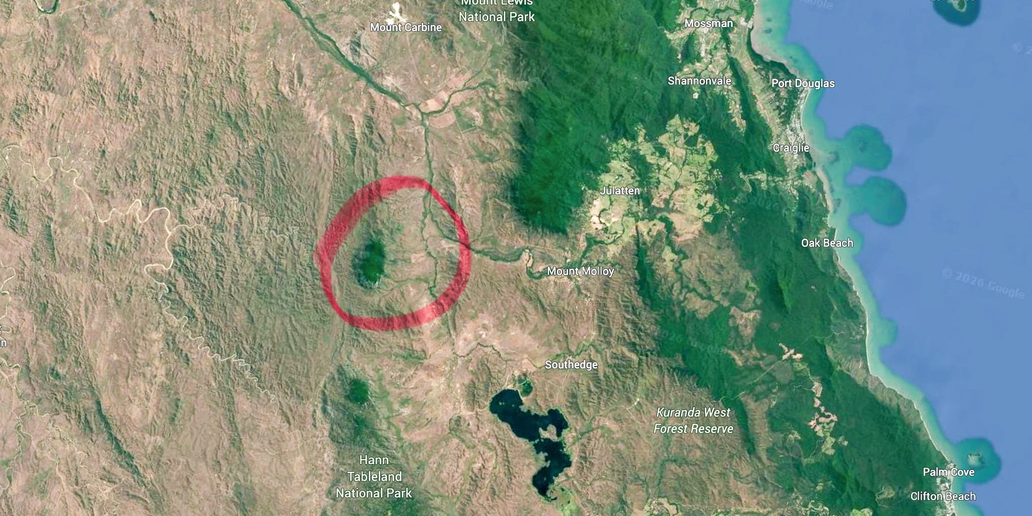
From the air, Baker Blue Mountain near Julatten presents a striking contrast. The surrounding country appears dry and subdued in colour, yet the mountain rises above it, cloaked in dense green forest. Cloud drifts across its ridges, while extensive fields of angular boulders skirt its slopes.
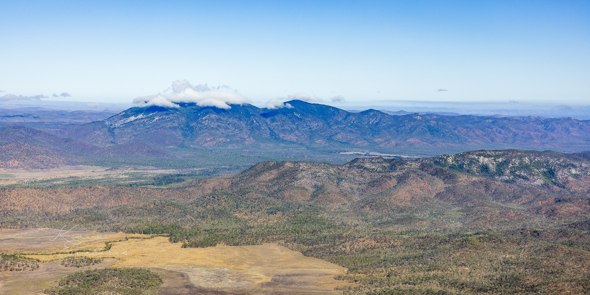
Baker Blue in the background
Why does this mountain look so different from the country around it? What has produced its unusual rocky flanks? And what can these features tell us about the forces and processes that have shaped this landscape?
Looking at the mountain from above offers an opportunity to explore how geology, weathering, water and vegetation interact to create the landscape we see today.
An ancient geological foundation
The geological map identifies the underlying rock as Bakers Blue Granite, of Permian age. Its origins lie hundreds of millions of years in the past, when molten rock cooled and crystallised beneath the Earth's surface.
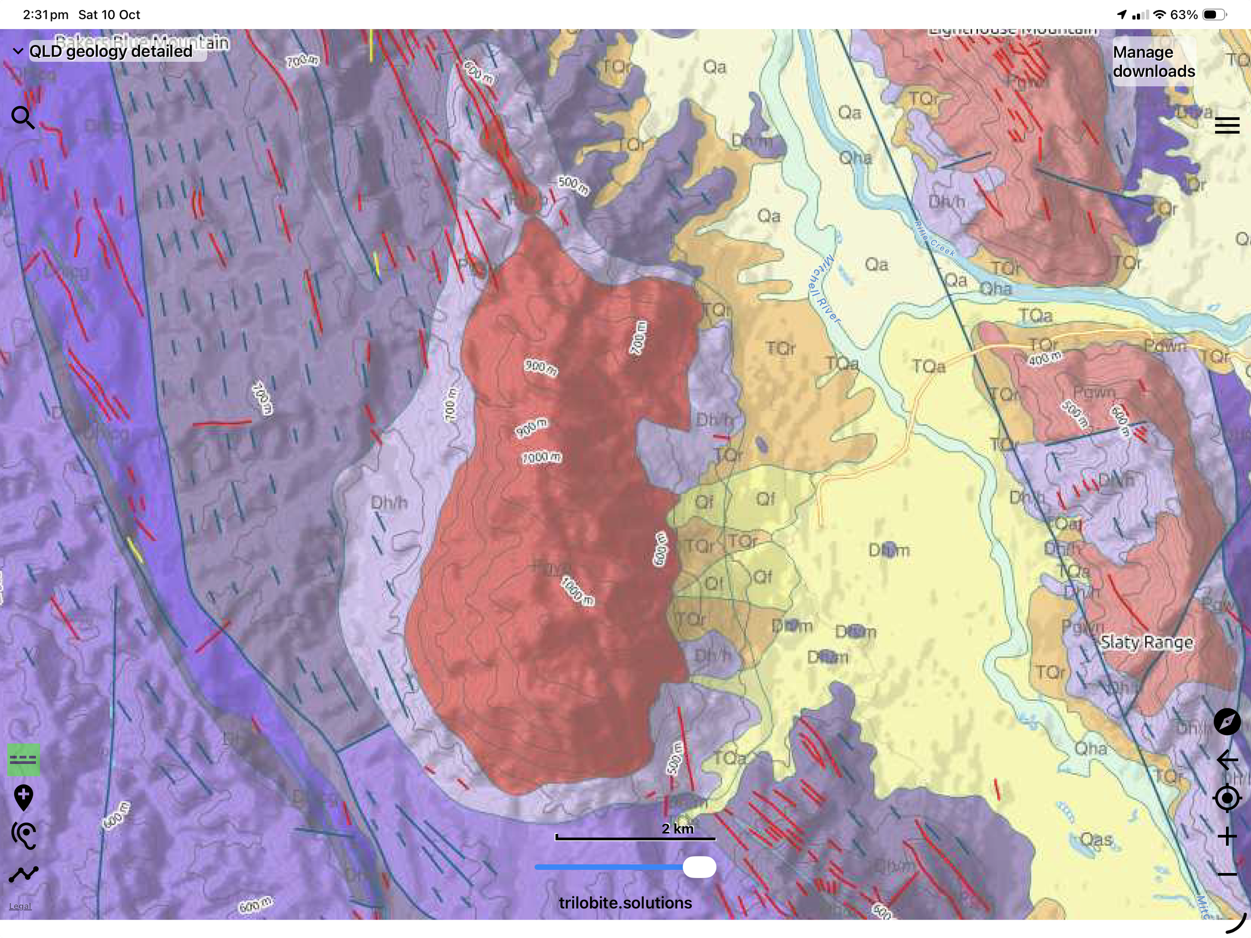
Surface geology map for Bakers Blue
Granite may appear solid and enduring, but its geological history can leave it divided by fractures and joints. Cooling, changing pressure and episodes of geological stress can create weaknesses through the rock. In some cases, fractures are subsequently filled by molten material from beneath, forming dykes, or by minerals deposited from fluids, forming veins.
The geological map records numerous linear features in and around the granite, with varying orientations. Their distribution suggests a complex structural history and raises an intriguing question: did this history influence how the granite eventually broke apart?
The mapped dykes and veins provide clues to the mountain's past, although they are not necessarily the same fractures that now divide the exposed rock into blocks. Establishing that relationship would require closer examination of the mapped structures and the joints visible in the granite itself.
How granite becomes a field of boulders
The extensive boulder fields along Baker Blue Mountain's flanks are among its most distinctive features.
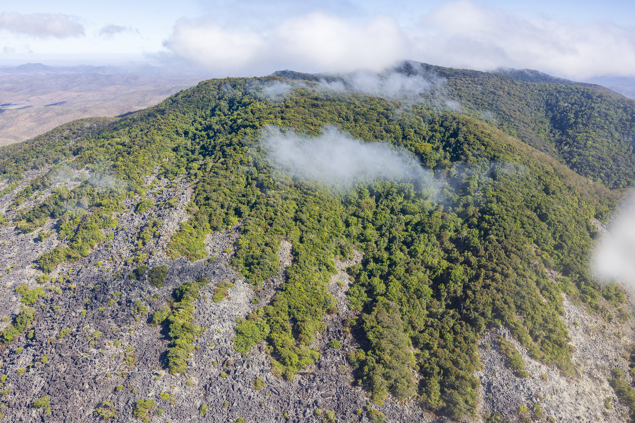
Fractures and joints divide granite into blocks. Water entering these openings can promote chemical weathering, gradually altering susceptible minerals and weakening the rock. Weathering may be particularly effective where fractures intersect, allowing corners and edges to break down.
Over long periods, surrounding material is weathered and removed, exposing more resistant blocks. Gravity, runoff and other slope processes can then move some of these blocks downslope, contributing to the accumulation of boulders.
The spacing and orientation of joints influence the size and shape of the blocks that form. Closely spaced fractures may produce smaller blocks, while more widely spaced fractures can leave large masses of rock intact.
From the air, the extensive rocky margins of Baker Blue Mountain invite us to consider how its geological structure has influenced the shape of its slopes. The precise contribution of fracturing, weathering and downslope movement remains a question for further investigation, but together these processes offer a plausible explanation for the landscape's rugged appearance.
Why is the mountain so green?
The contrast between the mountain's forest and the surrounding dry country is equally compelling.
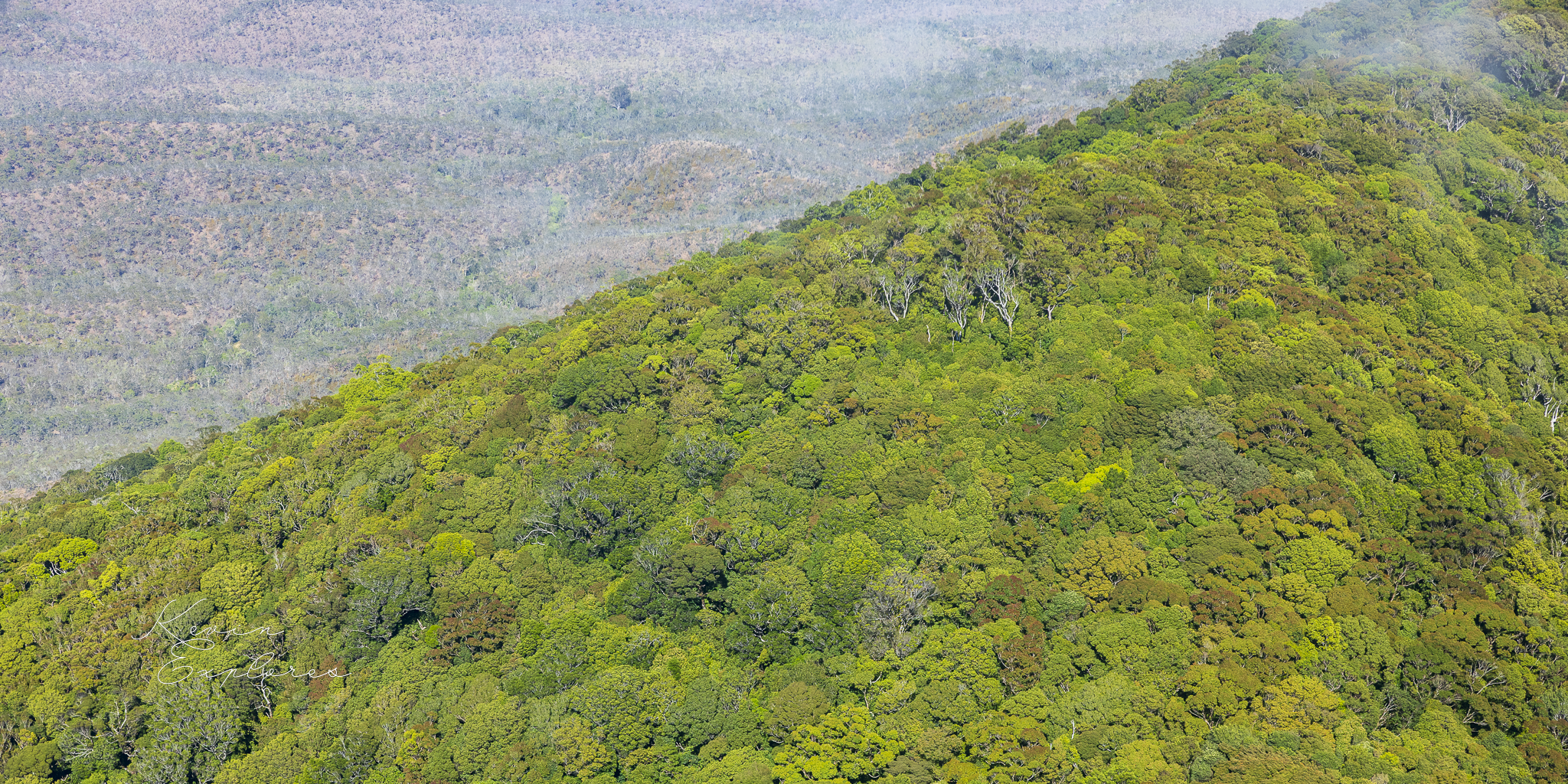
In the photographs, cloud appears to interact with the elevated ridge. This suggests that the mountain's height and exposure to atmospheric moisture may contribute to the conditions supporting its dense vegetation.
As moist air rises over elevated terrain, it cools and may form cloud or additional rainfall. Where forest is regularly immersed in cloud or mist, moisture deposited on leaves and branches can supplement rainfall. Cooler conditions, sheltered slopes and differences in drainage may also influence how much water remains available to plants.
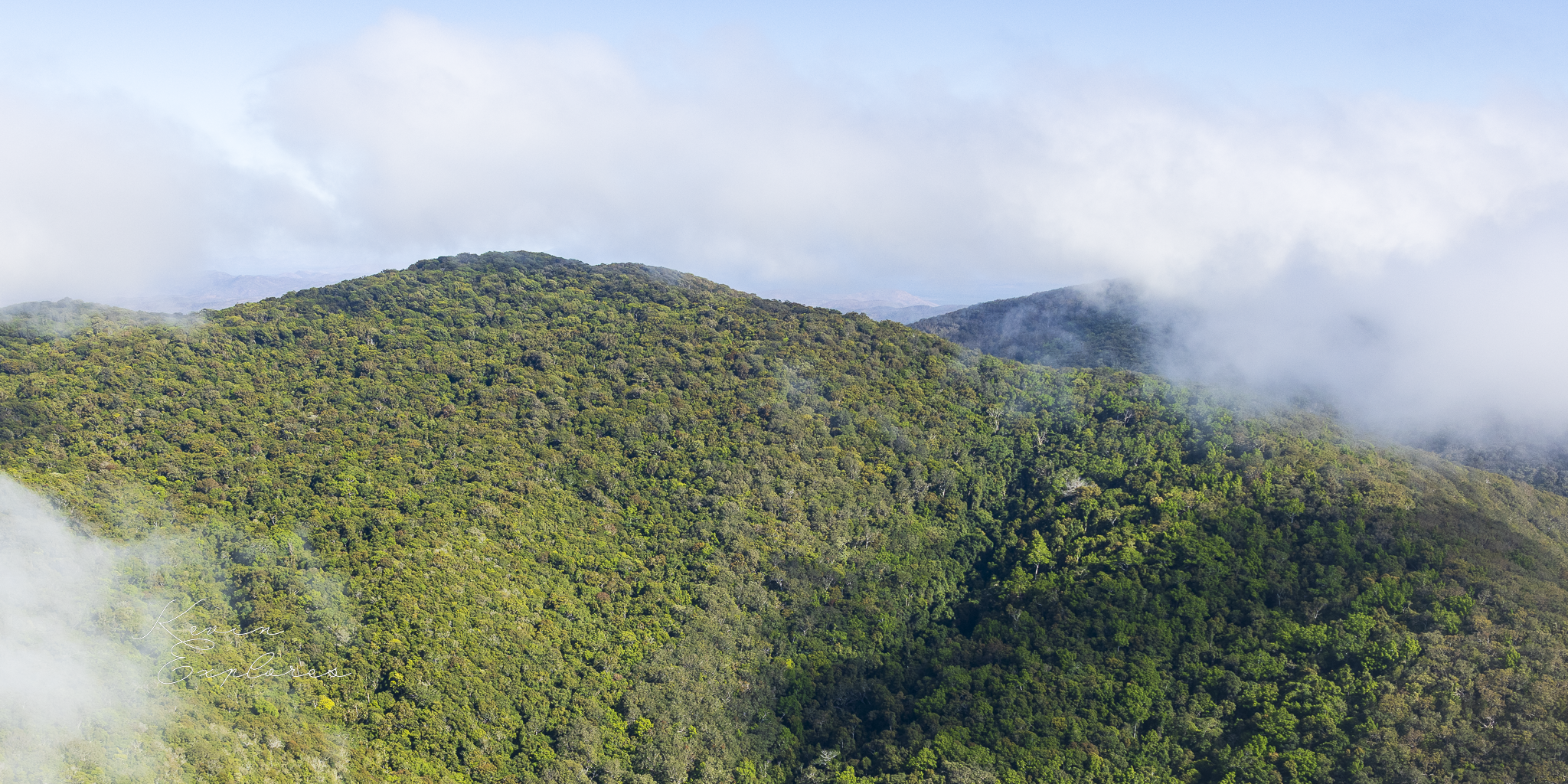
Geology may contribute in a different way. The characteristics of weathered granite influence soil depth, drainage and the distribution of moisture within the ground. Fractures can provide pathways for water, while variations in topography create different growing conditions across a mountain.
These factors may combine to make parts of Baker Blue Mountain a local environmental refuge, supporting vegetation that contrasts sharply with the surrounding landscape.
The photographs provide clues rather than a complete explanation. Rainfall records, elevation data, vegetation mapping and observations of cloud exposure would help establish which factors are most important here.
A wider pattern across granite country
Baker Blue Mountain is not the only place in North Queensland where rocky uplands and contrasting vegetation invite this kind of investigation.
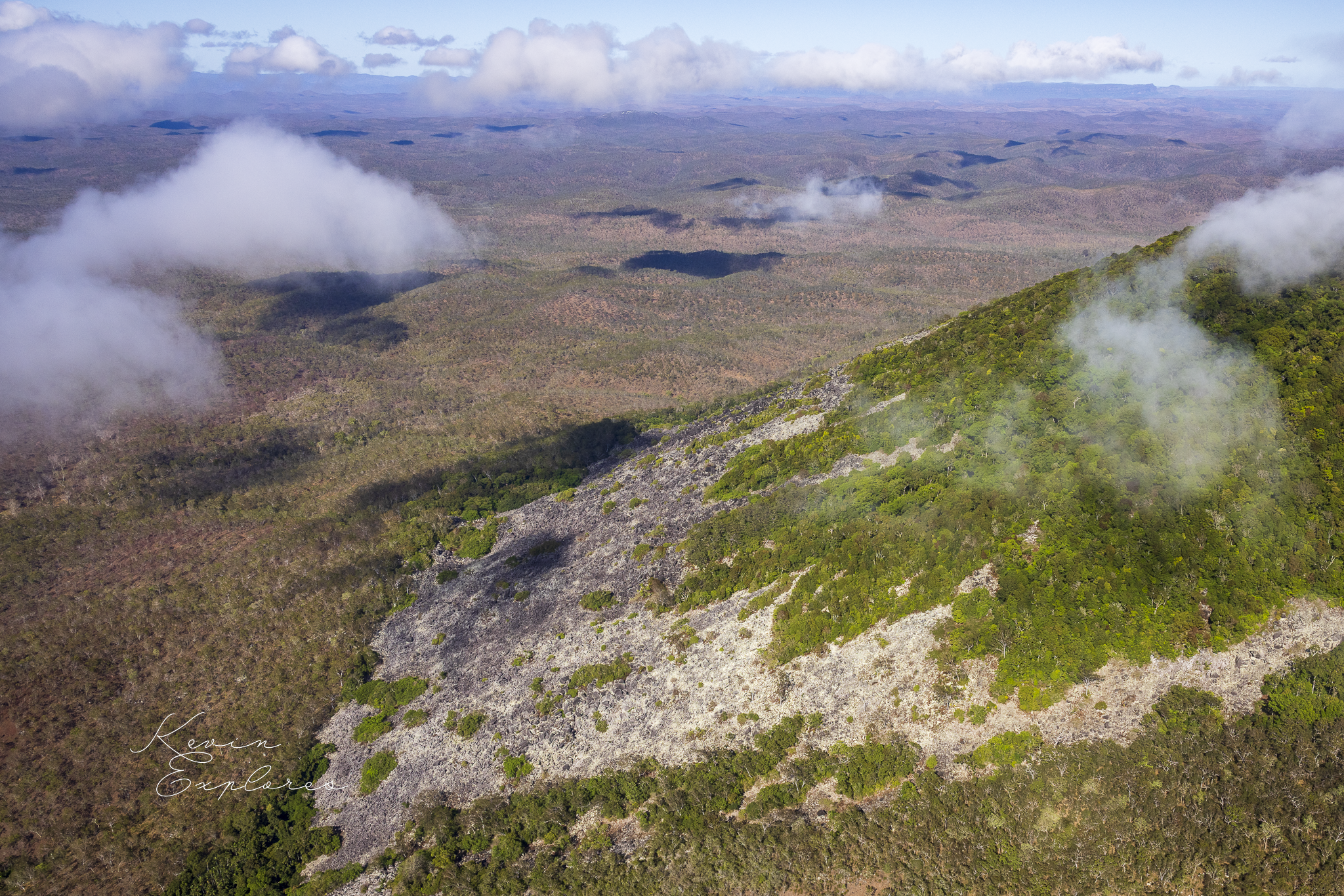
On the nearby Hann Tablelands, granite country also supports patches of green forest in some elevated areas, surrounded by landscapes that can appear much drier. This raises an interesting question: why does forest flourish in particular places while other areas remain comparatively open or dry?
Elevation, exposure to cloud, soil characteristics, drainage and fire history may all help explain the pattern. Similar underlying rock does not necessarily produce identical vegetation, because local environmental conditions and geological structures vary.
Further north, Black Mountain near Cooktown presents a dramatically different expression of a granite landscape, with enormous dark boulders forming its distinctive rocky mass. Around Chillagoe, the Metal Hills offer another opportunity to investigate the relationships between bedrock, geological structure, weathering and erosion.
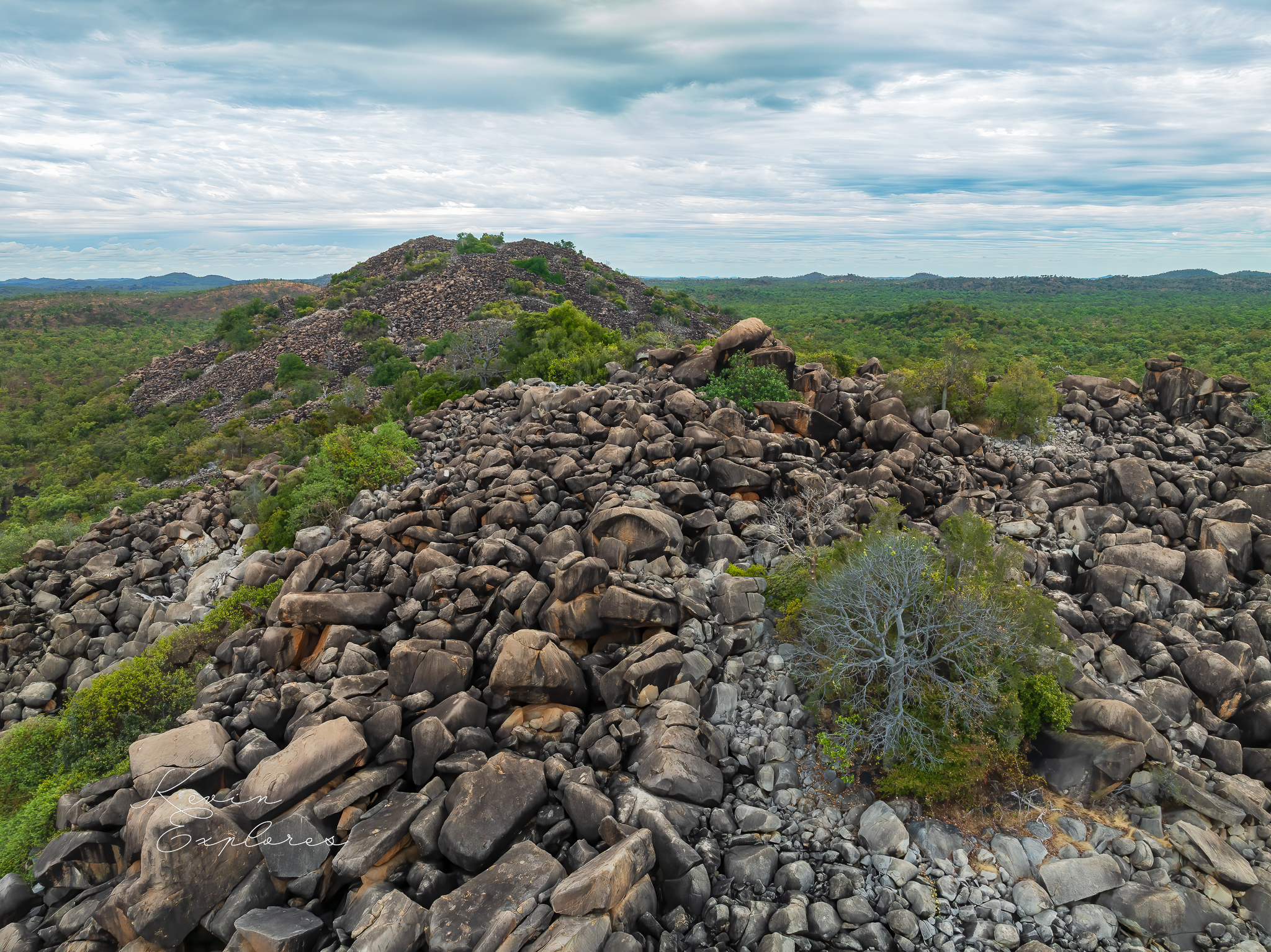
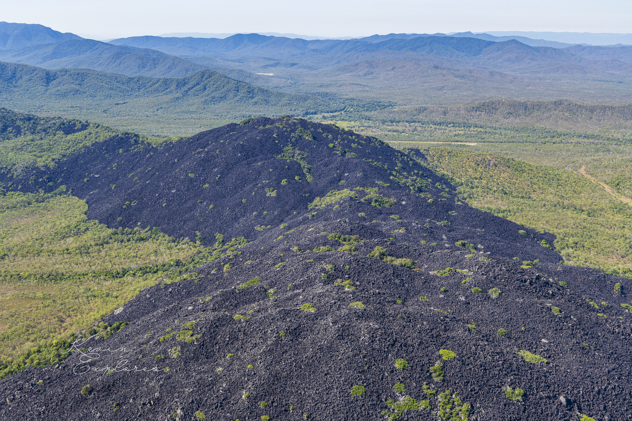
Metal Hills, Chillagoe (left) and Black Mountain, Cooktown (right)
These places should not be assumed to share identical geological histories or weathering processes. Their value lies in the comparisons they invite. How does the original rock influence the form of a landscape? How do fractures affect the breakdown of rock? And how do climate, water and erosion modify the results over time?
The differences between these places may be just as revealing as their similarities.
Reading the landscape from above
Seen from the ground, a boulder field might appear to be little more than a jumble of broken rock. From the air, its scale and relationship to the mountain become clearer. We can observe how exposed rock skirts the forest, how boulders occupy the slopes, and how the green canopy covers the higher terrain.
The geological map adds another dimension. It allows us to look beyond the present surface and consider the ancient structures inherited by the mountain.
Together, these perspectives reveal a landscape shaped by processes operating over very different timescales: the formation and fracturing of granite deep within the Earth, the slow breakdown and removal of rock at the surface, and the climatic and ecological processes that sustain vegetation today.
Baker Blue Mountain is more than a green peak rising above dry country. It is a place where geological history, the evolution of landforms and the distribution of life intersect.
And when we compare it with other granite landscapes across North Queensland, another question emerges: why do landscapes with some geological characteristics in common develop such different forms and patterns of vegetation?
That is the beginning of a much larger exploration of North Queensland's rocky country.
Kevin Explores — Understanding landscape through aerial interpretation.
Never miss a flight or Field Note - subscribe at Substack