Lighthouse Mountain: Reading 260 Million Years from the Air
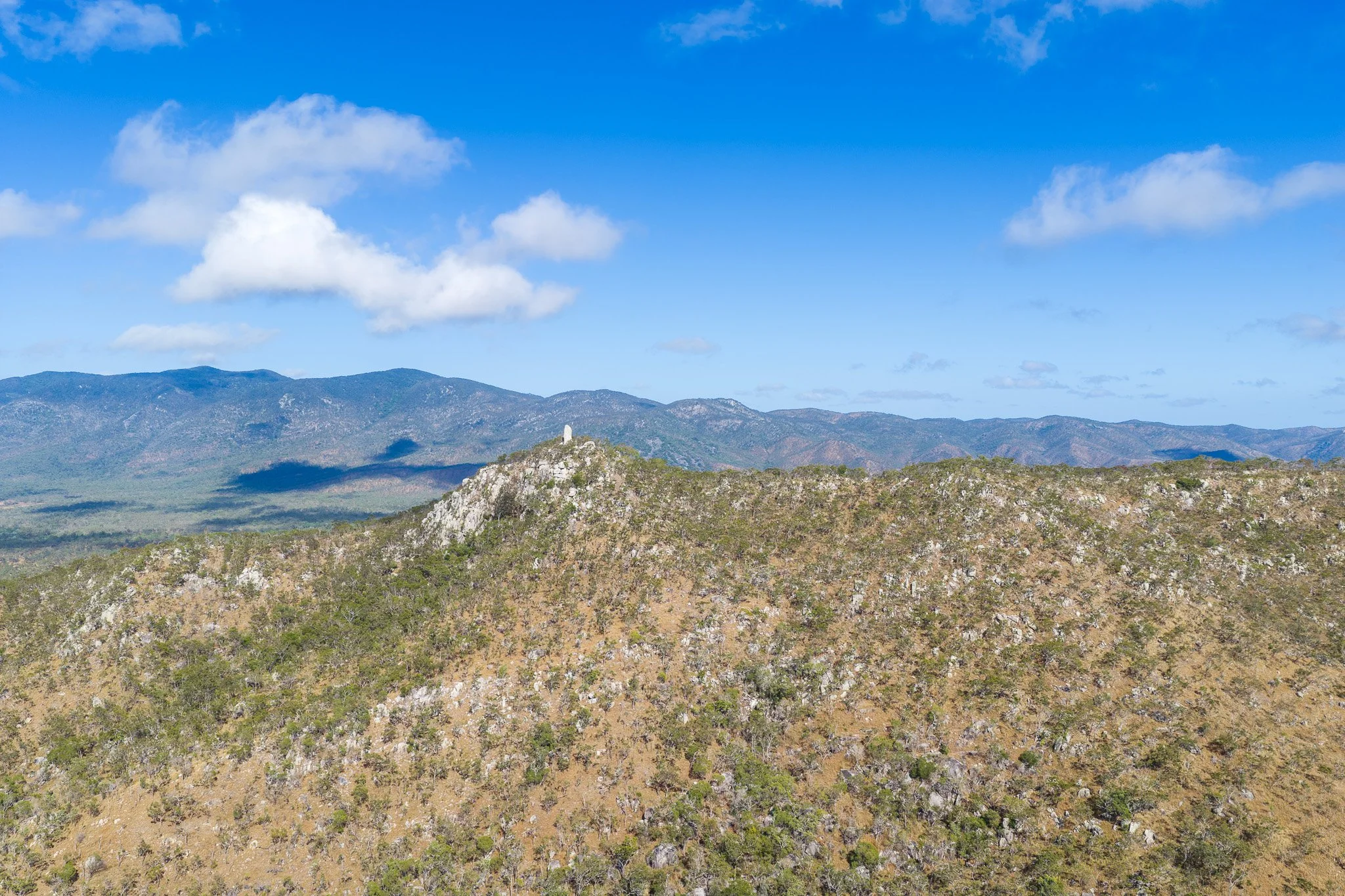
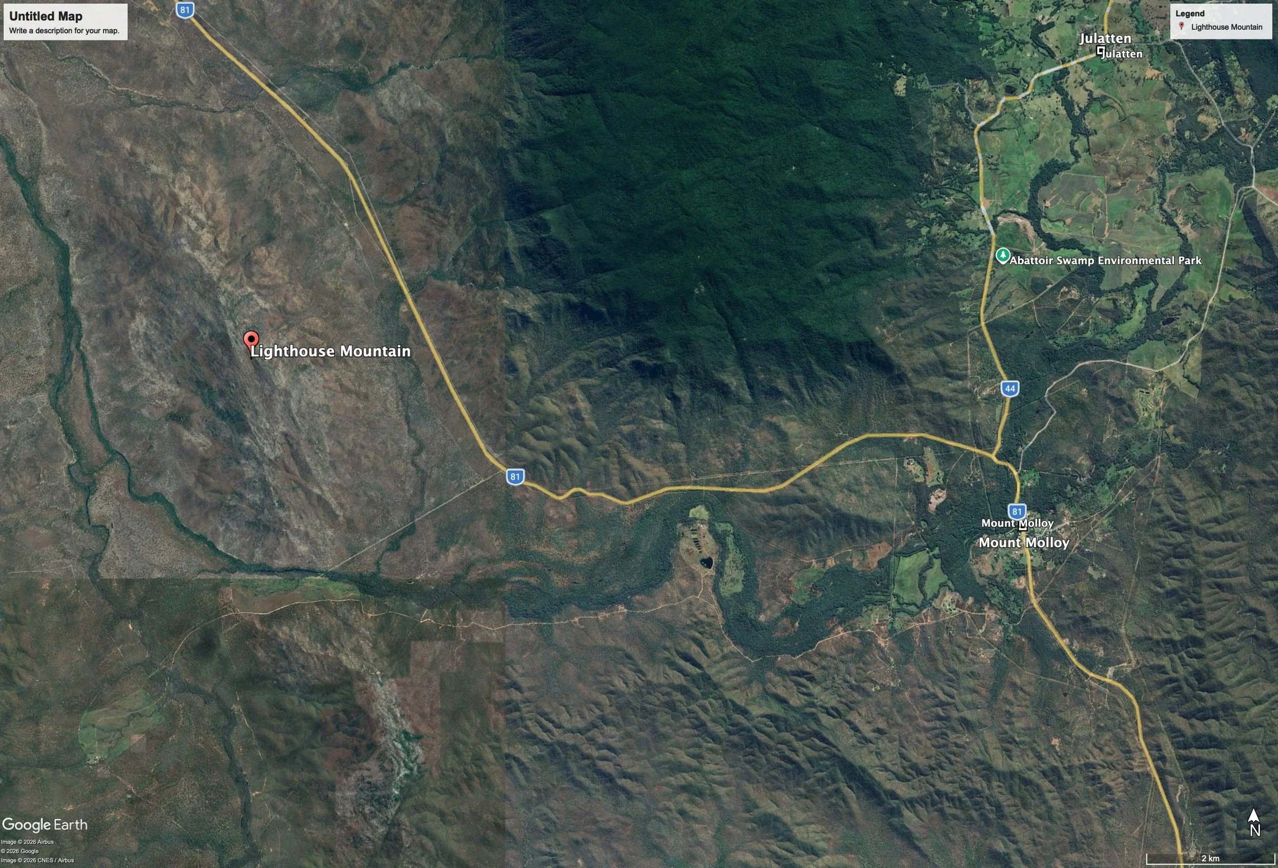
About 10 km from Mt Molloy along the Peninsula Development Road, heading to Mt Carbine, you may notice a sign "Lighthouse Mountain" and notice in the distance on a distant hilltop, a solitary white spike. Yesterday, I stopped to take a closer look with the drone. On returning home, I researched the location.
Where it sits
This stretch of the Peninsula Development Road, running northwest from Mount Molloy toward Mount Carbine and on toward Lakeland is ancient sea floor: the Hodgkinson Formation, a thick pile of Devonian-age marine sediment — greywacke, siltstone, shale and slate, laid down as turbidites on a long-vanished ocean floor, then folded, uplifted and eroded into the low ranges and hill country of today. It's only later, tens of millions of years afterward, that this package of old seabed was repeatedly intruded by rising magma, which cooled and crystallised into granite while still buried deep underground.
What's holding up the pinnacle
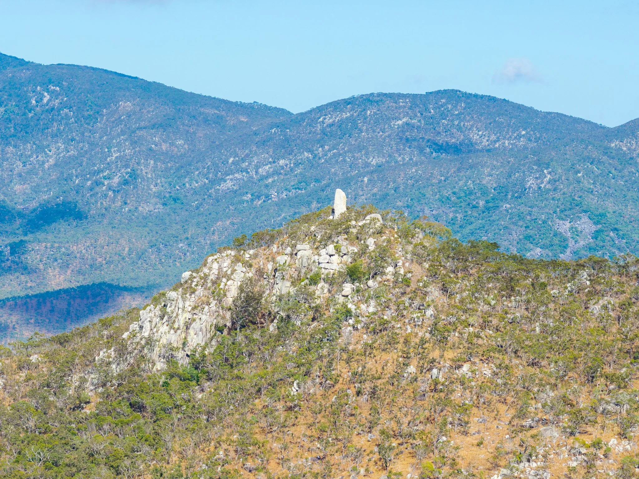
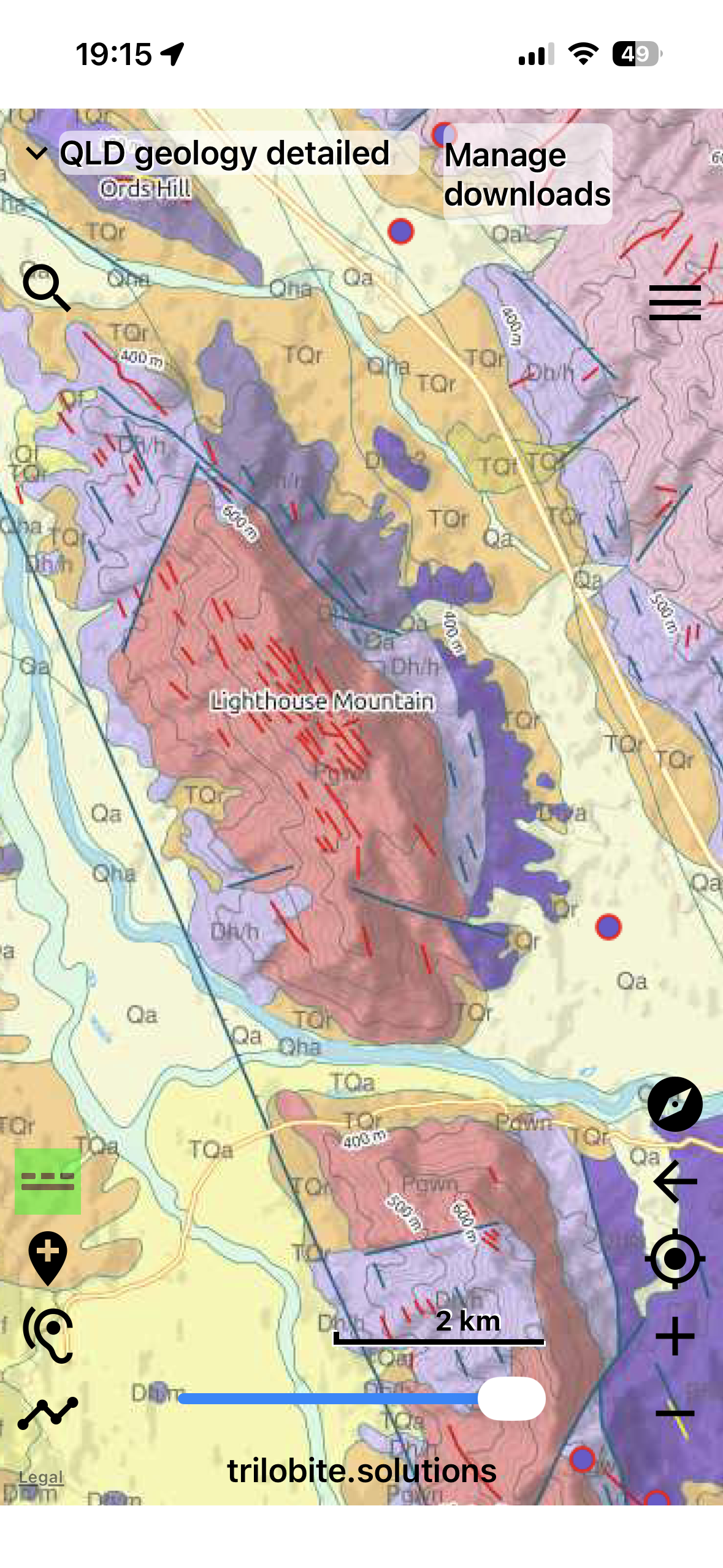
The rock underneath Lighthouse Mountain is mapped as the Northedge Granite (unit code Pgwn on the Queensland geology series), an intrusive body dated to the Permian period — somewhere between 260 and 299 million years ago. It formed the way most granites do: as a body of molten rock that pushed up into the crust, cooled slowly at depth, and crystallised into the coarse, interlocking mineral texture visible in the outcrop today. Everything above it — kilometres of overlying rock — has since been stripped away by erosion, leaving the granite itself exposed at the surface.
Officially, the rock is described as a white, medium- to coarse-grained, porphyritic monzogranite bearing garnet, tourmaline, muscovite and biotite, with occasional dioritic and metasedimentary inclusions and a subordinate muscovite-rich phase. That mineral list matters, because it explains the colour: muscovite (white mica), quartz and feldspar are all pale minerals, and with comparatively little dark biotite mica to darken things down, the rock reads as a bright, almost bone-white grey — especially striking in direct sun, and especially striking against the darker, tree-covered ridgelines around it.
Why a pinnacle, and not just a hill
Granite doesn't erode evenly, and importantly, most of the actual rotting happens well before the rock ever sees daylight. As it cools underground, granite develops a network of joints — near-vertical and near-horizontal fractures that form as the rock contracts. While the granite is still buried under many metres of overlying rock and soil, groundwater percolates down through that cover and works along those joints, chemically rotting the rock in place in a process geomorphologists call spheroidal or "onion-skin" weathering. This happens entirely underground, hidden beneath the surface, over millions of years. The corners and edges of each joint-bound block weather fastest, rounding them off into resistant "corestones," while the rock deep inside each block stays comparatively fresh — all of this still buried beneath a thickening blanket of soft, decayed rock (regolith).
Only afterwards — as a distinct, later stage — does erosion strip away that overlying blanket of weathered material, converting it to the sandy grus you can see mantling the lower slopes today and washing it downslope. As the cover is removed, the fresh corestones that formed underground are finally exposed at the surface. The most resistant, least-fractured of them are left standing as residual towers. This is a tor, sometimes called a castle koppie, and Lighthouse Mountain's pinnacle is a textbook example: a corestone that finished rotting underground long before it was ever uncovered, then simply outlasted everything stripped away around it once erosion caught up to it.
A second layer: the dyke swarm
The Queensland geology map also shows something else running through this same body of granite: a cluster of features labelled "dyke or vein," oriented in a loosely parallel trend across the hillside. These represent a later, separate episode — after the main granite mass had solidified (or partly solidified), fresh magma or mineral-rich fluid was injected along cracks in the rock, forming thin sheet-like intrusions.
Given the tourmaline-muscovite chemistry of the host granite — the signature of an evolved, volatile-rich melt — these are plausibly aplite, pegmatite or quartz veins, though pinning down exactly what they are would need either a formal sheet report or a close look at the vein material itself. Practically, a dense swarm of harder, quartz-rich dyke material threading through the granite may also help explain why this particular knob has held its shape so well, reinforcing the rock mass on top of the joint-controlled weathering already at work.
Surface Geology (Trilobite)
Standing since the Permian
Put it together and Lighthouse Mountain is a small, slow-motion story spanning a quarter of a billion years: a granite magma crystallising deep in the Permian crust; a network of joints etched into it as it cooled; a later swarm of dykes and veins injected along fresh cracks; and then an almost unimaginably long period of weathering and erosion that has patiently stripped away everything except the toughest core — the pale, mica-rich spike now visible from the air, and from the road below.
It's a reminder of how much geological history is written into even a small, unremarkable-looking hill — you just need to get above the canopy to read it properly.
Location: Lighthouse Mountain, near Rifle Creek, Peninsula Development Road, between Mount Molloy and Mount Carbine, Mareeba Shire, Far North Queensland